Texas State HP - White Sands, Carlsbad Cavern, Guadalupe, and Big Bend National Parks - 2024 Eclipse
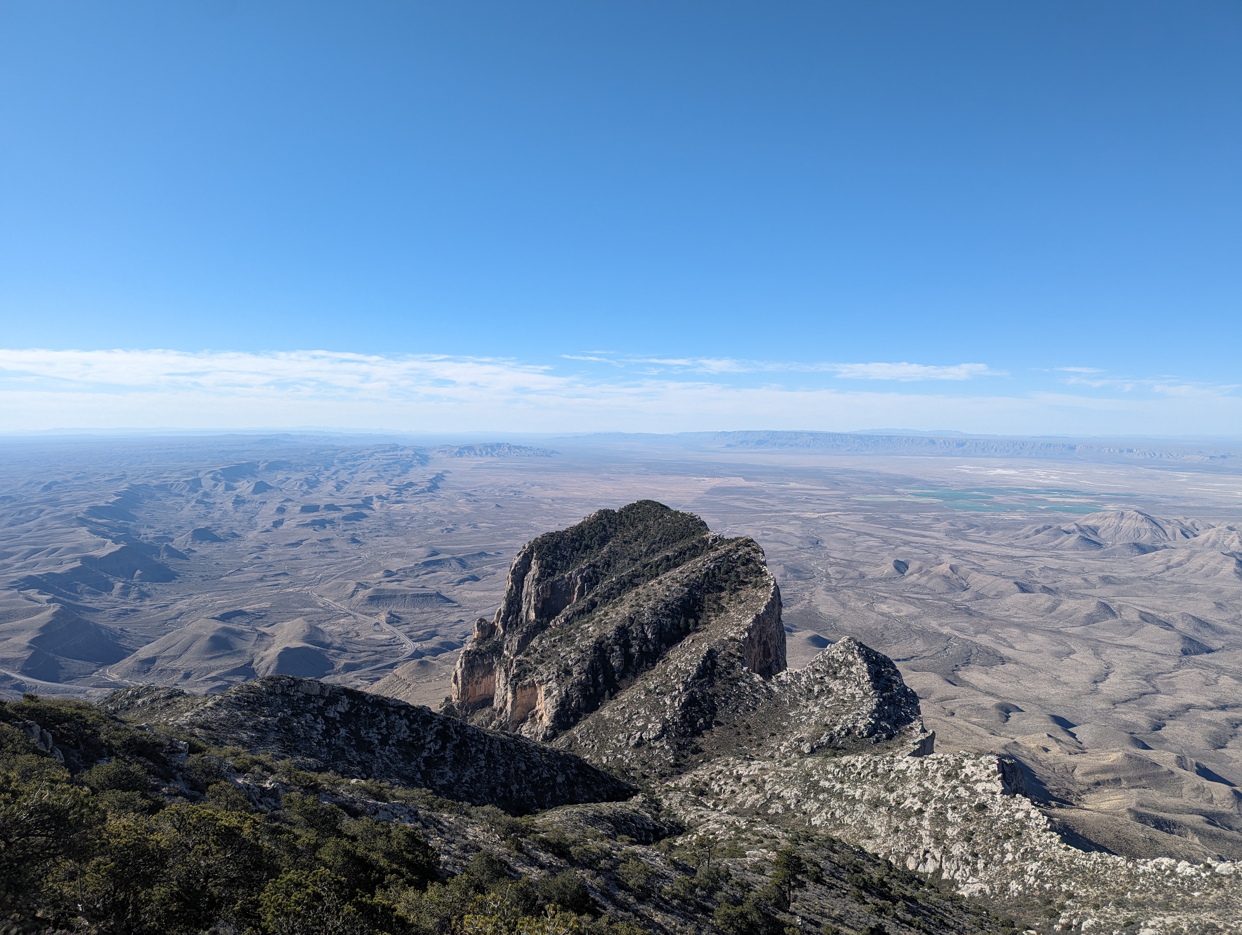
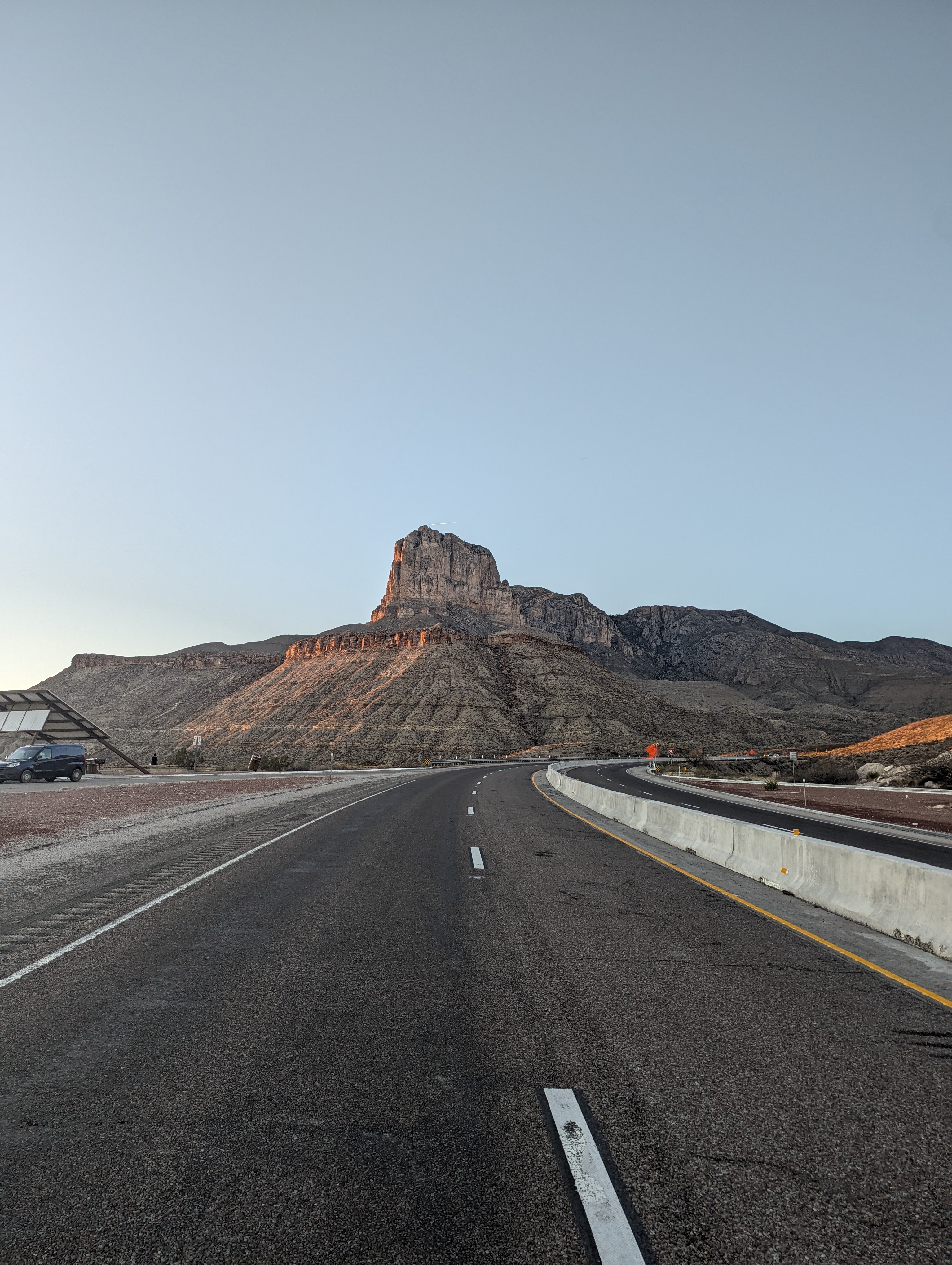
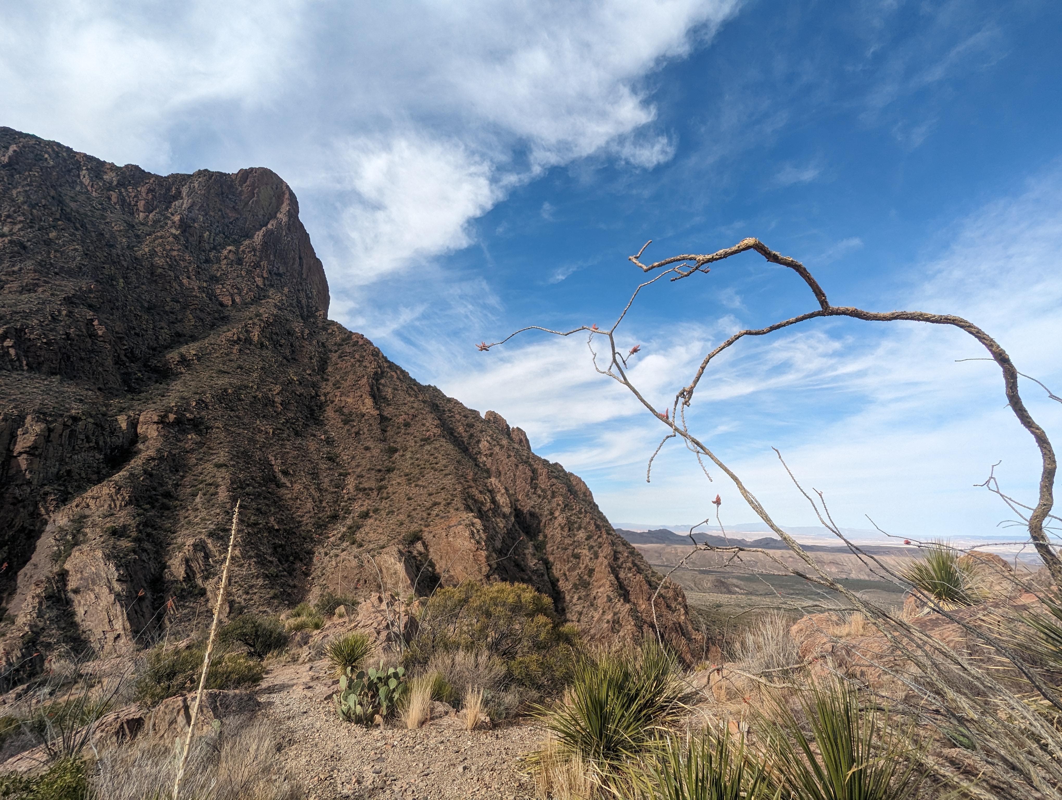
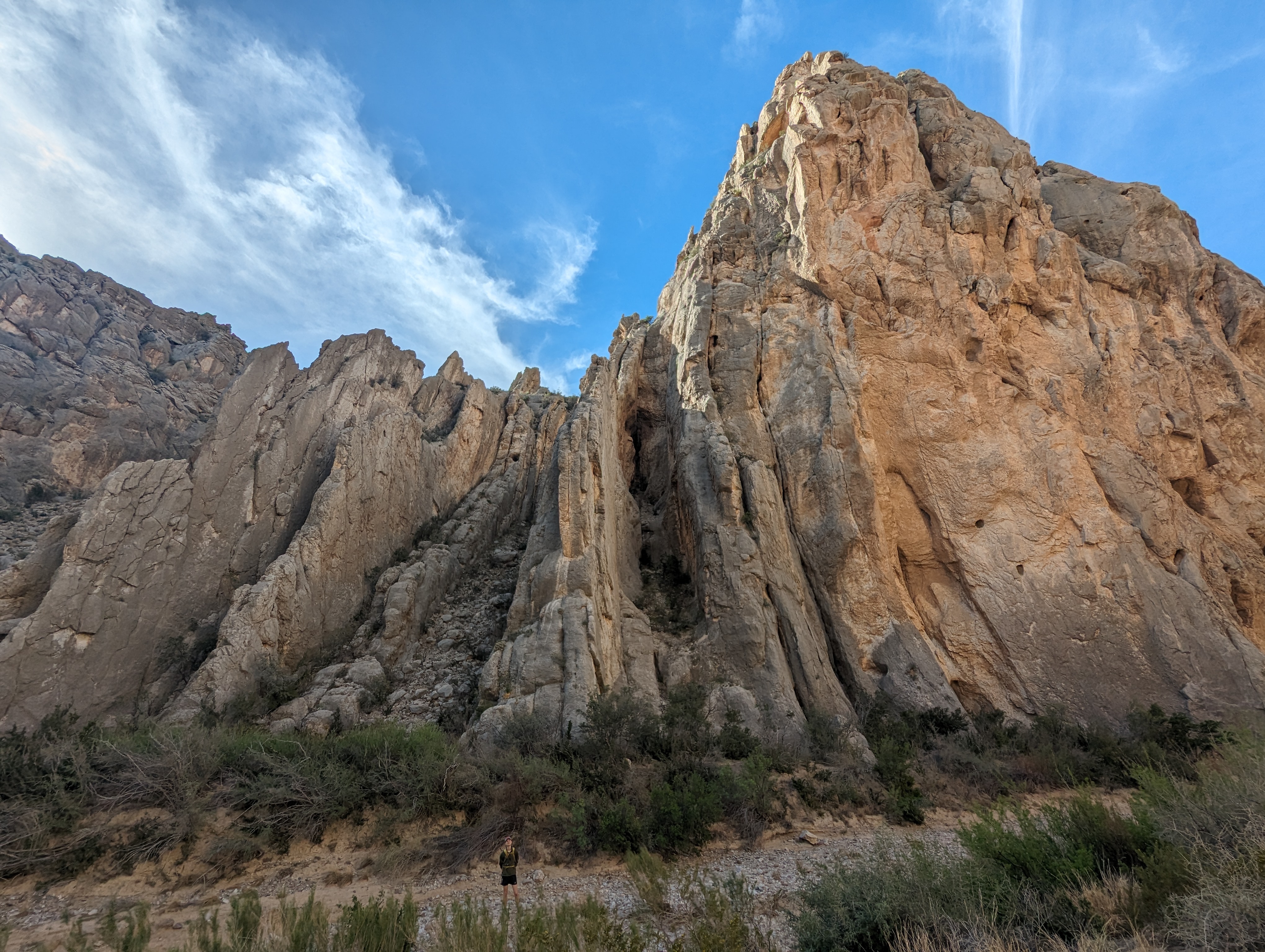
A GREAT VALUE desert road trip that included 1 state high point, 4 national parks, and maybe 1 total eclipse of the sun. A taste of the desert is shown here with El Capitan in Guadalupe NP.
This great value road trip was based on one simple bet: that southwestern Texas was the least likely spot in the continental U.S. to have cloud cover on Monday, April 8th for hopefully clear viewing of a total eclipse of the sun. Huge shoutout to Eclipsophile for compiling the statistics! It would be my second eclipse, having viewed my first in 2017 in the Oregon Cascades just north of Mount Jefferson, so I was excited to get almost double the time in totality in Texas. It would be Ethan and Tori's first eclipse, so I was keen on getting them the best show, but also acutely aware that there was a ~45% chance of being clouded out. Therefore, I created this road trip to make sure the occasion was worth it, regardless of the eclipse viewing success.
The plan I came up with was to fly into El Paso, renting a car and hitting White Sands, Carlsbad Caverns, Guadalupe, and Big Bend national parks (NP) as well as tagging the Texas state highpoint (HP) on our way east across the state to Sonora, TX, just outside the path of totality, to make a play for the best conditions anywhere in a 200 mile radius on eclipse day.
Read on to find out whether the plan worked out :).
April 4th - Day 1 - White Sands, Carlsbad Cavern, and Camping in Guadalupe National Park
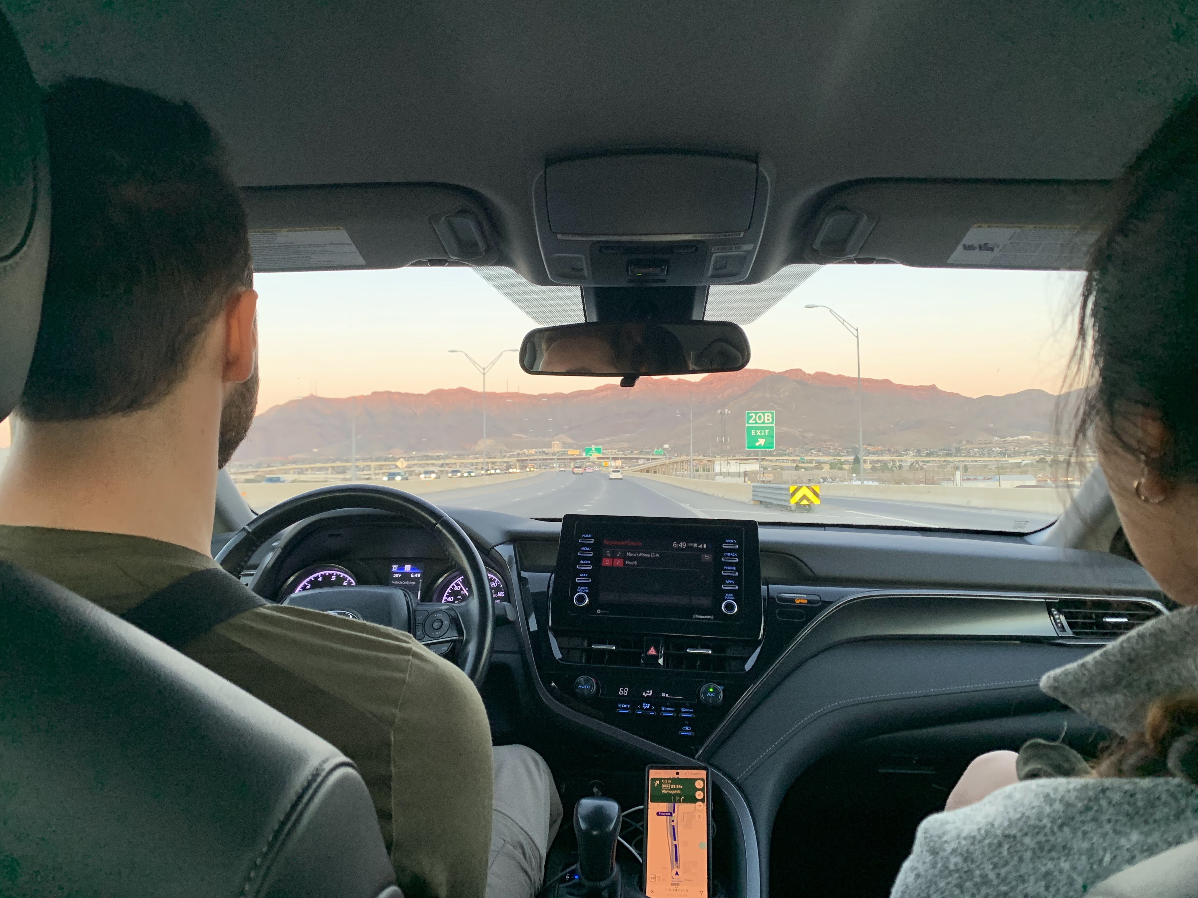
Flying in from different locations Ethan, Tori, and I met up at the El Paso airport the evening of April 3rd. We promptly headed to Walmart to stock up on supplies for our journey, including plenty of extra water, and many items from Walmart's "Great Value" brand, the inspiration for the name of our trip. We had timed entry tickets for 2:30pm at Carlsbad Cavern the next day, the last time to enter. With White Sands to visit and 6 hours of driving to complete before our entry time, we had a long day ahead of us.
Groggy eyed we typed White Sands NP into Google Maps and were off, only to find ourselves at the gate of White Sands Missile Range turning around to backtrack 30 minutes. Turns out Google doesn't ask if you have a CAC to drive through military instillations, bummer. Delayed we only had about 30 minutes to spend when we finally got to White Sands NP. For me, that was more than enough time. There was sand. The sand was white. After a proper frolic in the dunes we were off to Carlsbad. You can see a map of our very short hike in White Sands and the other hikes from our trip here.
The Sacramento Mountains rising more than 6000' above White Sands to the east were honestly more impressive than the park in many respects. We ascended from the desert to open pine forests with some lingering snow, passing through Cloudcroft and gradually down the opposite side. This was my first time seeing in person the "sky islands" of green I had seen so many times on Google Earth. I look forward to visiting more. After lunch at Sonic we made it to Carlsbad and were greeted by some ibex on the drive up to the cave.
I was wholly unprepared for Carlsbad Cavern. I have been in caves: Cave of the Winds, cenotes in the Yucatan, and many others. Each had great geologic formations but none compare to the shear scale of Carlsbad Cavern. Walking down into its maw is truly special. The path is steep with seemingly hundreds of switchbacks. You enter one large section where you could seemingly park a couple 747s, keep going down to find another section of even greater size. And then another. And another. The Big Room should really be named the "F*@KIN HUGE HANGER". For me, in terms of pure amazement and wonder Carlsbad Cavern NP beats Shenandoah and Smokey Mountains NPs easily.
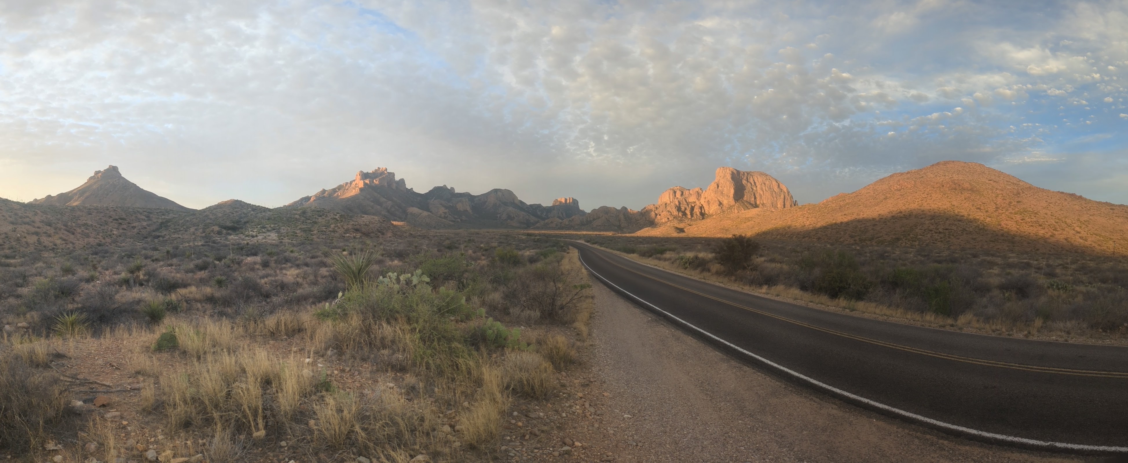
Thoroughly satisfied, we headed to our third NP for the day, Guadalupe, where we would camp for the night at the base of our hike for the following day. After setting up our tents we headed south to a roadside picnic area at the base of El Capitan for sunset and dinner. The vast distances and sharp relief of the desert is always best at sunset.
Story continues after Day 1 photos.
 Driving north towards White Sands NP, soon to be turning around by an annoyed guard at the gate of a missile range.
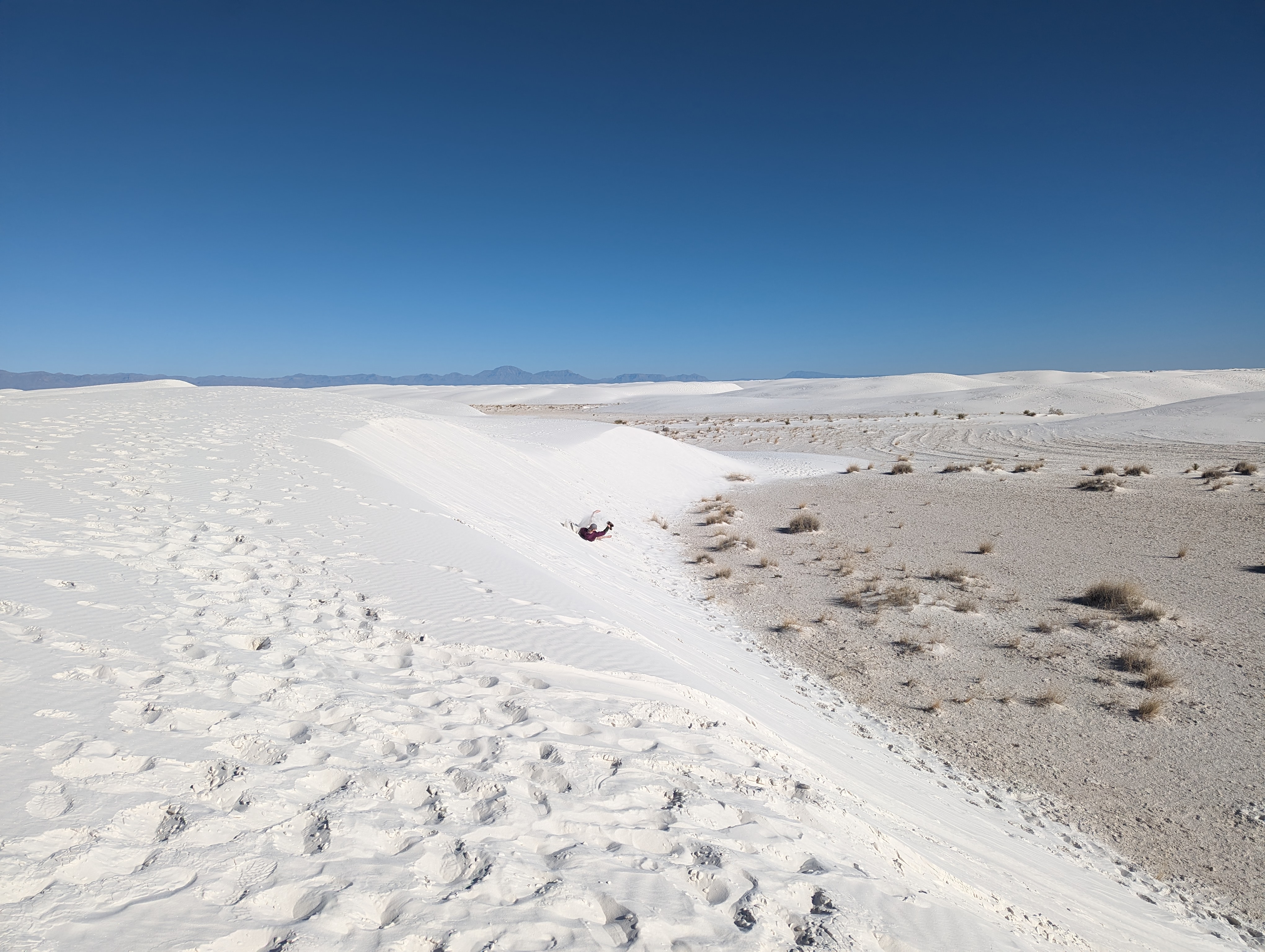 Ethan, in frolic mode, a controlled tumble down a particularly enticing sand dune.
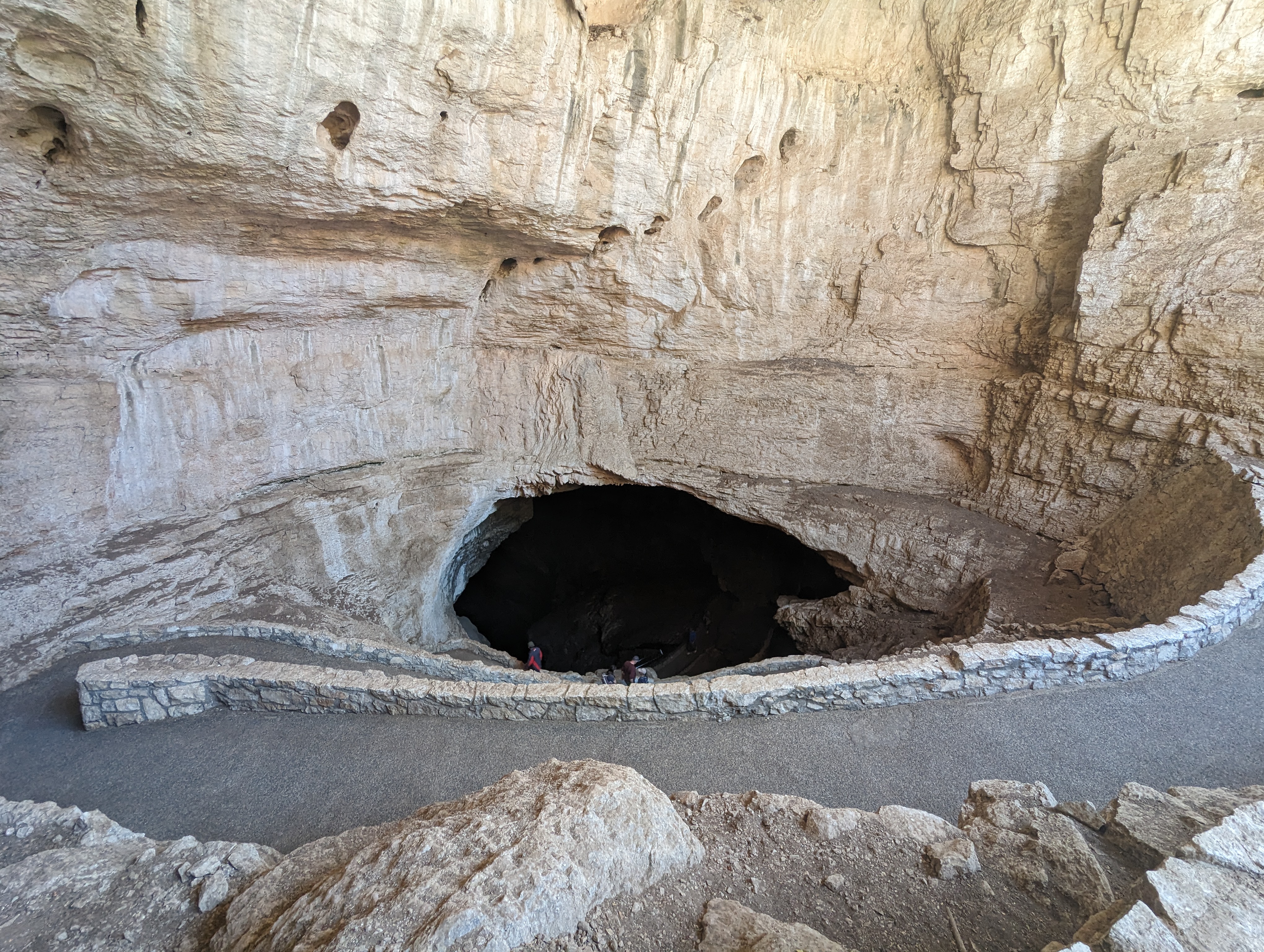 The entrance to Carlsbad Cavern, descending into darkness.
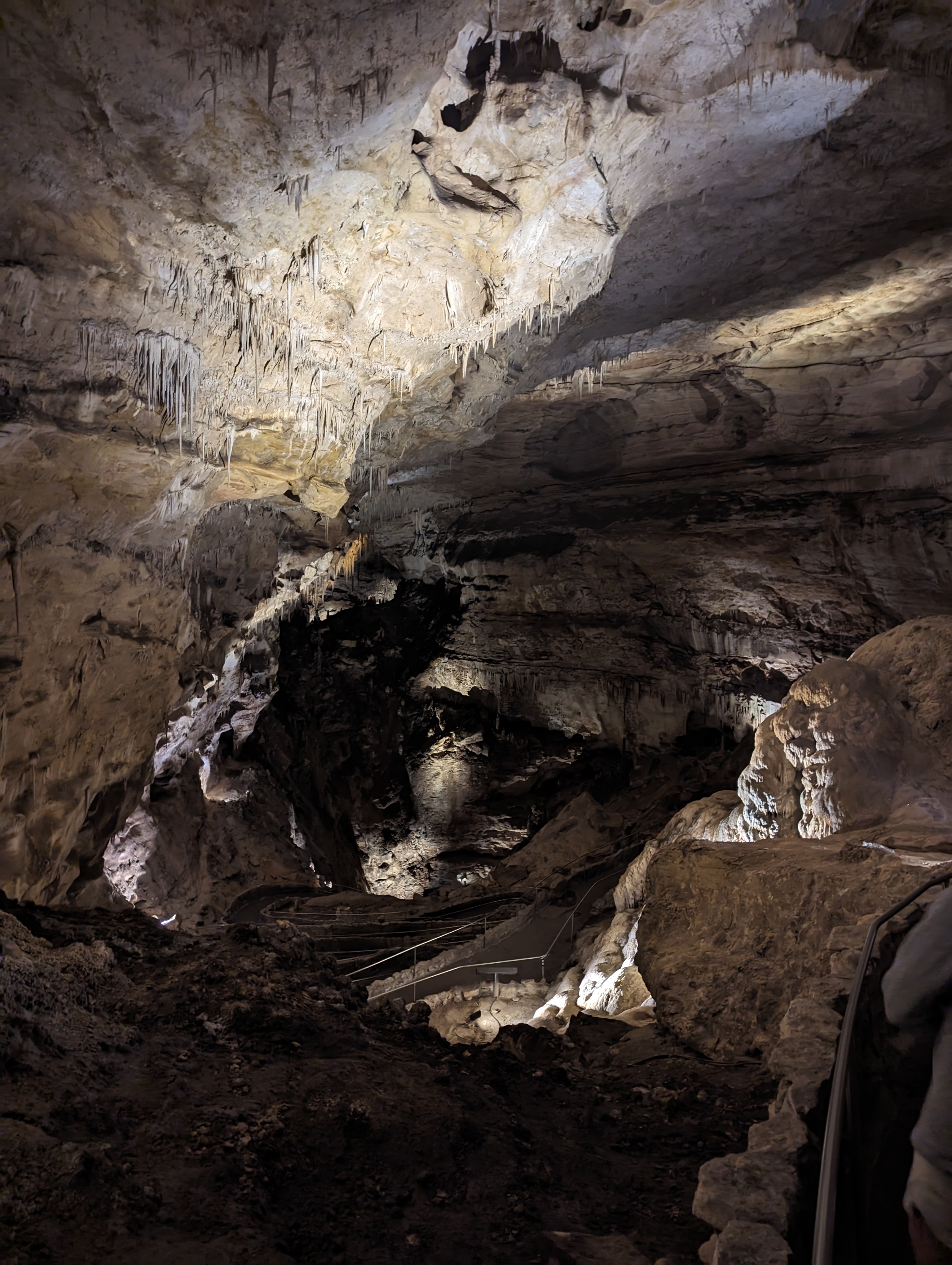 It just keeps going down.
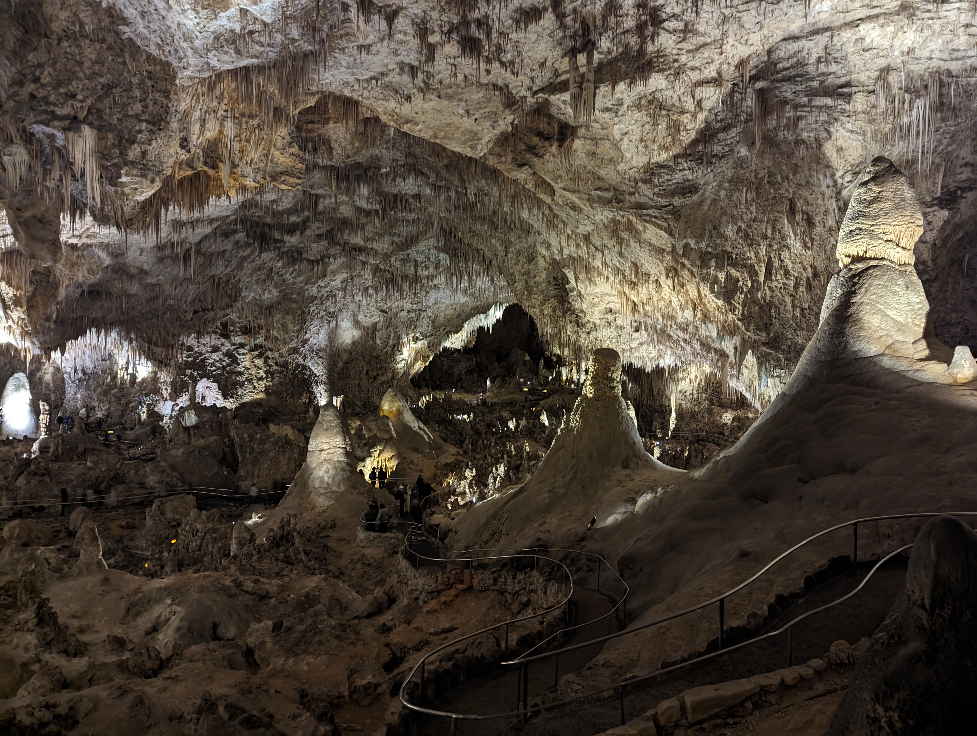 The Big Room from near the Rock of Ages. In the distant darkness is the far wall, almost 3000 feet away.
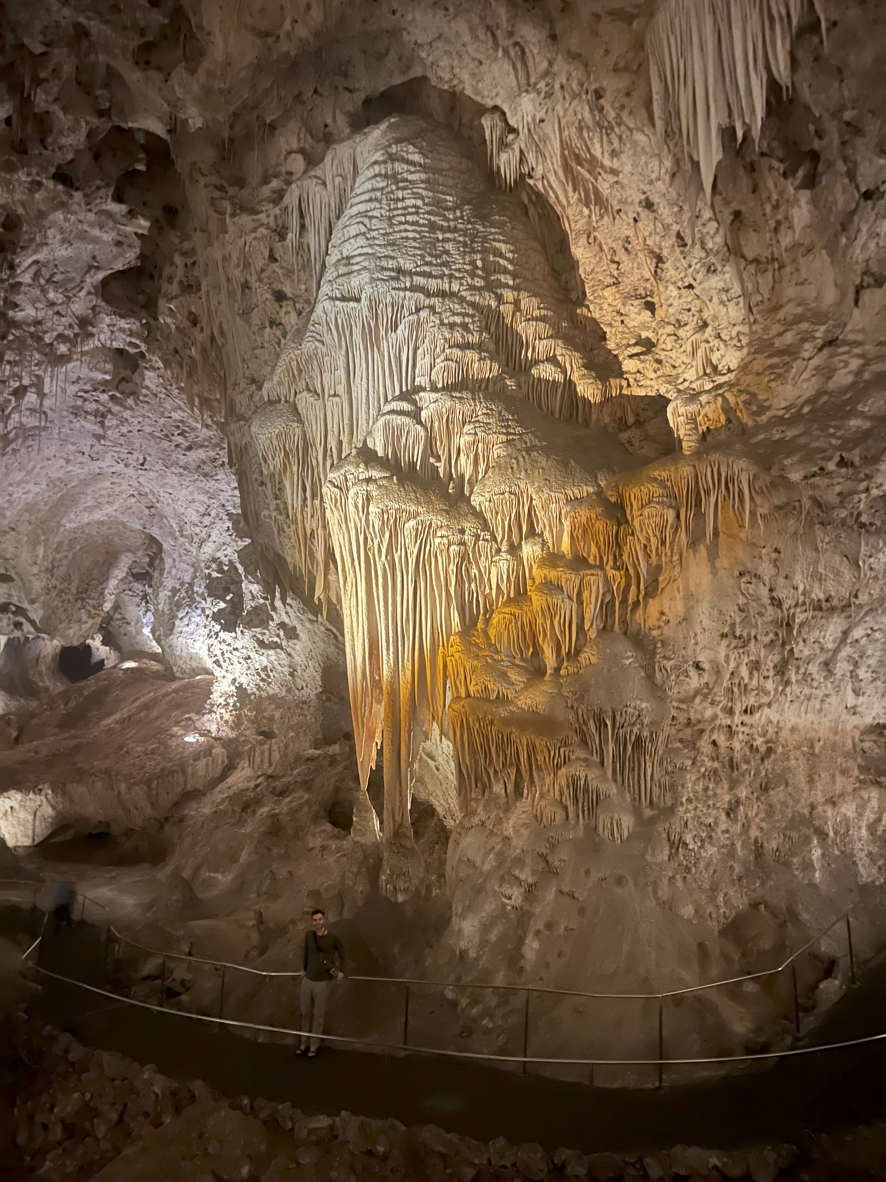 Me standing below one of my favorite formations that reminded me of tree canopy.
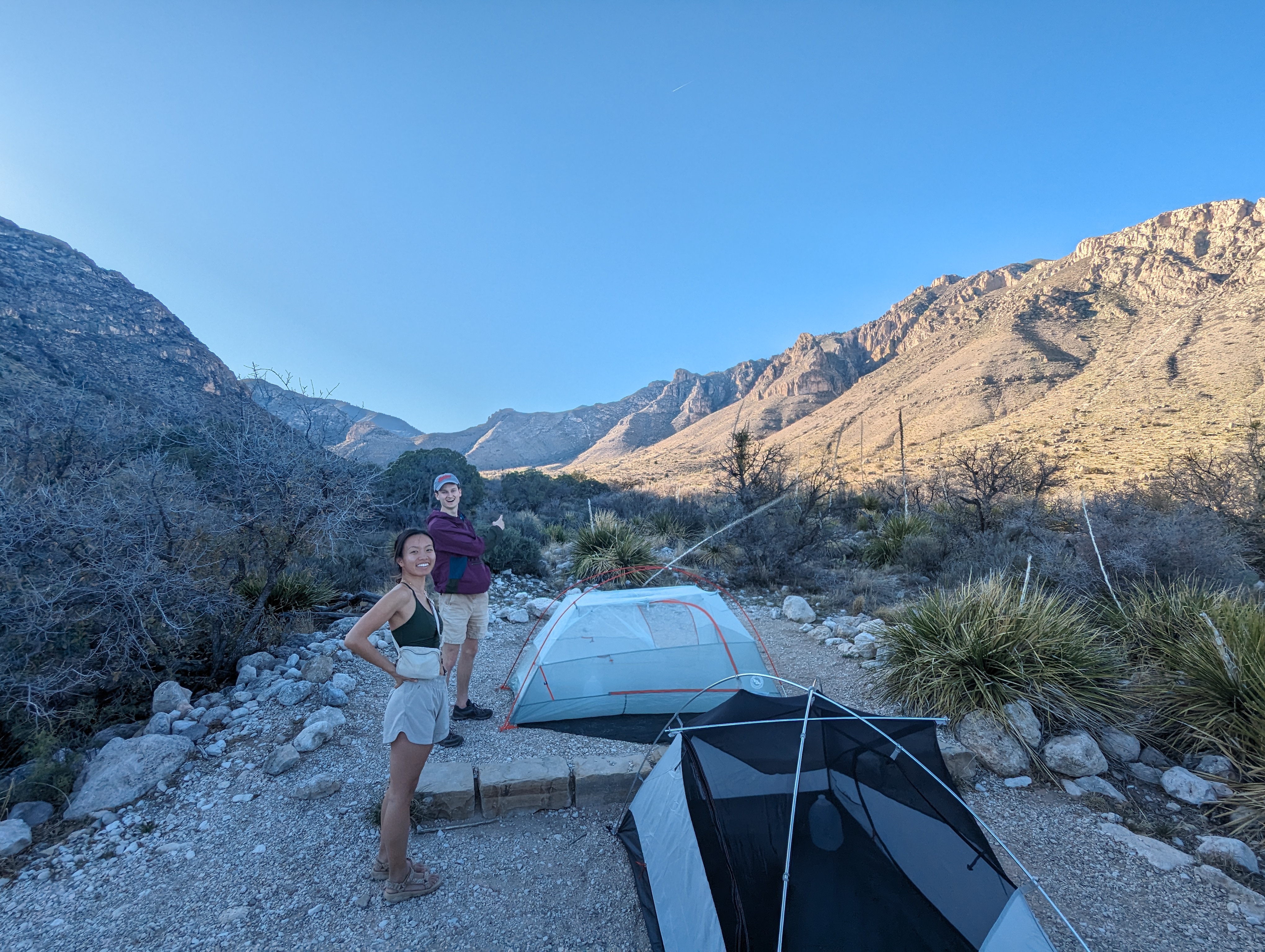 Our campsite in Guadalupe NP. The trail to Guadalupe peak starts up the shaded ridge on the left.
 Our dinner spot at the base of El Captain which hides Guadalupe Peak just behind it.
April 5th - Day 2 - Guadalupe Peak (TX State HP), A Desert Oasis, and Camping in Big Bend National Park
We woke up early (again), ate some Great Value brand muffins, and set out up the trail (route here) to the top of Texas. We wound our way around prickly pear, agave (cowboy killers), and scraggily junipers up to elevation where sparse pine began filling the hill tops.
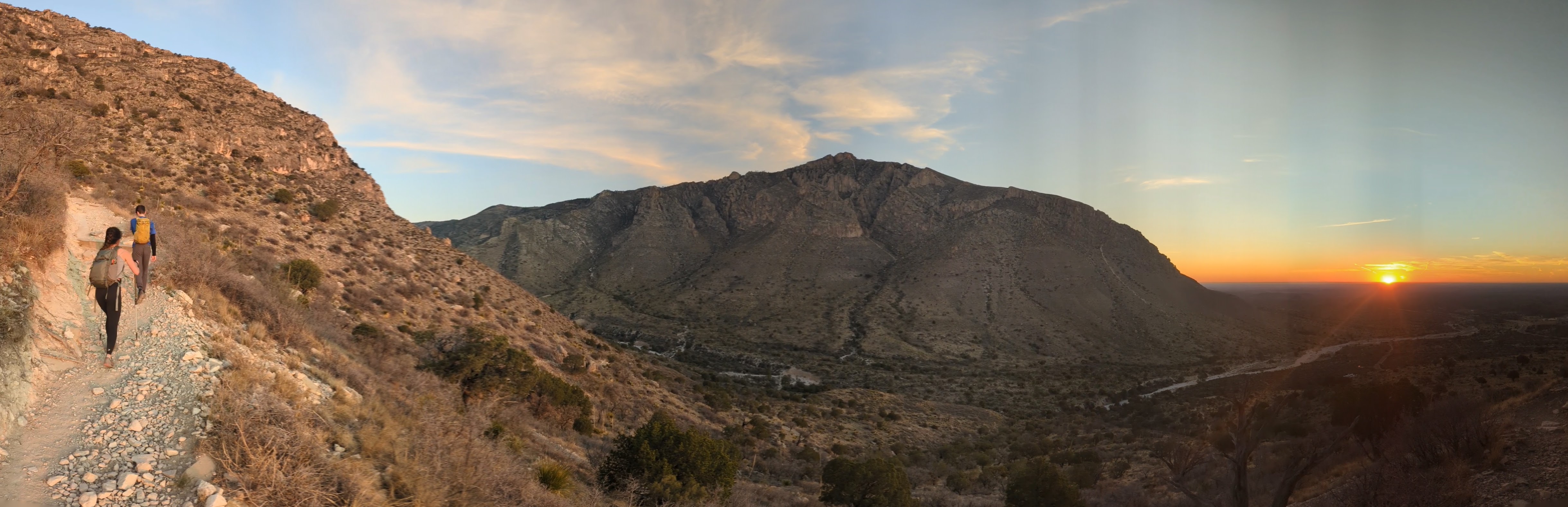
We eventually popped above the trees and were greeted with a sweeping view over the top of El Capitan to the east. The top of Guadalupe Peak (8,751 ft; 2,667 m), the Texas state HP, is marked with an interesting metal pyramid that is quite striking against the background. While eating lunch on top we bumped into a couple other fellow highpointers including a dad and his son who were somewhere in the 40s in terms of peaks climbed. After some panoramic photos we headed down. On the trail just a couple hundred feet below the summit I saw the fossil of a shell, an amazing reminder that the rock we stood was formed as the bed of a shallow sea, since being uplifted almost 9,000 feet into the air.
We made it back to our vehicle quite tired at about 1:00pm with a long drive still to the outskirts of Big Bend NP. Along the way we stopped at a beautiful swimming spring in Balmorhea, TX to cool off and relax a little before continuing our drive. The vastness of western Texas was overwhelming. We finally made it to our campsite, a dirt trailer lot, just outside the Big Bend park boundary at about 7pm, just enough time to try to race into the park for sunset. We missed it but stuck around for the great stars in one of the darkest places in the lower 48.
Story continues after Day 2 photos.
 Sunrise as we head up through the desert scrub. Our campsite is below on the right.
 Getting higher now, more grasses, and a better view of the endless folds of the Chihuahua Desert.
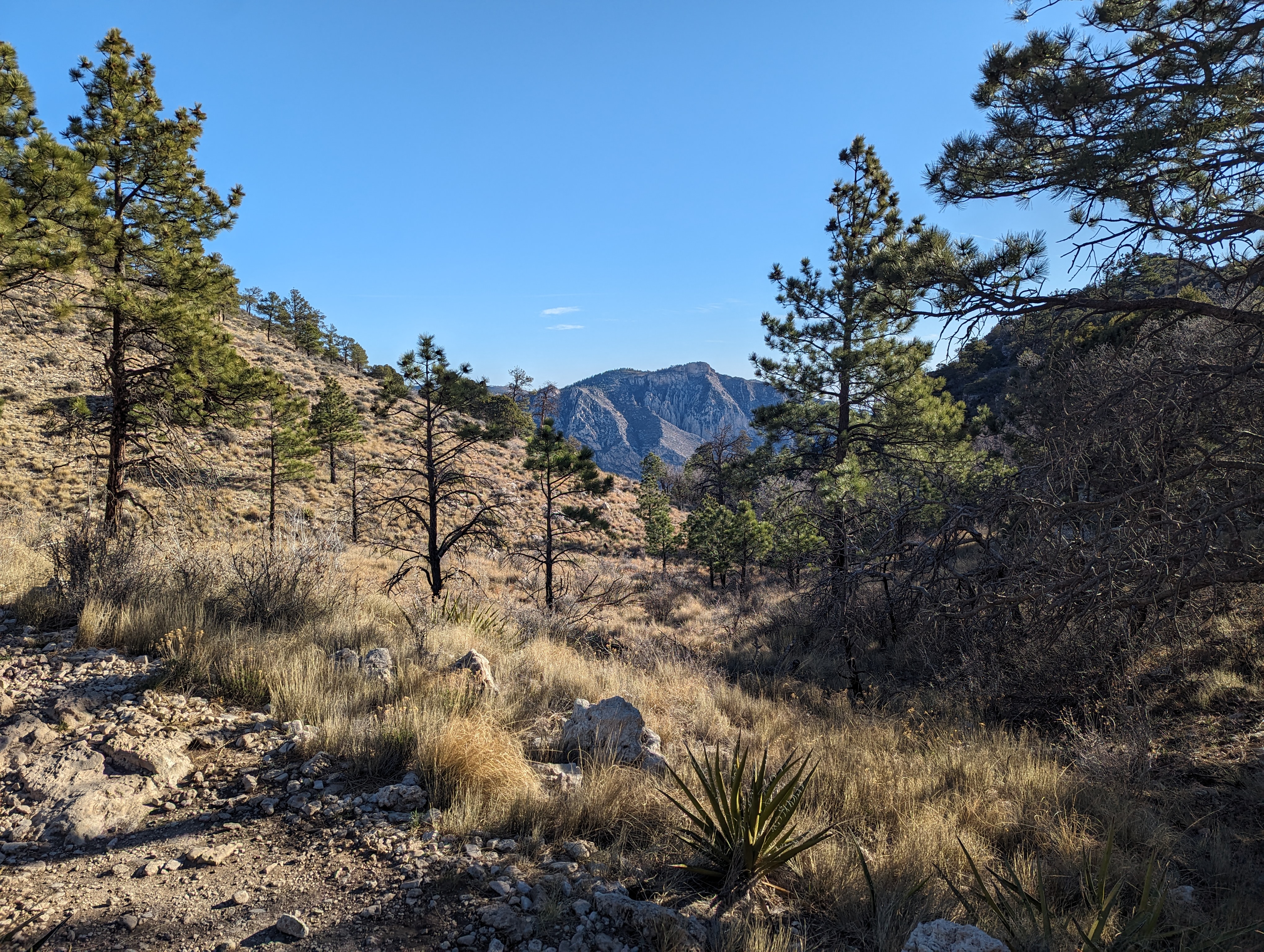 Sparse pines filled in above 7,000 feet or so, here looking north into the rest of Guadalupe NP.
 Climbing up up up, no more shade.
 The spike at the top of Texas. View looking south toward Mexico.
 We had dinner the night before looking up at the face of El Capitan. Now we got to have lunch looking down at the backside of El Capitan.
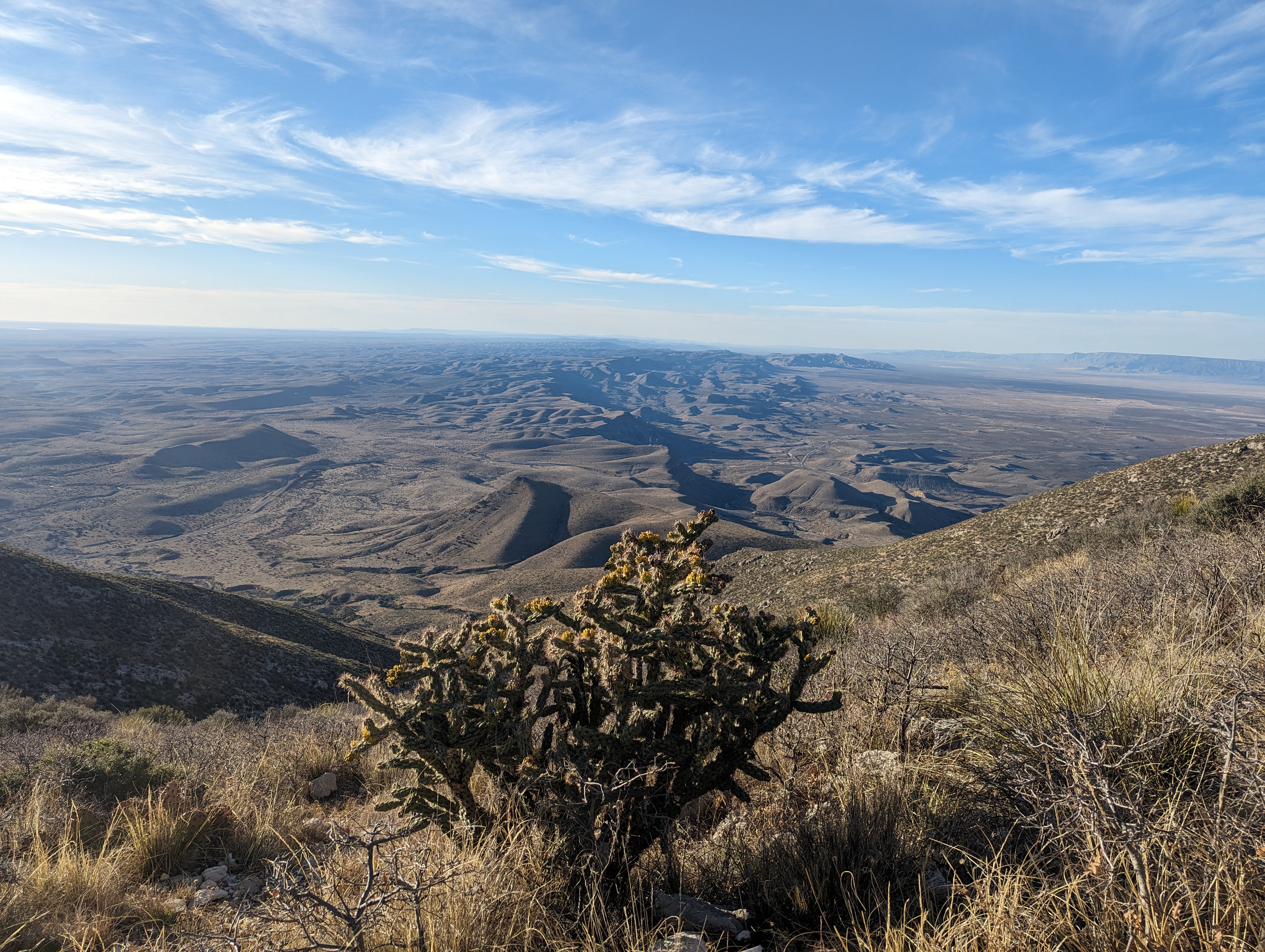
 A panorama, looking northeast on the left, south toward Mexico in the middle, and to the northwest on the right back into Guadalupe NP.
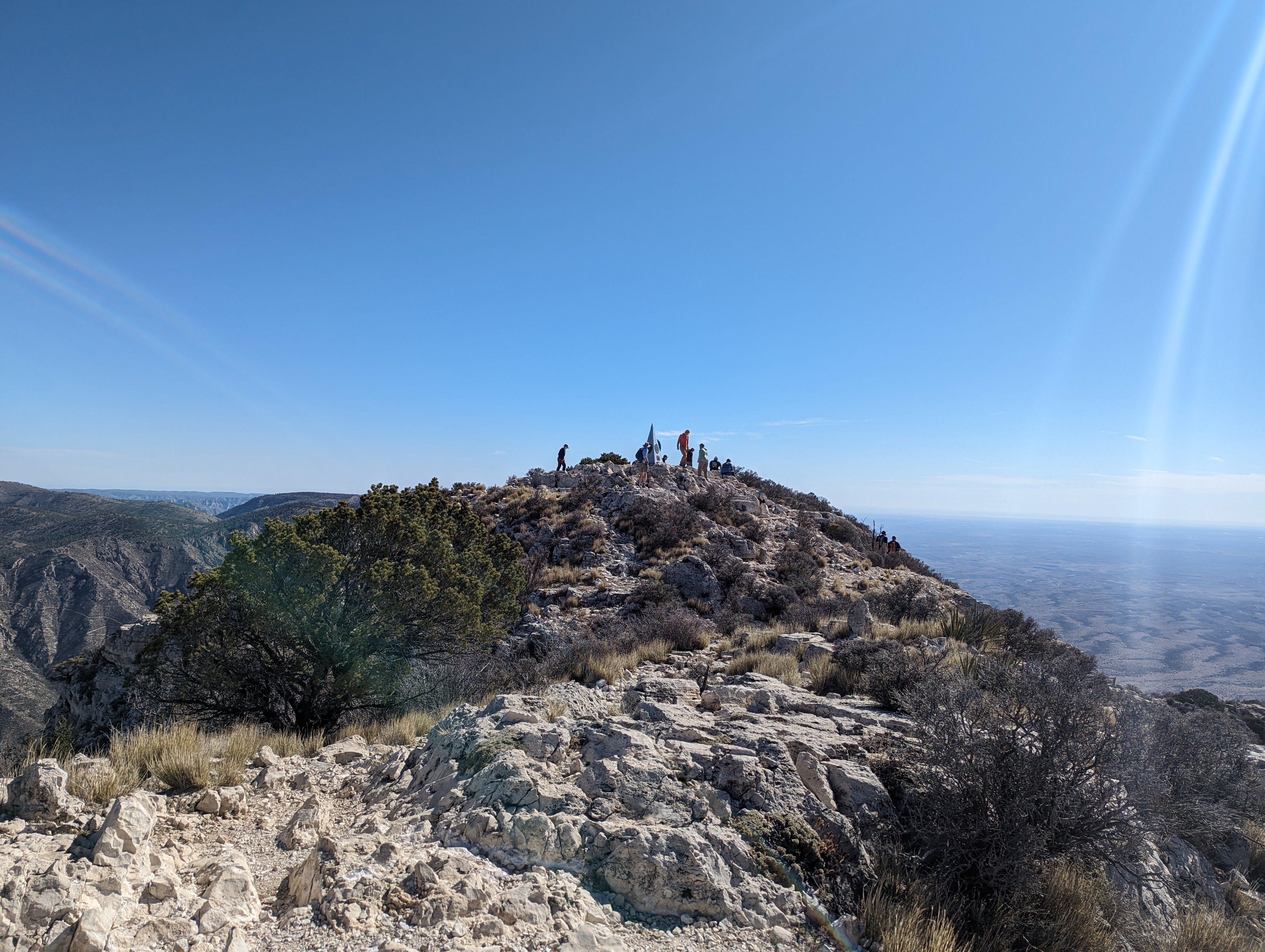 On the shoulder of the Guadalupe peak closest to the south face drop off looking back north. Lots of folks at the summit!
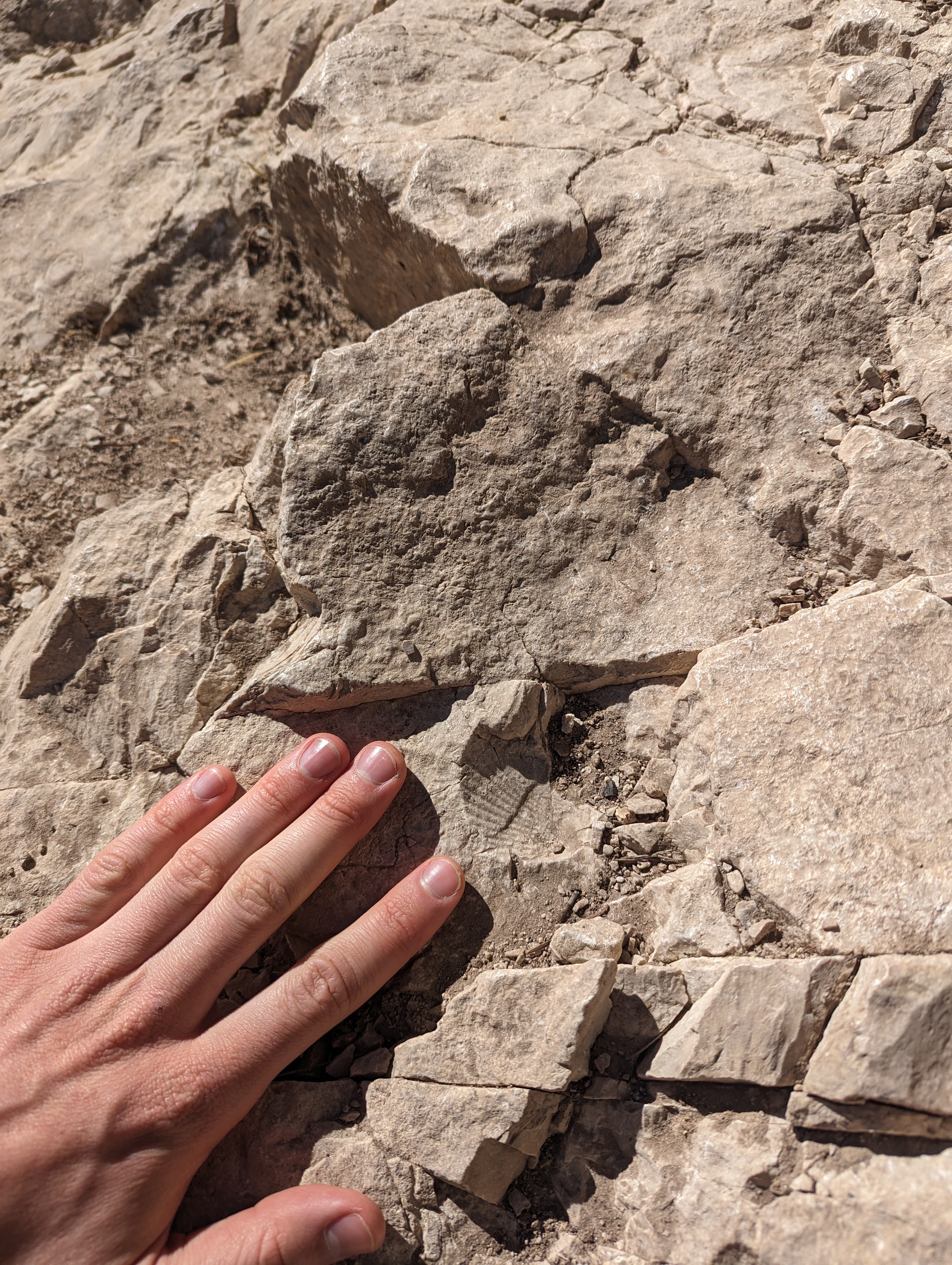 A fossilized shell at 8,000 feet, pretty cool!
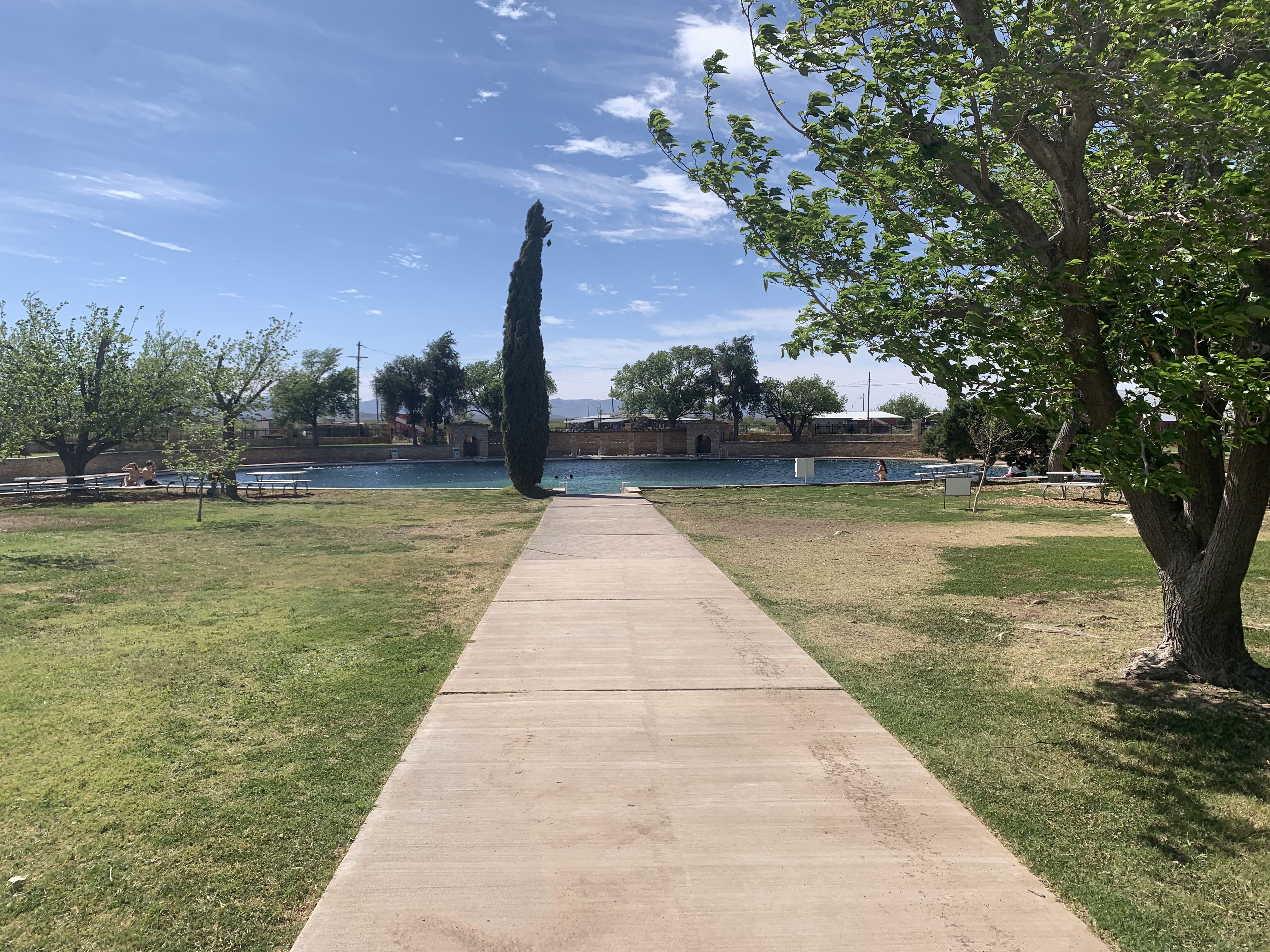 San Solomon Springs, a much needed oasis in the desert.
April 6th - Day 3 - Big Bend Chisos Basin and the Rio Grande River
We woke up early once again on day 3 (shocker), this time to get into the Chisos Basin and hike The Window trail before things heated up too much. The morning light on the basin walls was great, and the water smooth rock of the slot canyon that forms The Window was fun, and scary knowing a slip would send you down hundreds of feet. We saw some great flowering cacti and of course ocotillo, one of my favorite desert plants. Again, routes for our hikes can be found here.
When we arrived back at the car we were glad we arrived early, the parking lot was packed and on the road out there was a line 50 cars long waiting for cars to leave to enter the basin. We zipped on around the Ross Maxwell Scenic Drive on our way to Santa Elena Canyon, stopping briefly here and there for photo opportunities before jumping back into the AC of the car. Ethan saw something moving against the desert landscape so we turned around, found a spot to park and investigated on foot. It turned out to be quite the magnificent Aoudad.
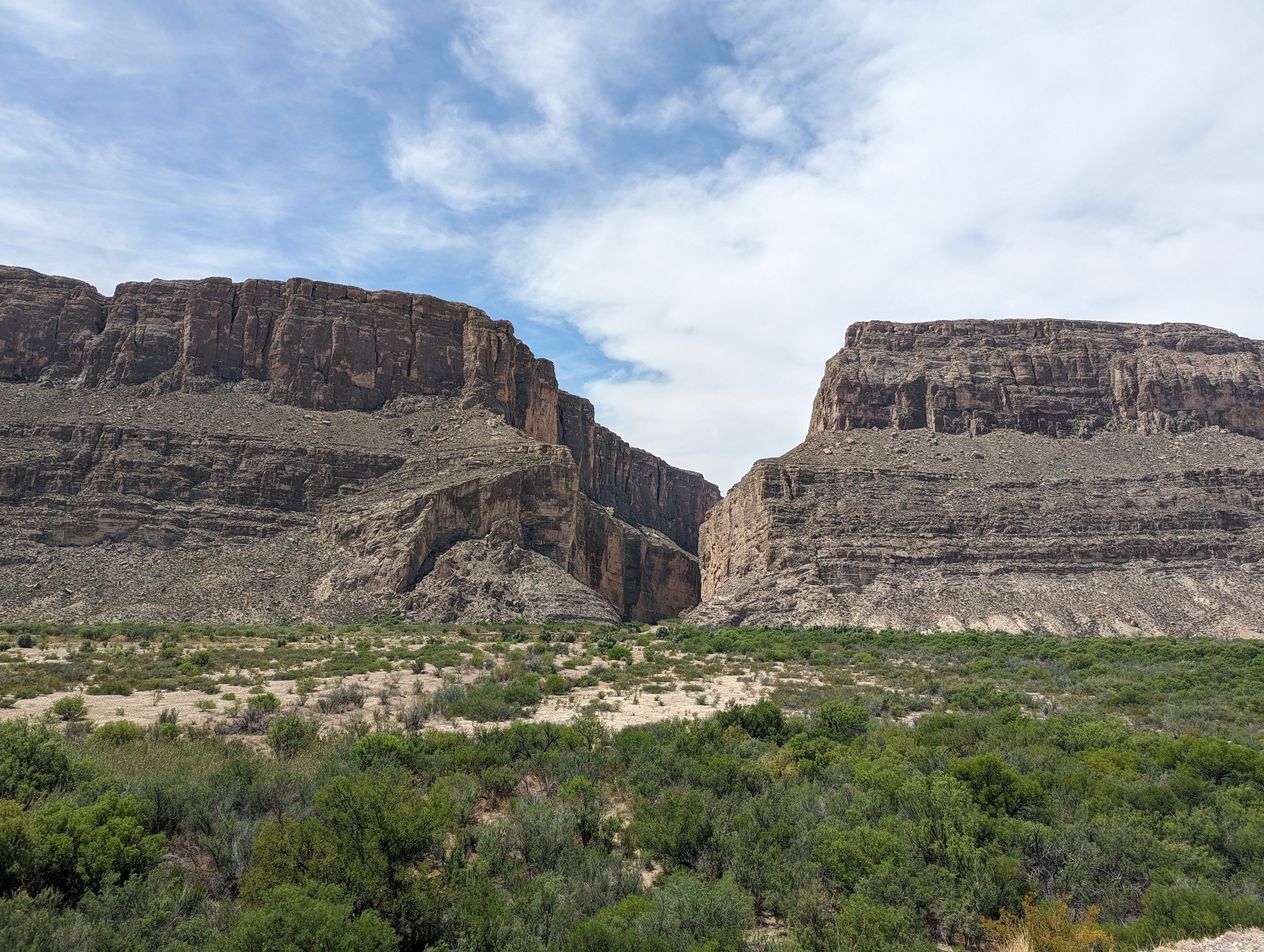
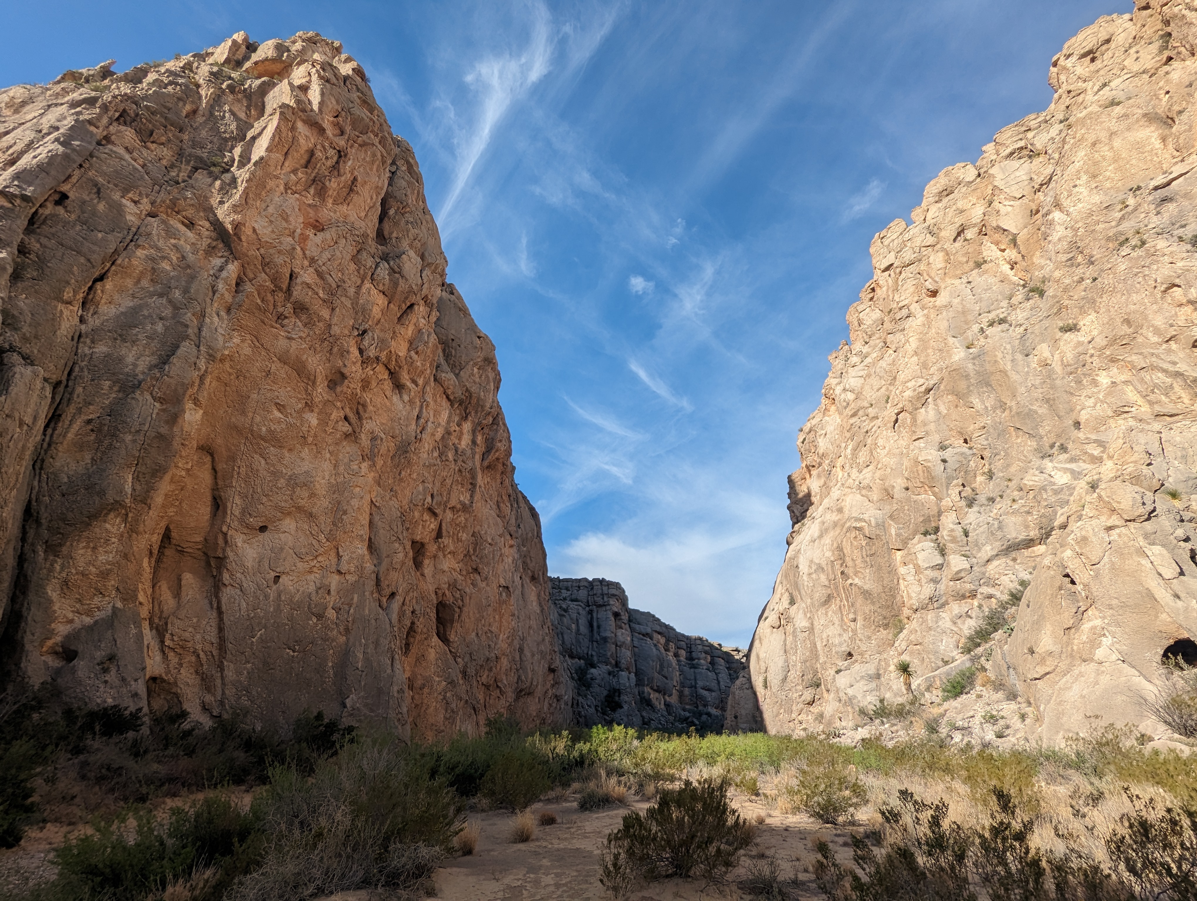
We stopped at the Santa Elena Canyon overlook before finding a spot to park at the crowded trailhead. The Rio Grande comes right out of the cliffs and it was fun to wade deeper into the canyon walking the line between U.S. and Mexico as we went. The river was barely flowing as it exited the canyon, meaning you could literally hop over it and into Mexico (and back).
We drove clear around to the other side of the park to Boquillas Canyon but didn't stick around too long because the port of entry to cross into the Mexican town of Boquillas del Carmen was closed. We took a photo with the park sign, returned to a favorite sunset viewpoint, and then retreated once again to our dirt lot campground closing the day.
Story continues after Day 3 photos.
 The hills that make up the Chisos Basin from the north side looking south.
 Ocotillo above The Window overlook.
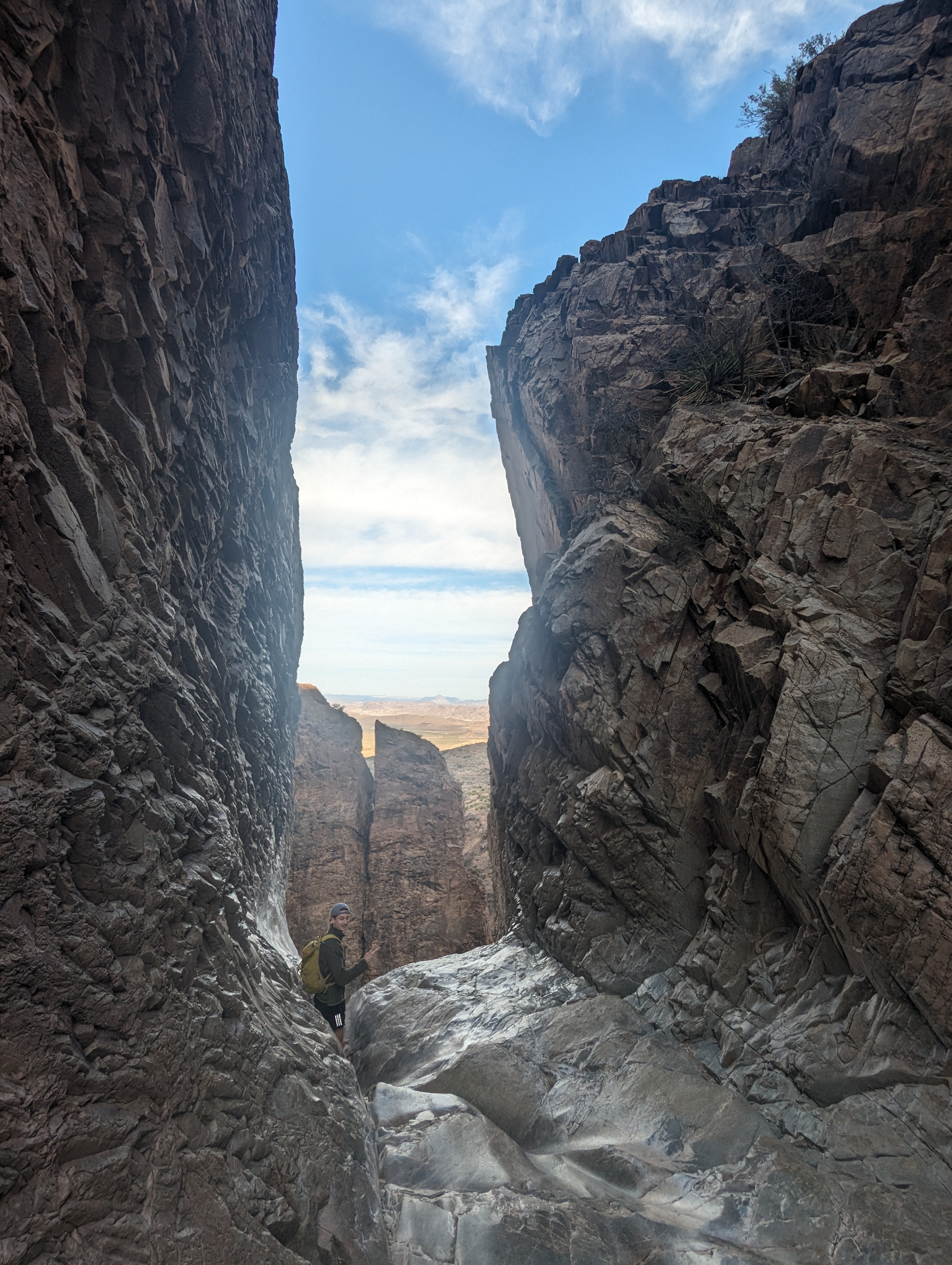 The Window, with Ethan on the ledge for scale.
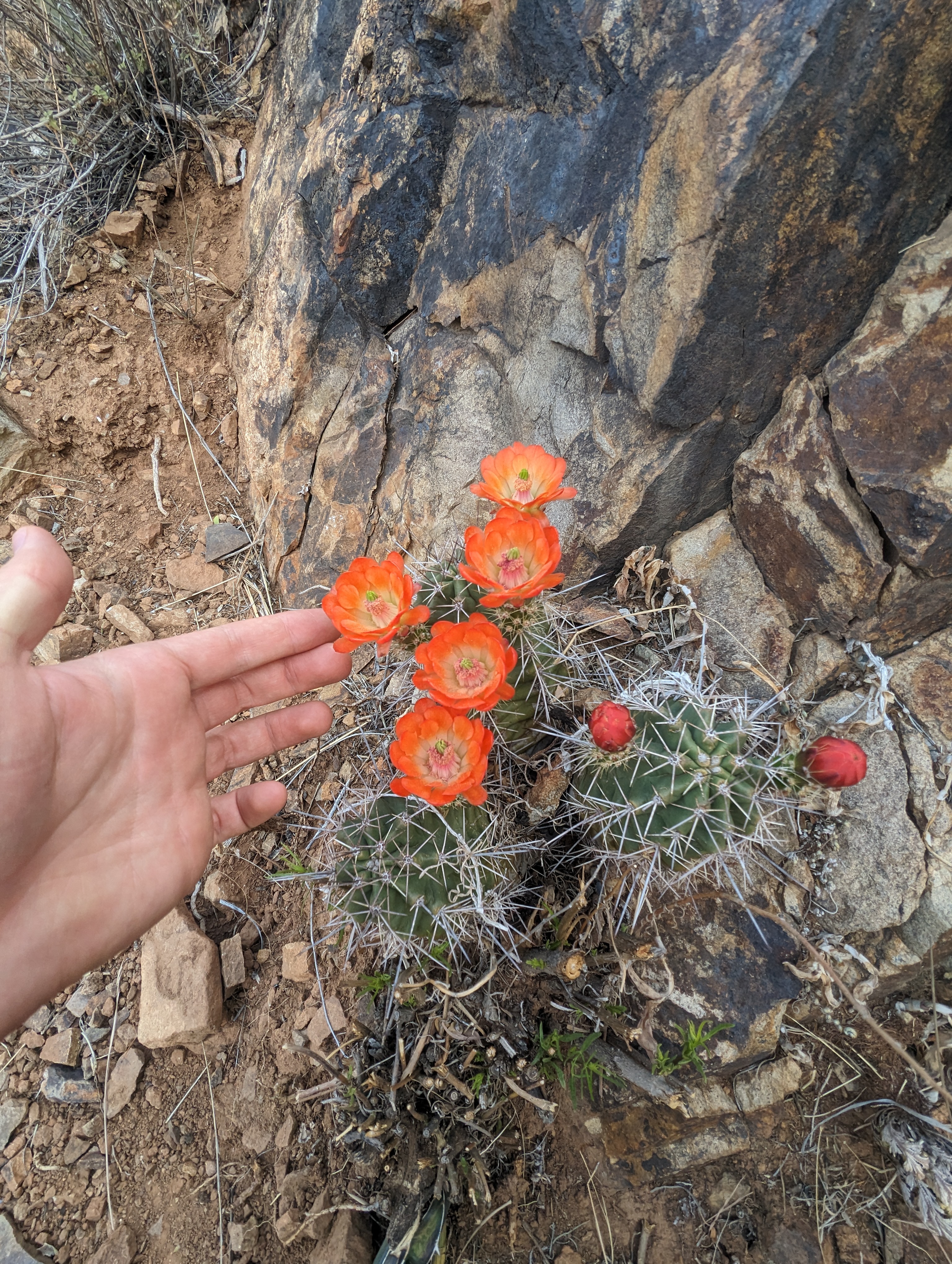 Had to bring out my inner botanist and make sure my hand was in the photo for scale of these nice flowers.
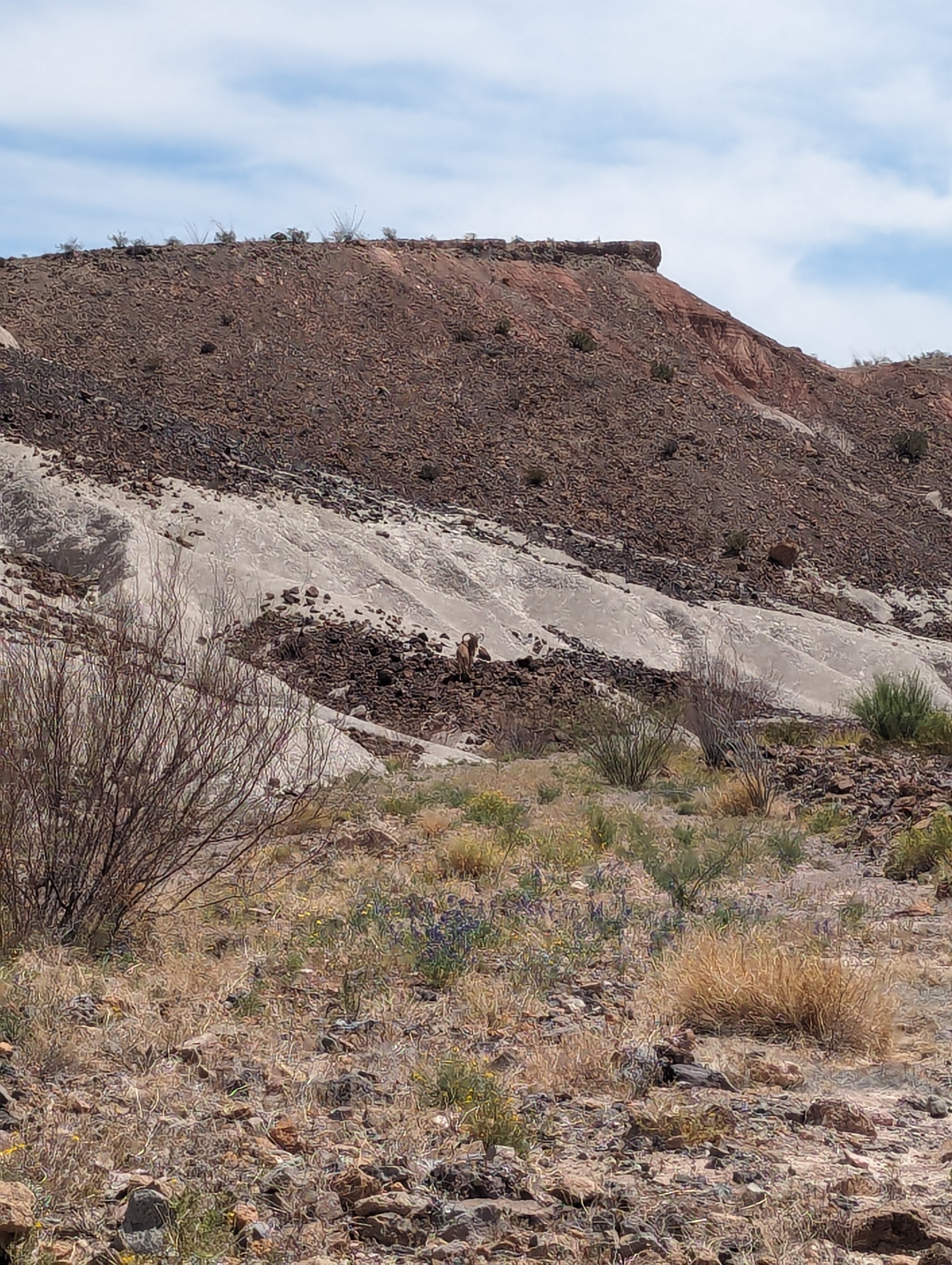 An Aoudad in the 100 degree heat.
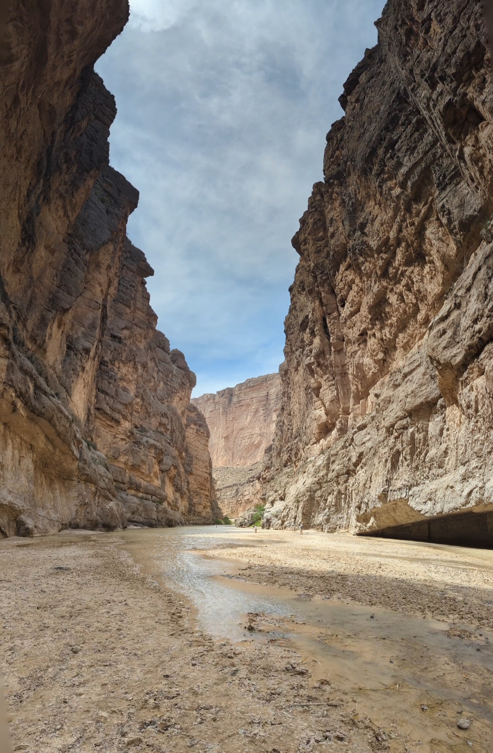
 Santa Elena Canyon, with the Rio Grande providing some green in the desert.
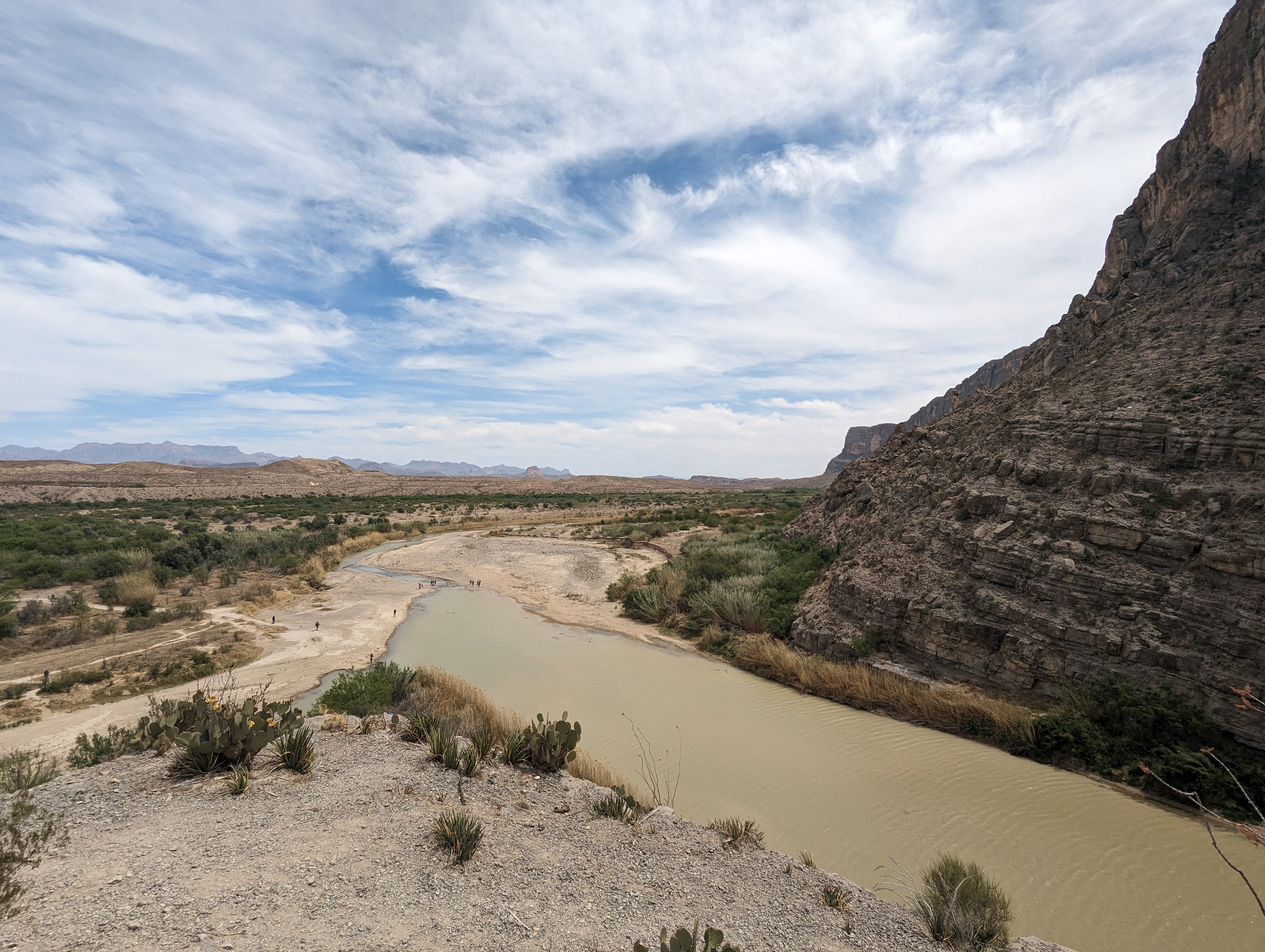 A view from the mouth of the canyon looking back to the north. Some folks can be seen hoping the border at the rivers narrowest point.
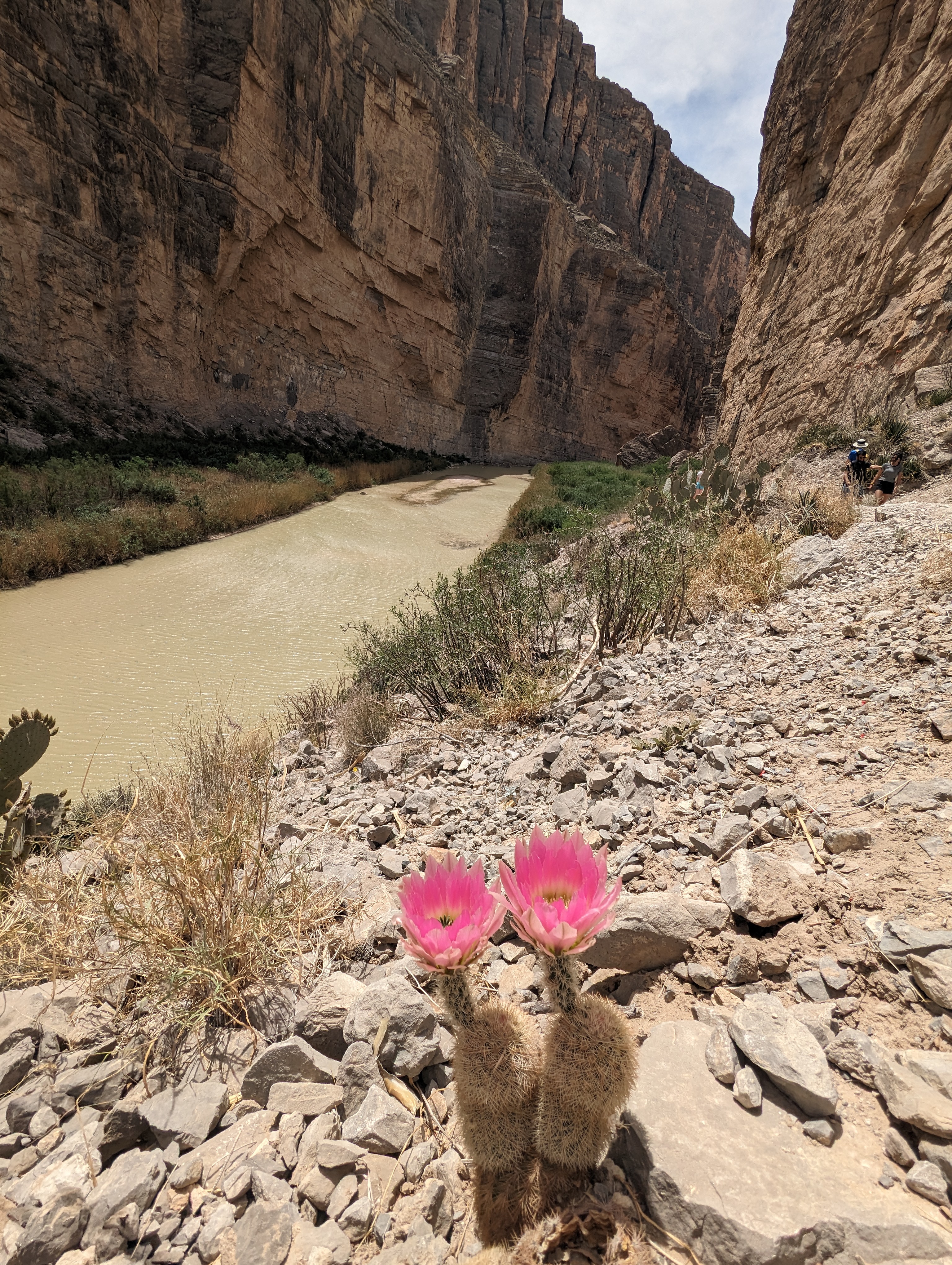 More great cactus flowers looking into the canyon.
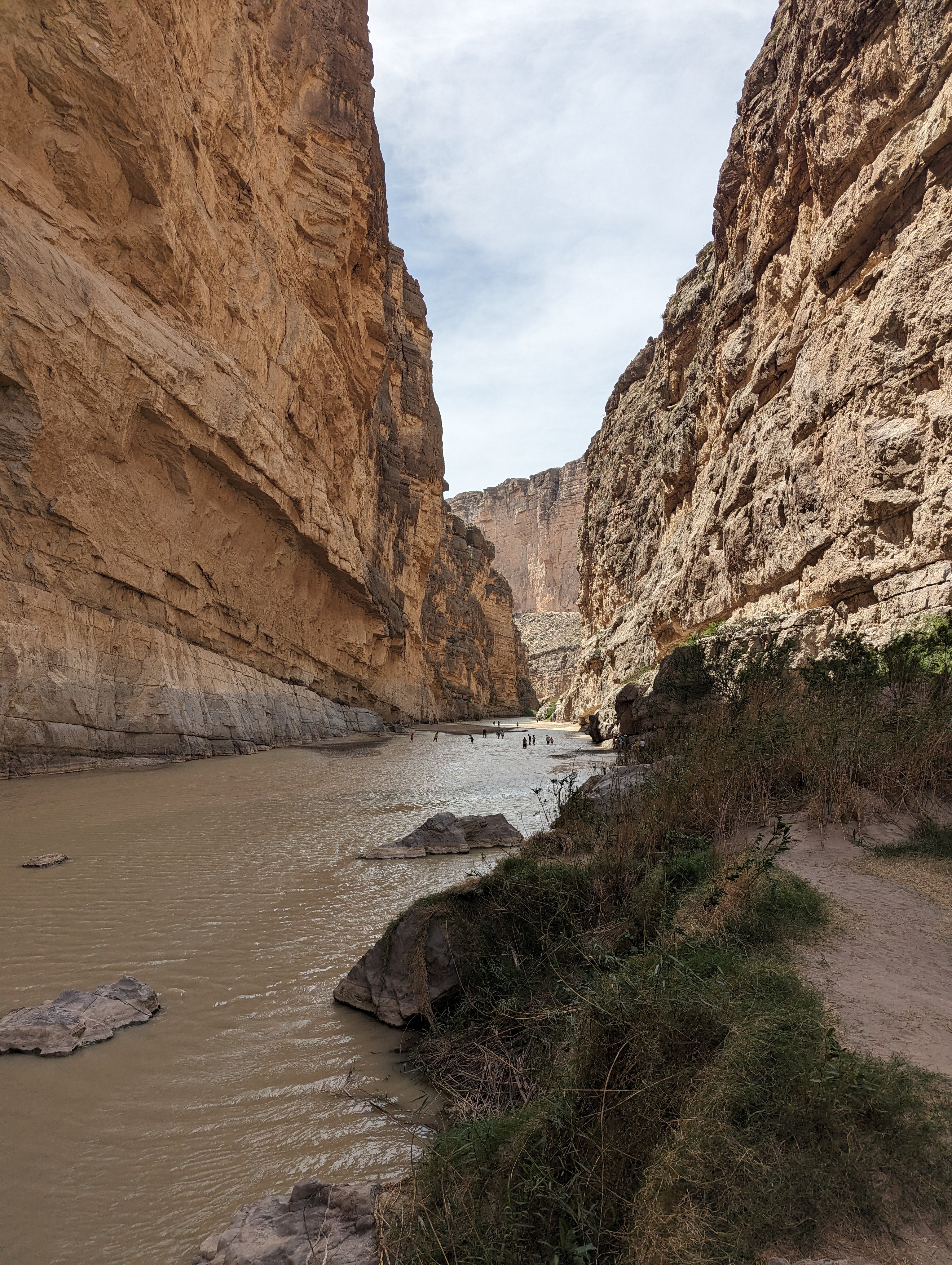 Lots of people enjoying wading up the water at the bottom of the canyon.
 A cold wind was blowing down the canyon and in the shadows it was actually quite cold, despite the 100 degree heat back out in the flats.
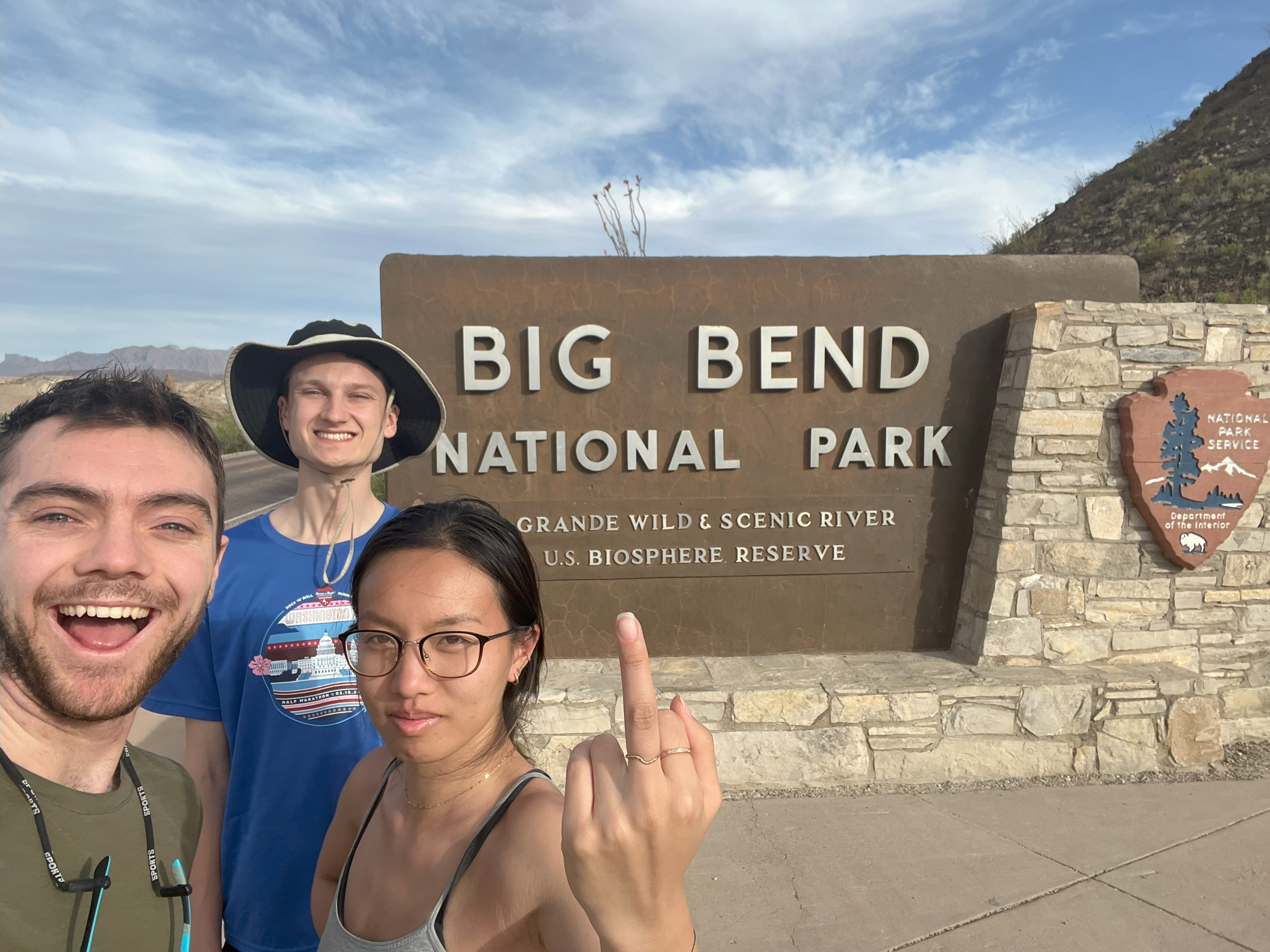 Mixed feelings at the sign after a long day :D.
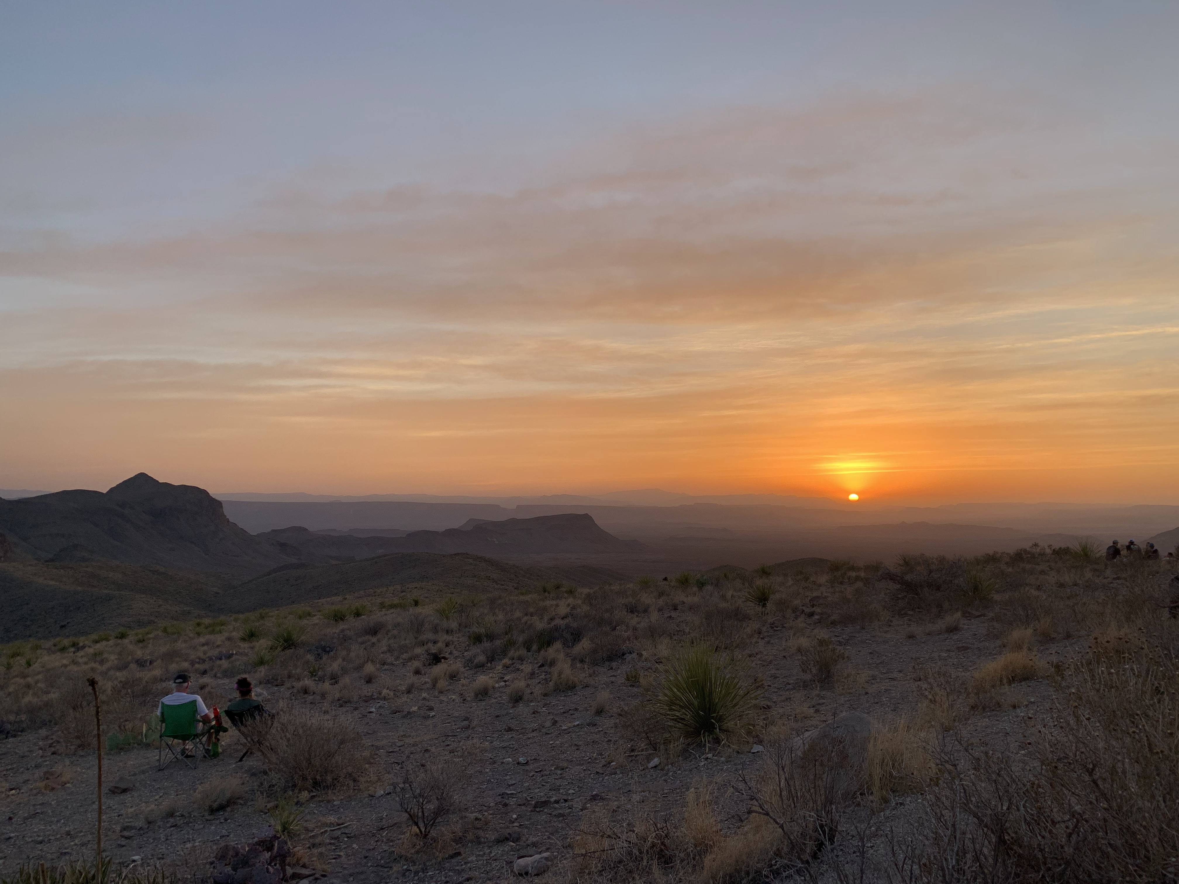 Sunset over the desert looking southwest. We could make out five separate layers of mountains off on the horizon.
April 7th - Day 4 - Big Bend East Side, Devils Den, and Eclipse Positioning
You already know we were up early again on day 4, our travel day to make it to Sonora, TX to be within striking distance of the path of totality. On our way out of the northeast side of the park we stopped by the Dinosaur exhibit. Big Bend is a hotspot for many fossils and there were some very nice specimen on display.
We planned one last hike in the park before exiting up Dog Canyon and Devil's Den. The hike took down a dry creek bed and into a canyon sliced through uplifted stone. The vibe was similar to The Hills Have Eyes, so a little spooky. The story behind the name Dog Canyon didn't help either. In the 1800s a dog was found waiting by a deserted wagon in the draw, presumably waiting for its owner to return. They never did. There were numerous caves in the surrounding cliffs to explore.
On the way out we decided to see if we could get to Devils Den canyon, enticed by the potential of scrambling some water carved pour-overs in the bottom. Walking in the wash we came upon a barn owl sleeping in the scrub. As we approached it flew low and quiet further up the wash. This repeated at least 10 times until it finally exited the wash. We didn’t make it to the pour-overs, but the owl encounter made the detour more worth our time.
Not much of interest happened after we exited the park and headed to Sonora. We arrived around 4pm and I quickly turned to the task of picking our eclipse viewing location.
Before arriving in Texas I had spent hours scouring Google Maps for ideal pullouts scattered across the path of totality and using a Google Earth plugin to compare totality time. I had chosen about 10 possible spots, some as far south as Uvalde and as far north as Brady. Unfortunately, the weather had other plans, as with 18 hours to go all the forecasts showed clouds over most of Texas during totality. I had been keeping tabs on the forecast for our entire trip and they only got worse as the date got closer. Now it was crunch time, do or die, and I wasn't about to let us down. After considering all the options, including driving through the night to hit a clear spot in southwestern Arkansas, I decided that our best bet was to head north towards the outskirts of the Dallas metro area early in the morning with time to position further in the hours before first contact.
I used Clear Outside hourly forecasts that showed cloud percentages for high, mid, and low level coverage to make my decision, and left up the forecasts for about 10 small towns in Texas Hill country on my phone for final positioning in the morning. With that, it was time to try to get some sleep before our celestial event.
Story continues after Day 4 photos.
 Looking west up Dog Canyon and back into Big Bend NP.
 Some great exposed bedding that has been rotated up.
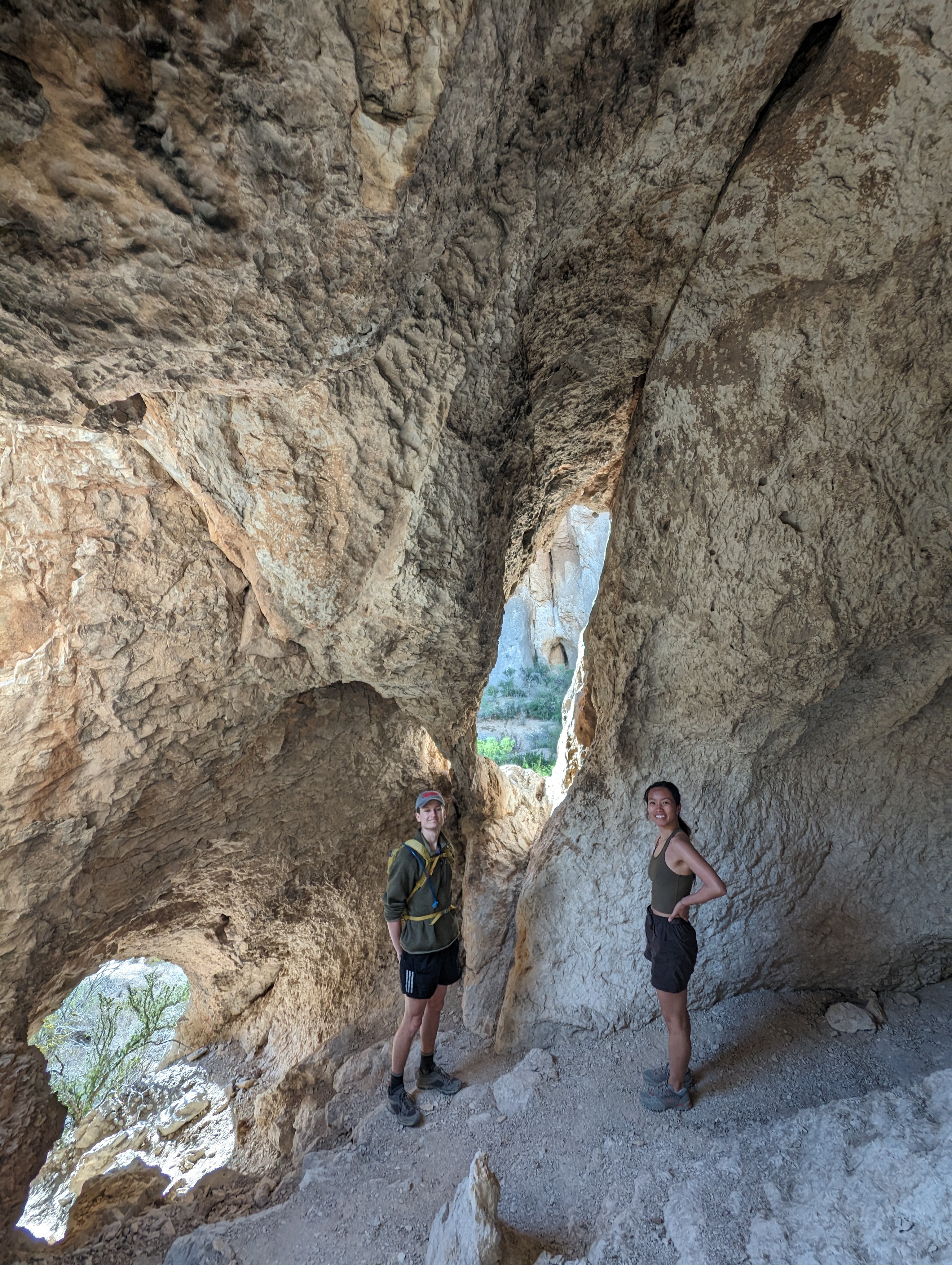 Inside one of the caves on the canyon walls.
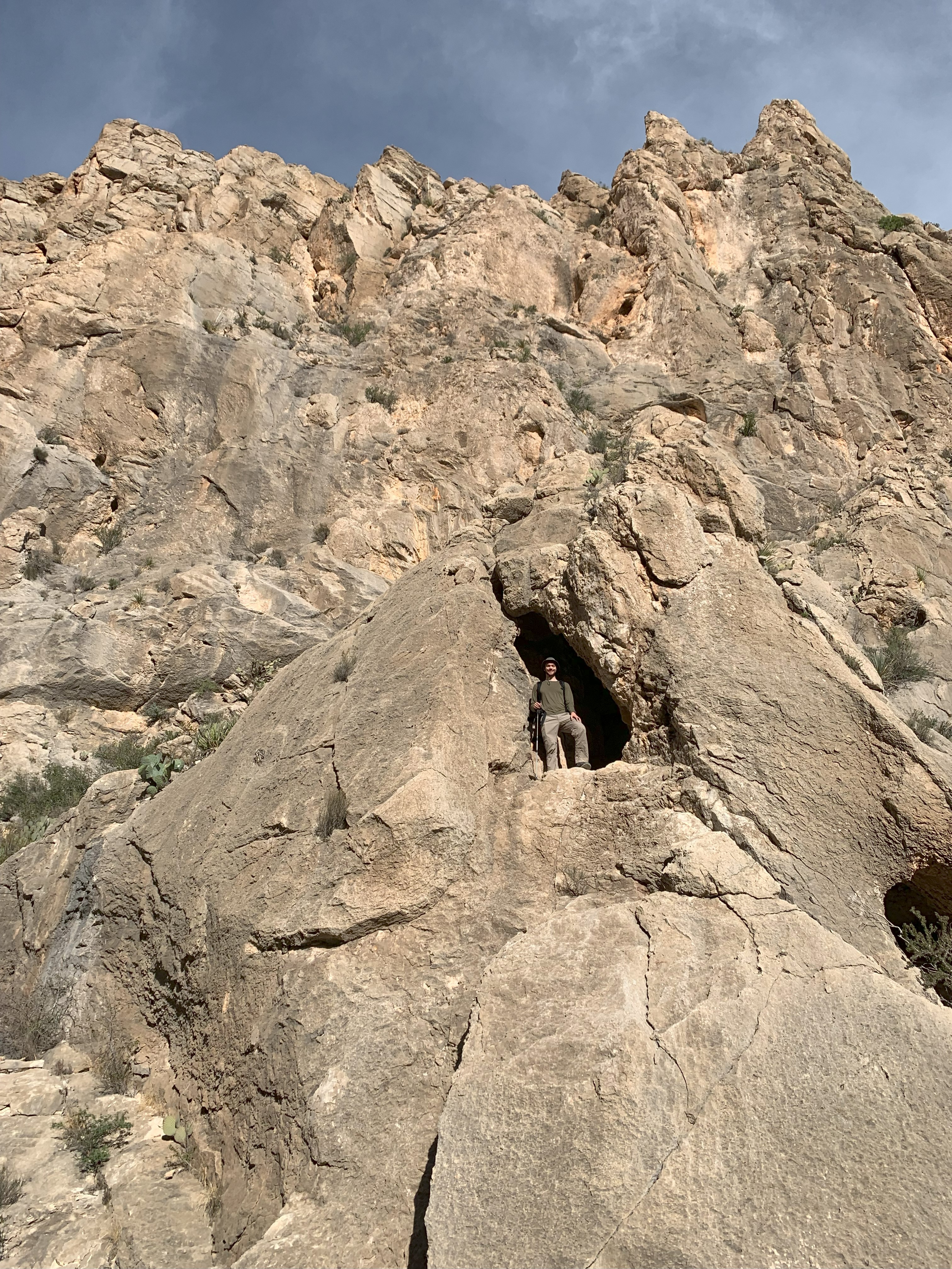 Me, standing at the window of a cave in Dog Canyon.
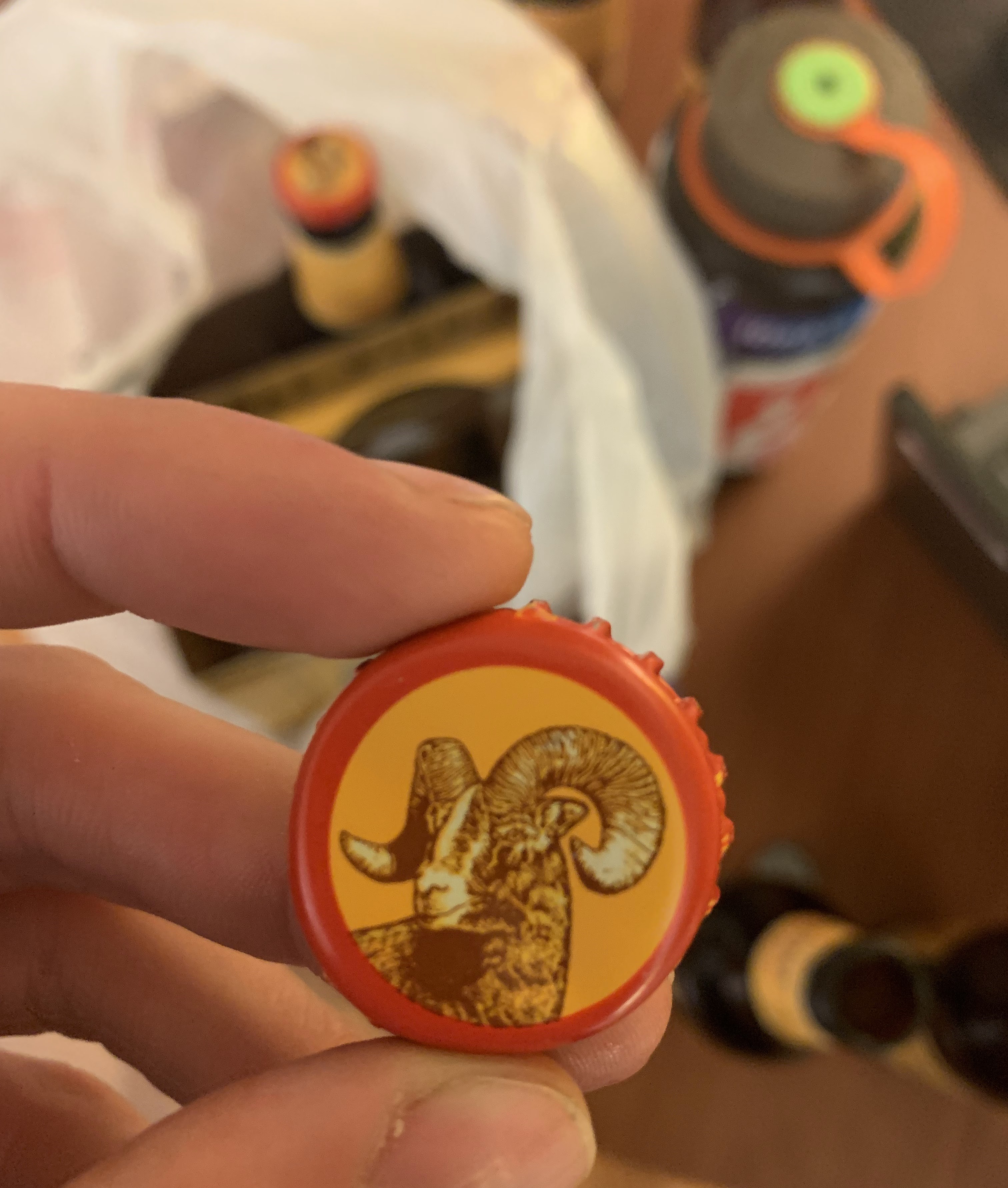 I have no idea when we acquired these beers, but I had a couple of them while I was frantically trying to find some cloudless options for the next days great eclipse.
April 8th - Day 5 - Eclipse Day, Dodging Storms and Traffic
4am and we were off, racing northeast from Sonora in Texas hill country. I was very tired after getting little sleep but the adrenaline from trying to not hit any of the numerous deer and the knowledge of what the moon was about to do kept me going. Our set destination to start was a McDonalds in Brownwood TX to get some food and regroup to find the final location. It looked like some low stratus was expected to come up from the gulf around 8am from the southeast but pull back from the edge of hill country by the time of totality. The other threat was high clouds streaming in from the southwest just before totality. I settled on a picnic area just east of Goldthwaite TX that put us far enough northwest to be on the edge of the stratus and also happened to be on a nice hill with good viewing toward the south, the direction of the shadows approach.
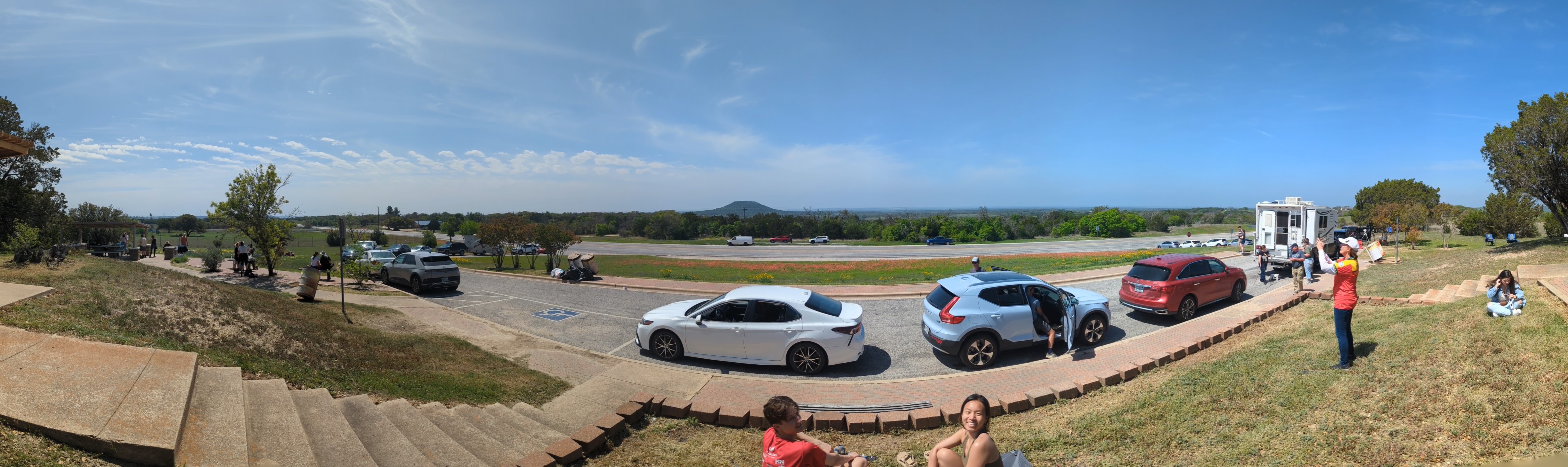
When we arrived at the picnic area at 8am, the situation looked bleak with heavy stratus blanketing the sky, but I had faith in the forecasts. When we showed up ourselves and a pickup truck with a camper shell were the only ones there. With almost 5 hours to kill we decided to walk laps around the little oval create by the picnic area pullout and the highway. We almost certainly looked insane, and maybe we were, naming the distinctive wildflowers amongst the many and greeting them each time we came around. Slowly the clouds began to pull back and the parking area began to fill up. By 11am there were patches of sun and cars parked out onto the highway, we were glad we came early and nabbed the best spot. A couple of folks had telescopes set up to view the sun spots which were fun to see.
With the sun fully out we took a last spin through the wildflower fields and then returned to the grassy knoll to setup our tent ground cloth and use our glasses to watch as the moon slowly covered the sun. The light got dimmer, and redder. I spotted crescent shadows made by the pinholes between the tree leaves. With five minutes to totality you could see the southern sky getting darker as the moon's shadow approached. Some puffy low clouds started to form as the lower atmosphere rapidly cooled. They even covered the sun momentarily but thankfully moved just enough with 15 seconds to go to fully reveal the sun once again.
And there it was: totality. The absolutely primal feeling of watching the sun disappear and the corona pulse into view as darkness descends during the day has no comparison. Getting to share it with others for their first time was equally special. As the sun came out again in the diamond ring I made a point of watching out for shadow bands and we saw them, much larger than I remembered from 2017. They looked like streaks at least a foot wide and several feet long scattering on the concrete.
With all the anticipation released, the circus of people scattered in every direction. We went south, headed to San Antonio. Us and thousands of others. We would have stayed longer to wait out the crowds but severe thunderstorms were sweeping down from the north. The drive was beautiful as hill country was filled with the spring wildflowers. We finally hit traffic in Fredericksburg and it was basically bumper to bumper all the way into the city. We saw several cars run out of gas, and more than several road rage incidents, but we were still riding high on the successful ending of a Great Value road trip that no amount of lifted truck tailgating could sour.
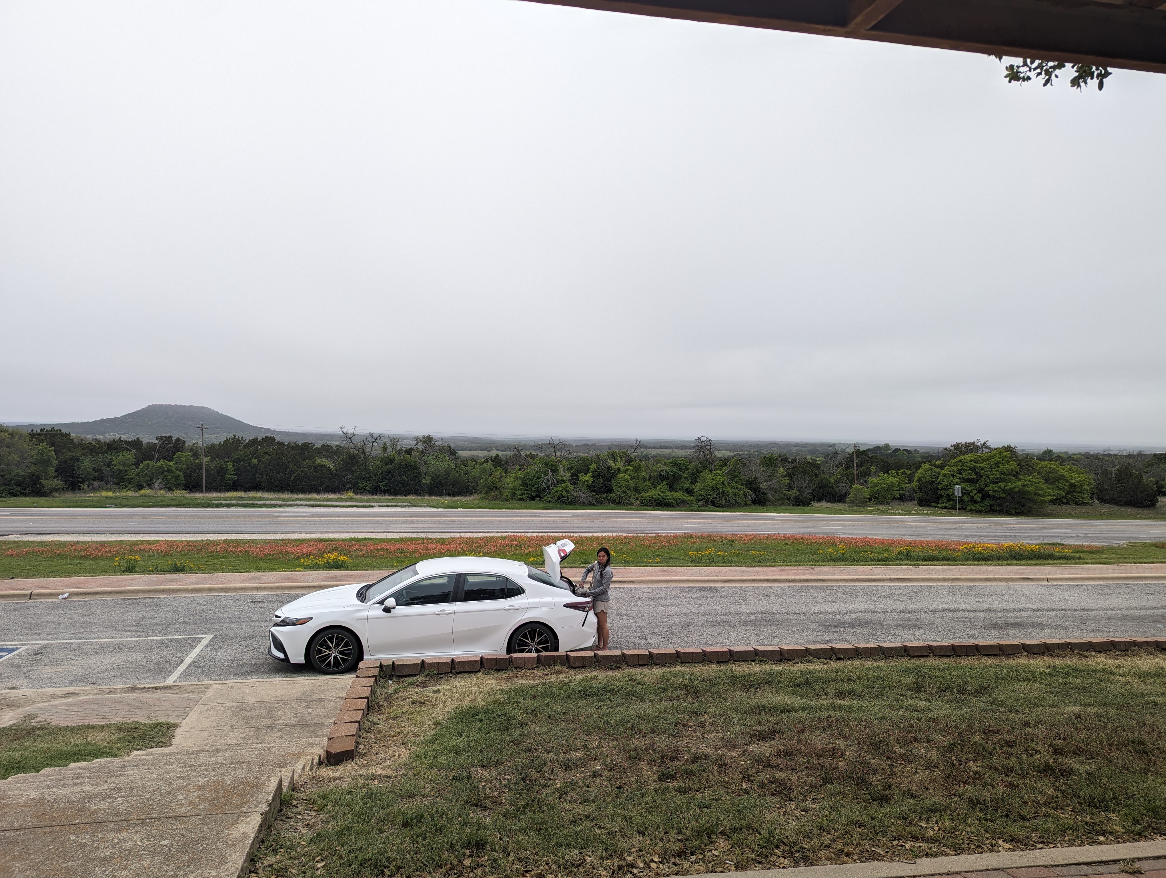 Just us in the roadside picnic area with cloudy skies at 8am. I knew the former would change and hoped the latter would as well.
 Sun comes out.
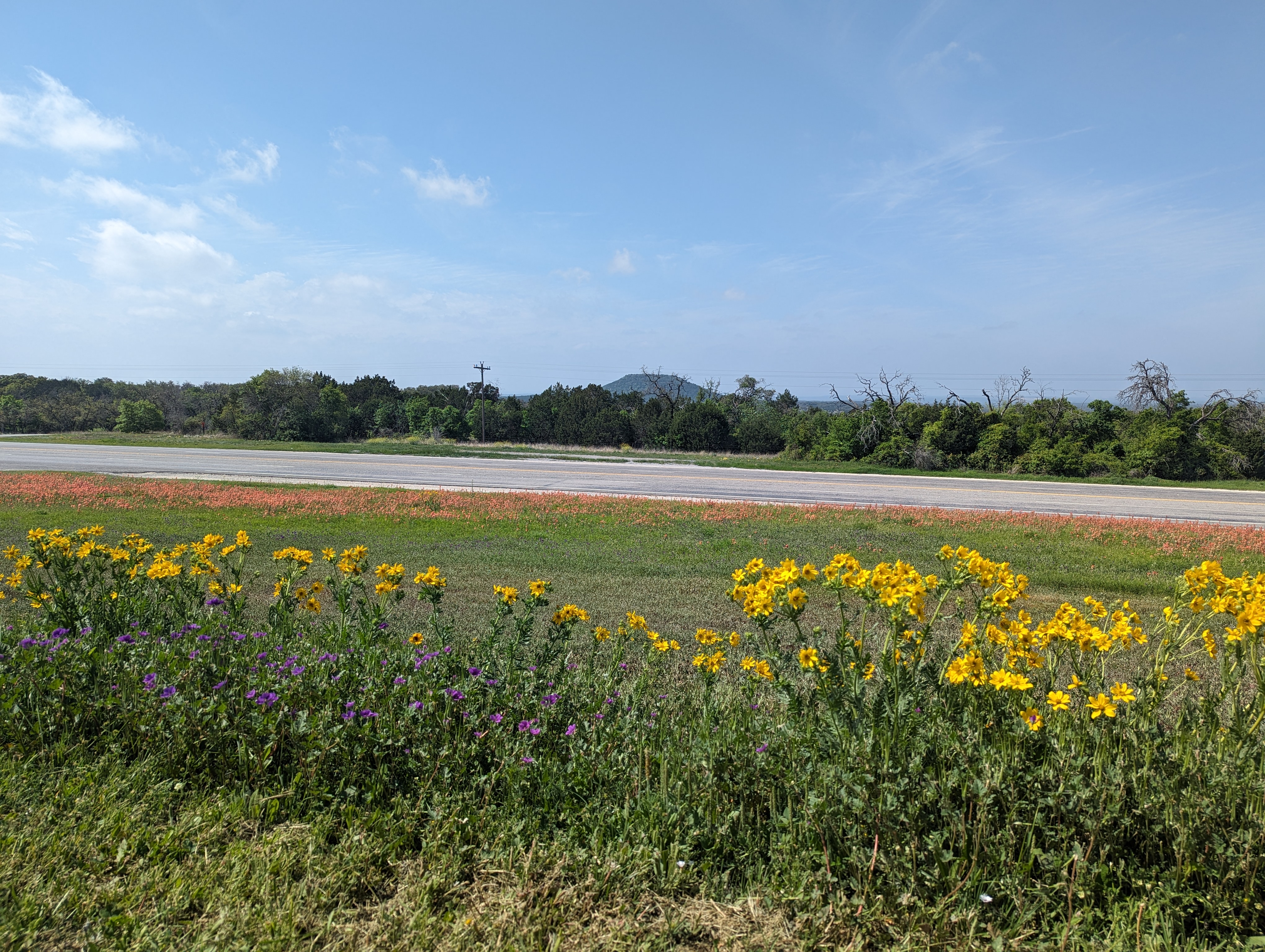
 Nice wildflowers were abundant, seen here looking back to our spot on the hill.
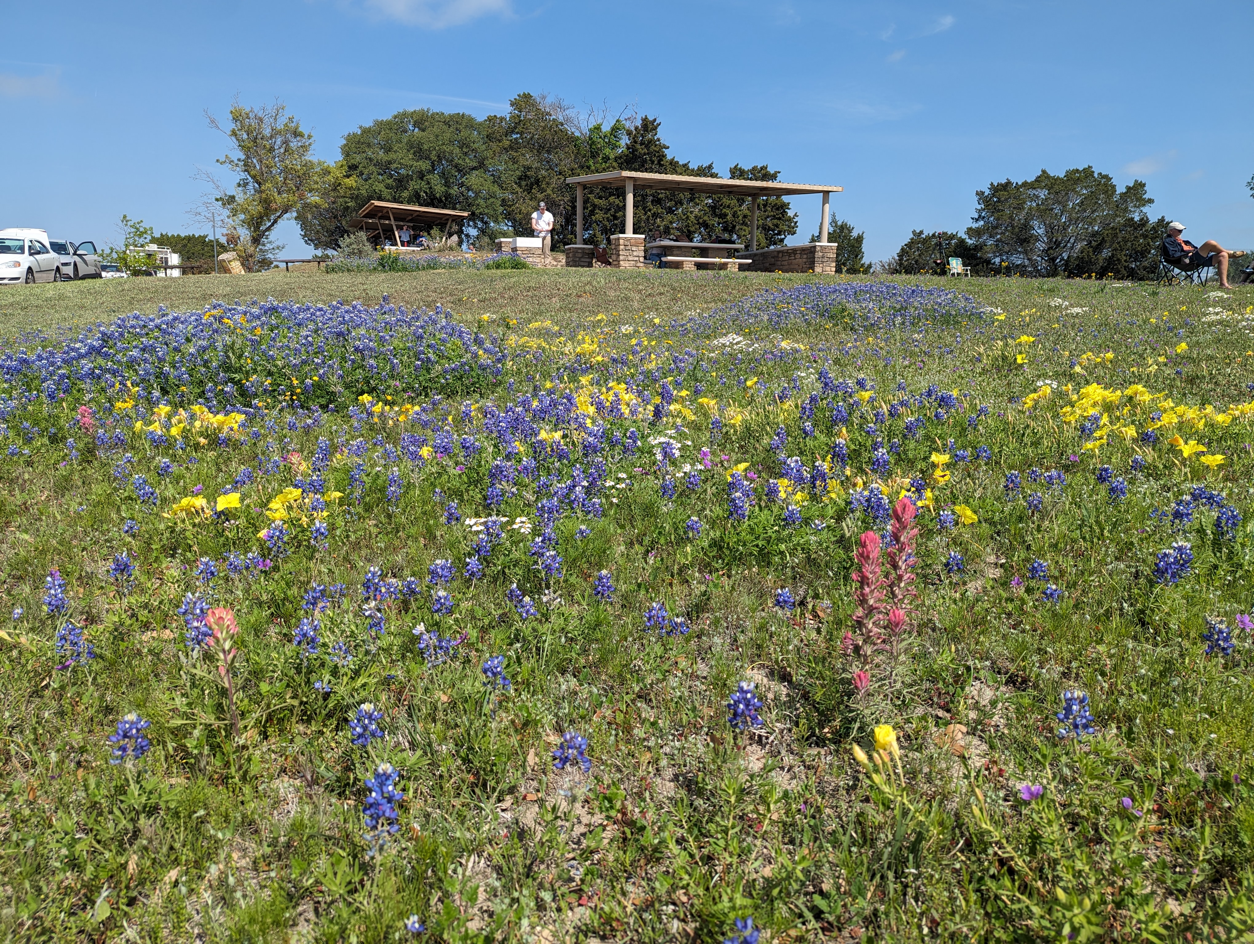
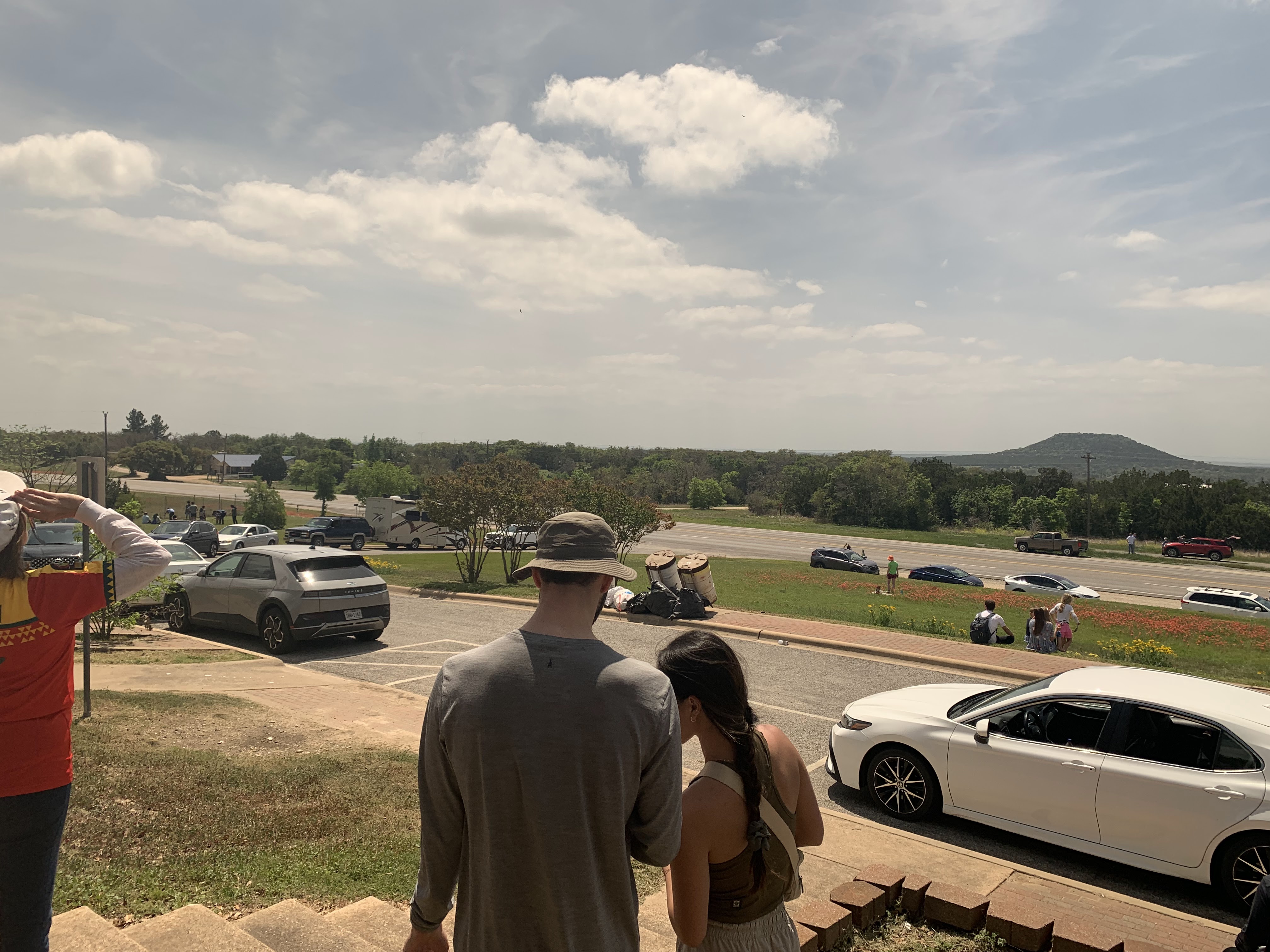
 The crowd filled in nicely! But we had our prime spot on the grass where no one could block our view :).
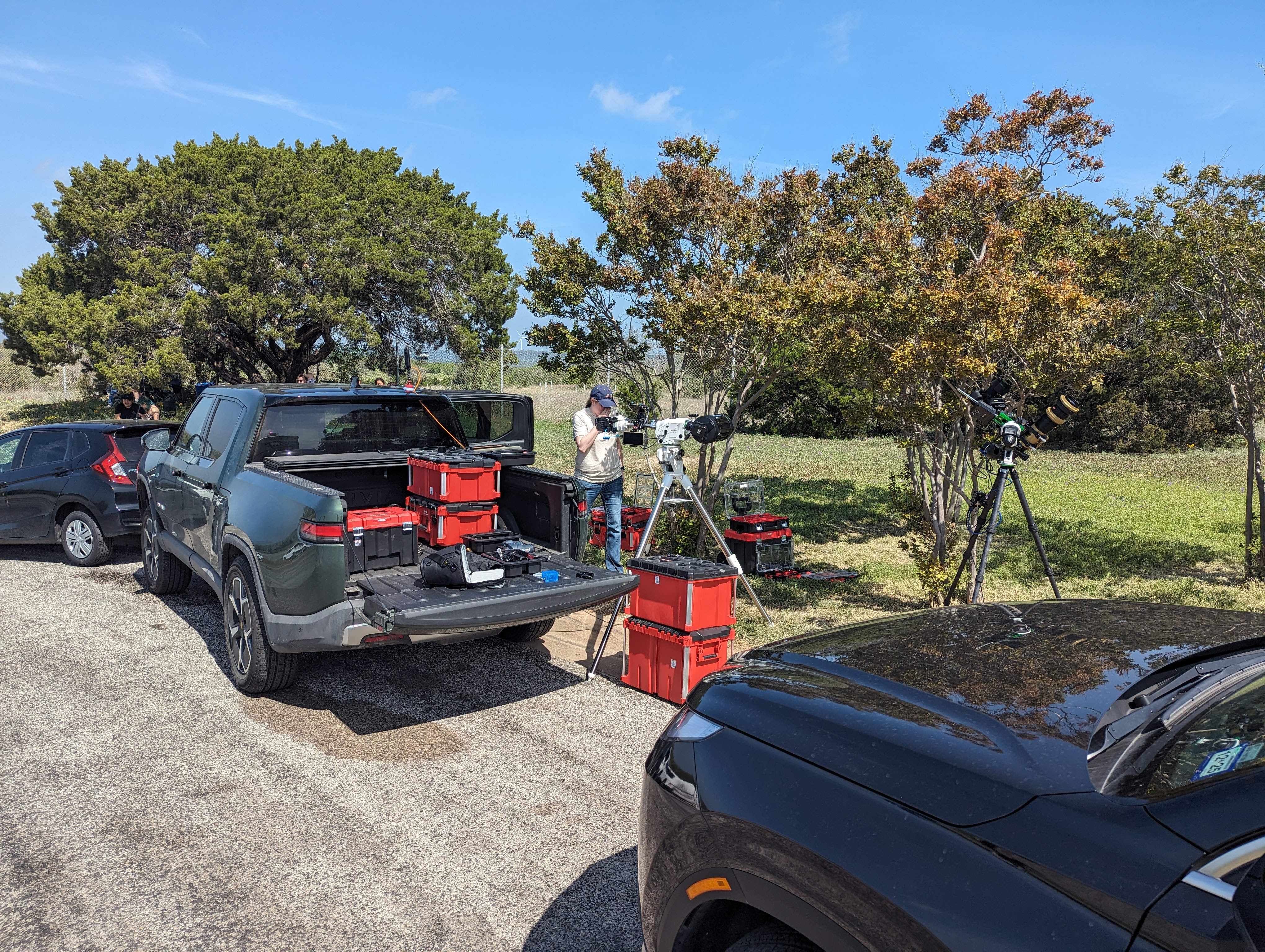 You know you picked the right spot when these folks show up. They had two tracking cameras and computer racks to run them. There goal was to livestream the eclipse but I think connectivity issues prevented it.
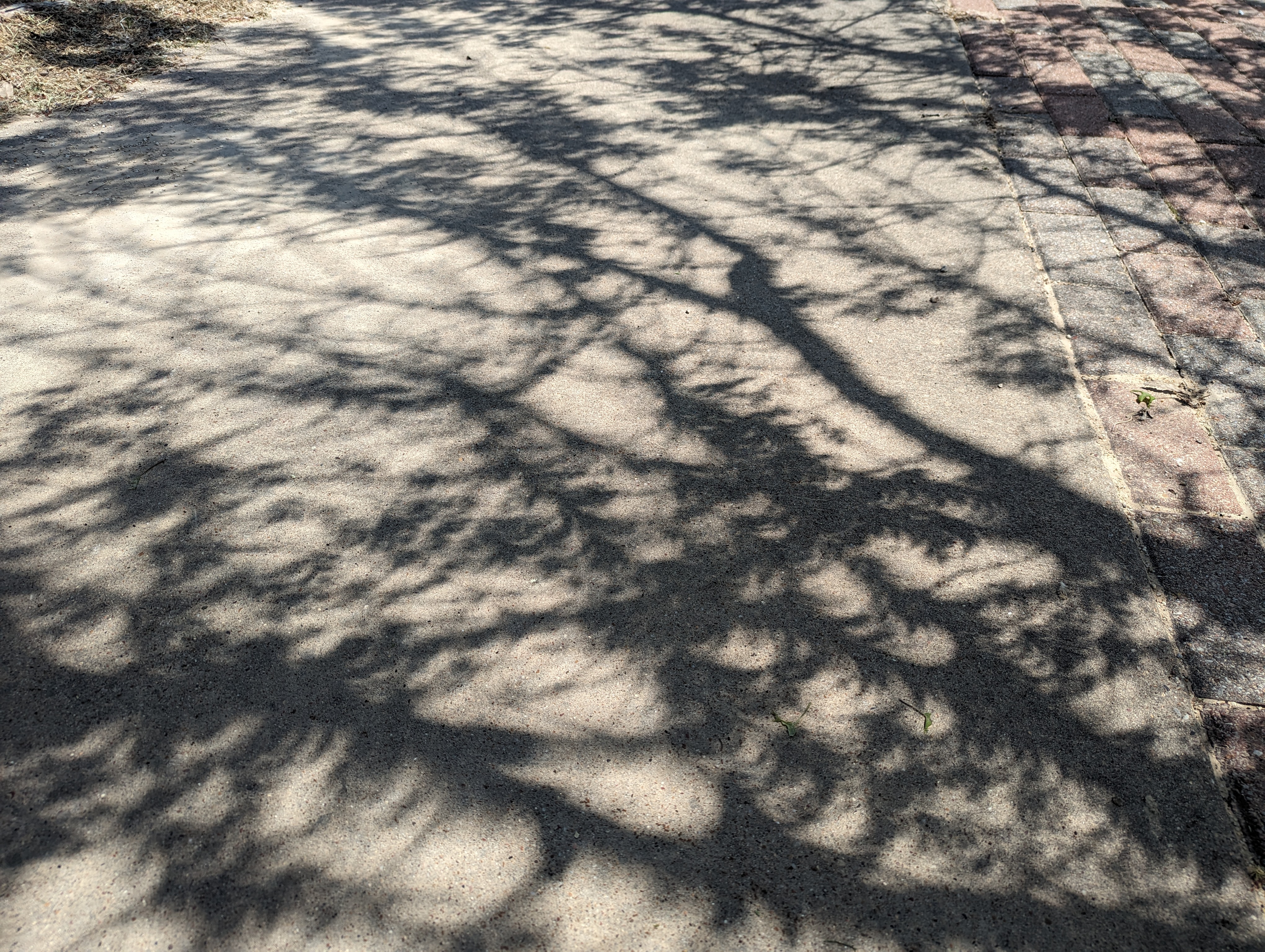 Do you see what I see in the tree leaf shadows?
 About 10 minutes out and the quality of the light has noticeably changed. The excitement from the crowd was growing and growing.
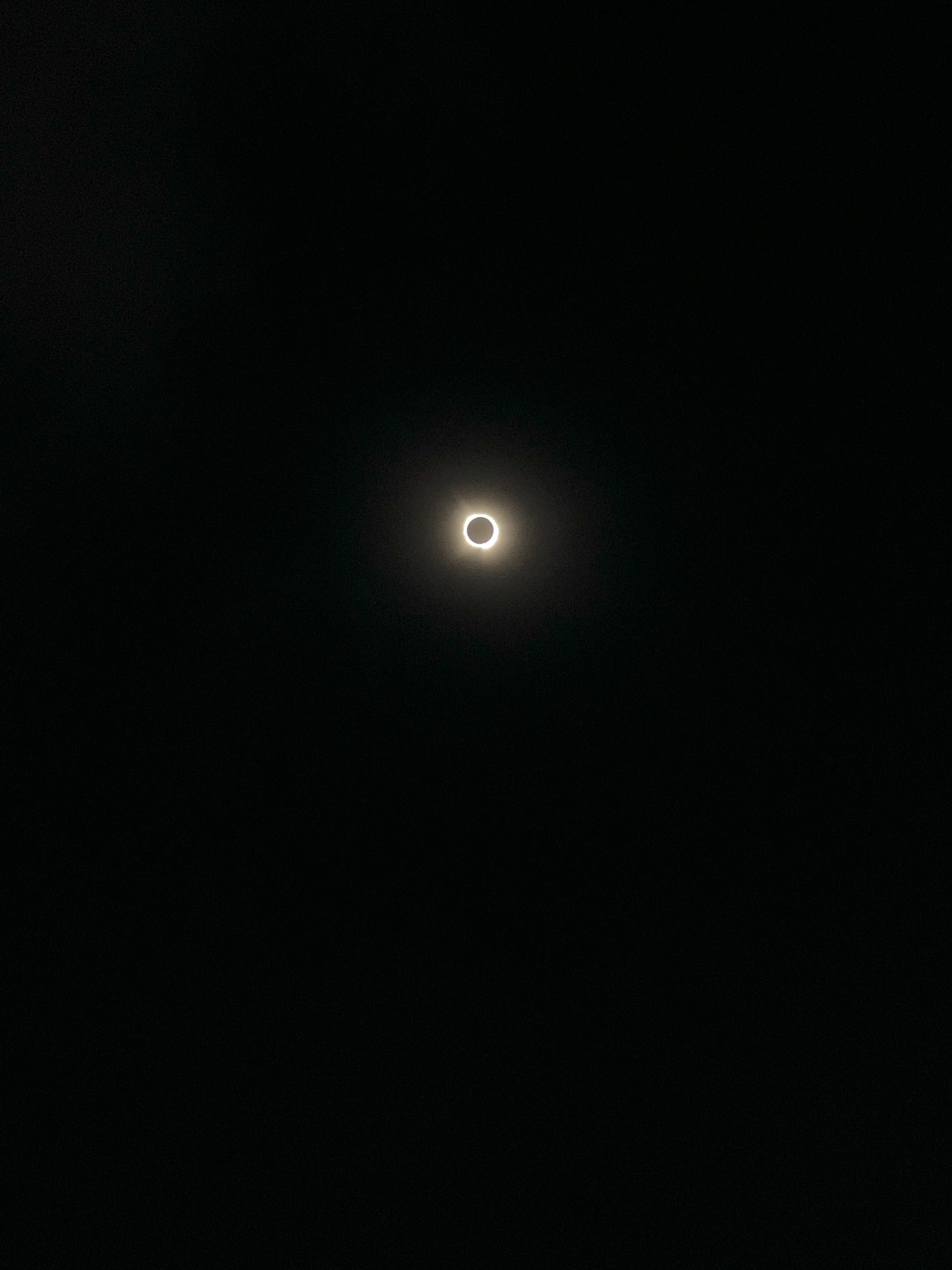 Success! A total eclipse of the sun!
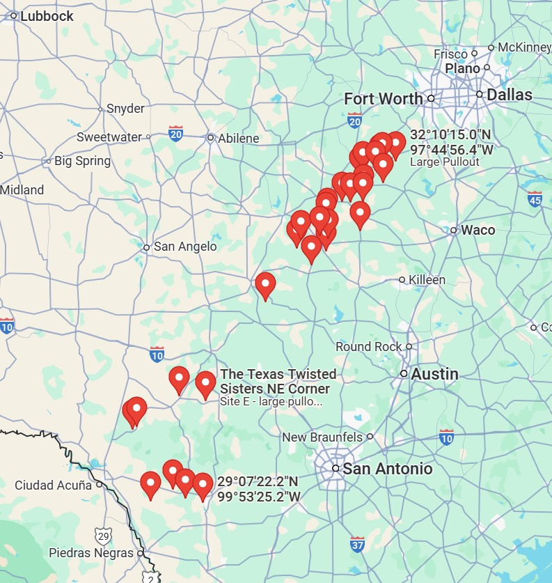 The many many pullouts I found as options for viewing. The cluster in the bottom left was the originally planned area, and the larger cluster further north is what I found in the hotel room the night before the eclipse with the changed forecast.
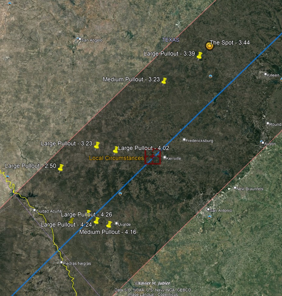 The Google Earth tool I used to find totality time. Our final location had about 3 minutes and 44 seconds of totality.