Acadia NP - CT and MA HPs
Some of the best foliage I have seen so far :).
October 15th - Day 1 - CT and MA State HPs
Yet another Northeast strike mission in the fall. Once again we were hunting for foliage with the goal of visiting two state high points and a national park. We left from Manhattan by commuter train to Poughkeepsie where we picked up our rental car to avoid the add on expenses in the city. Forced into a free upgrade, it was either a Jeep or a grey Dodge Charger with New Jersey plates. We went with the latter because it had much better milage, although not ideal for camping nor for avoiding the ire of the New England locals.
We zipped east into Connecticut to visit Kent Falls State Park before heading on to the Massachusetts border. Connecticut's state HP is really the shoulder (2,380 ft; 725m) of a mountain in Massachusetts, Mt. Frissell, that spills over the border. We were a little past peak in terms of foliage color but the drive into the trail head was gorgeous nonetheless. The trail was steep as it climbed over a couple rocky outcrops on its way to Frissell. After tagging the summit we headed directly south to reach the Massachusetts/Connecticut border and the Connecticut state HP. After signing the registry we were off to the next HP for the day. However on the way back to the car we choose to try to take a different trail back that showed up on both Caltopo and Gaia but was a little overgrown. We quickly learned why it was no longer preferred as the trail turned into a running creek channel. A map of our route up Mount Frissell can be found here. Somewhat slowed by the off trail navigation required to keep our feet dry, by the time we reached the car our ETA to the Massachusetts state high point was sunset exactly.
With a time to beat we were on the move, putting our muscle car to good use. We made up time cruising the back roads of The Berkshires and pulled into the parking lot atop Mount Greylock (3,489 ft; 1,063 meters), the Mass state HP. There is a nice observation tower/ monument atop the summit but more impressive is the view to the east with the landscape dropping out almost 2,000 ft to the town directly below. As drive up east coast high points go, it’s a damn good bang for your buck, easy 6/10.
With two high points under our belt for the day it was time to get to camp. Lets just say our muscle car and tiny tent did not fit amongst our big truck big tent neighbors. We got some interesting looks but were more concerned about getting some sleep before our early rise and 7 hour drive to Acadia National Park in Maine.
Story continues after Day 1 photos.
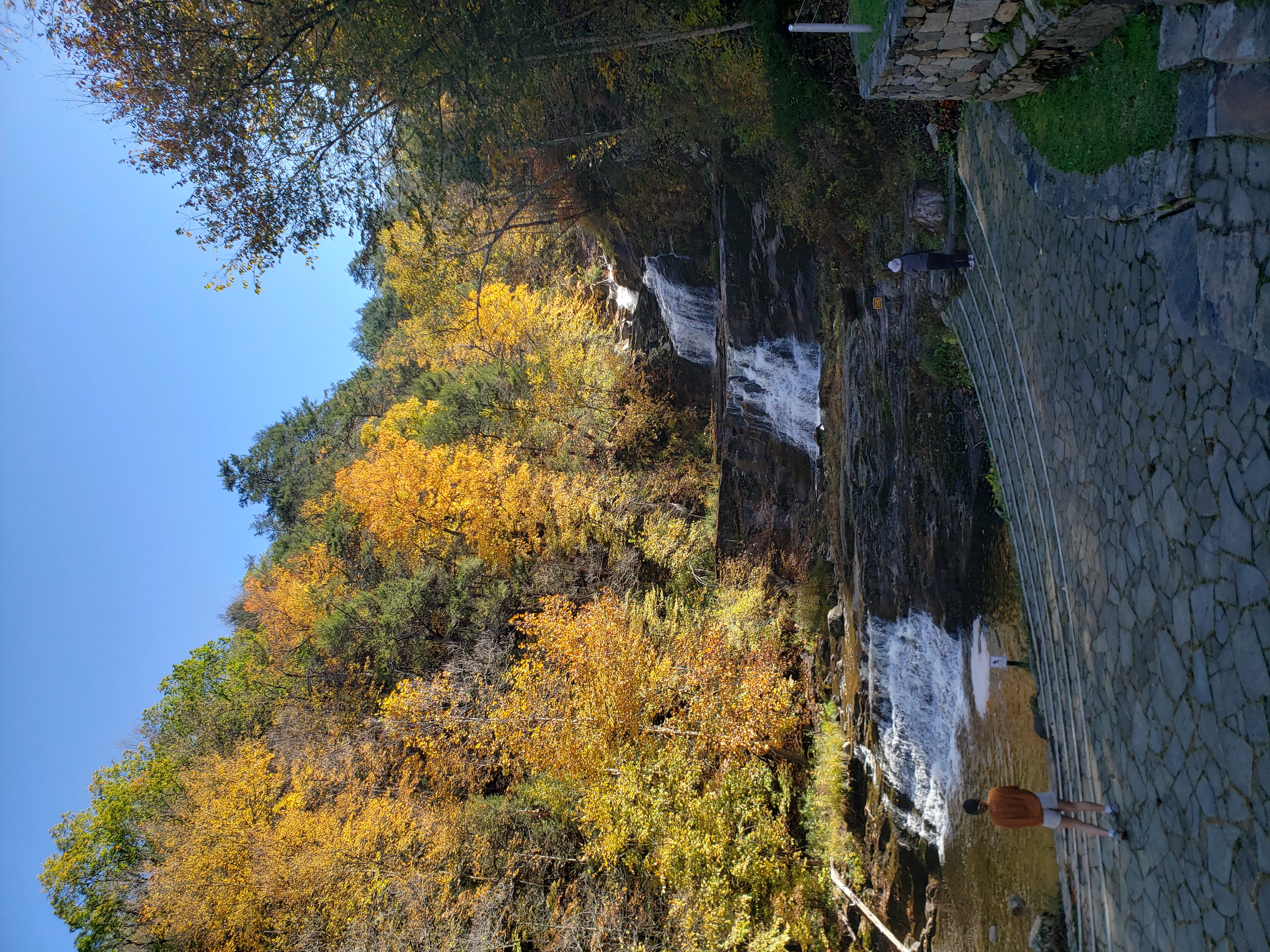 Kent Falls, Connecticut.
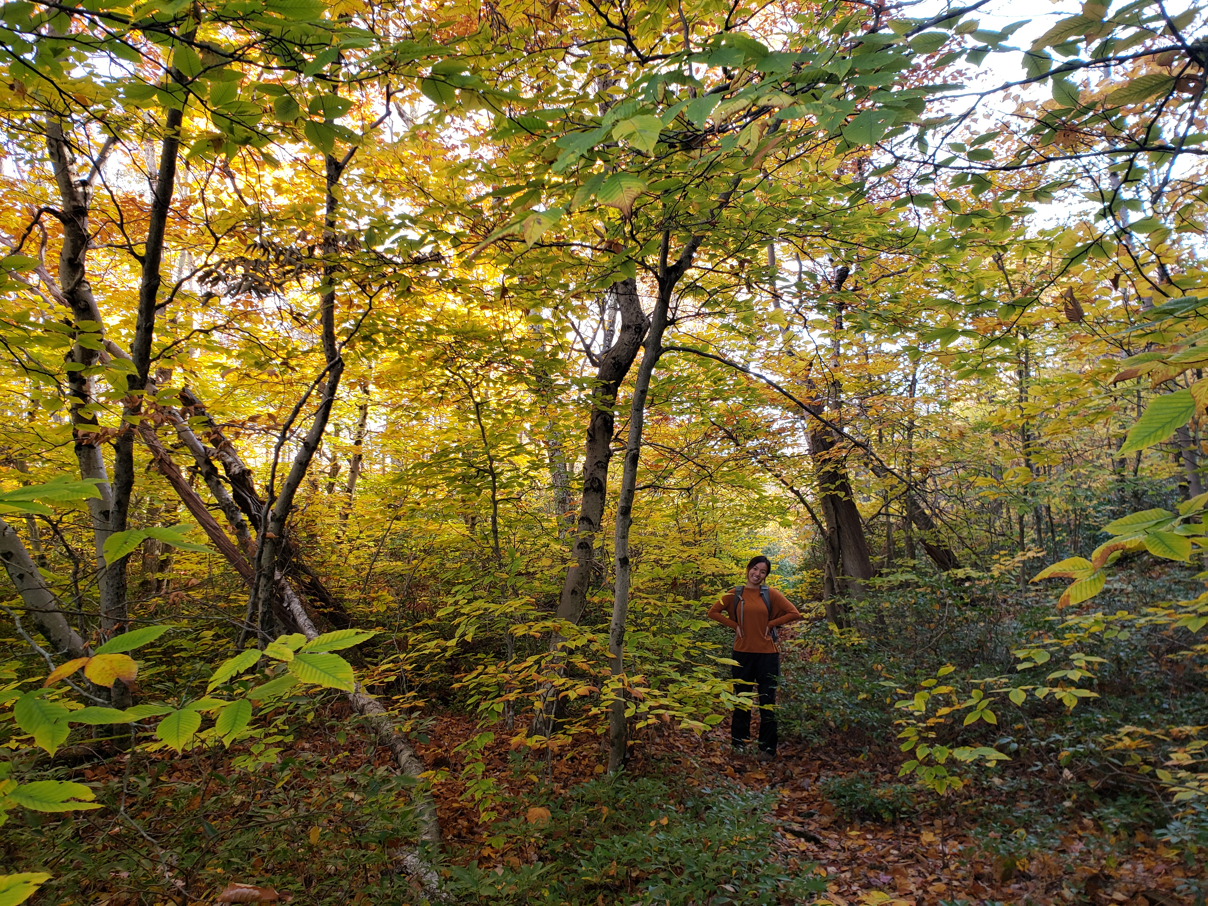 Still "on trail" but it didn't feel like it. The foliage made the wet walk less aggravating :).
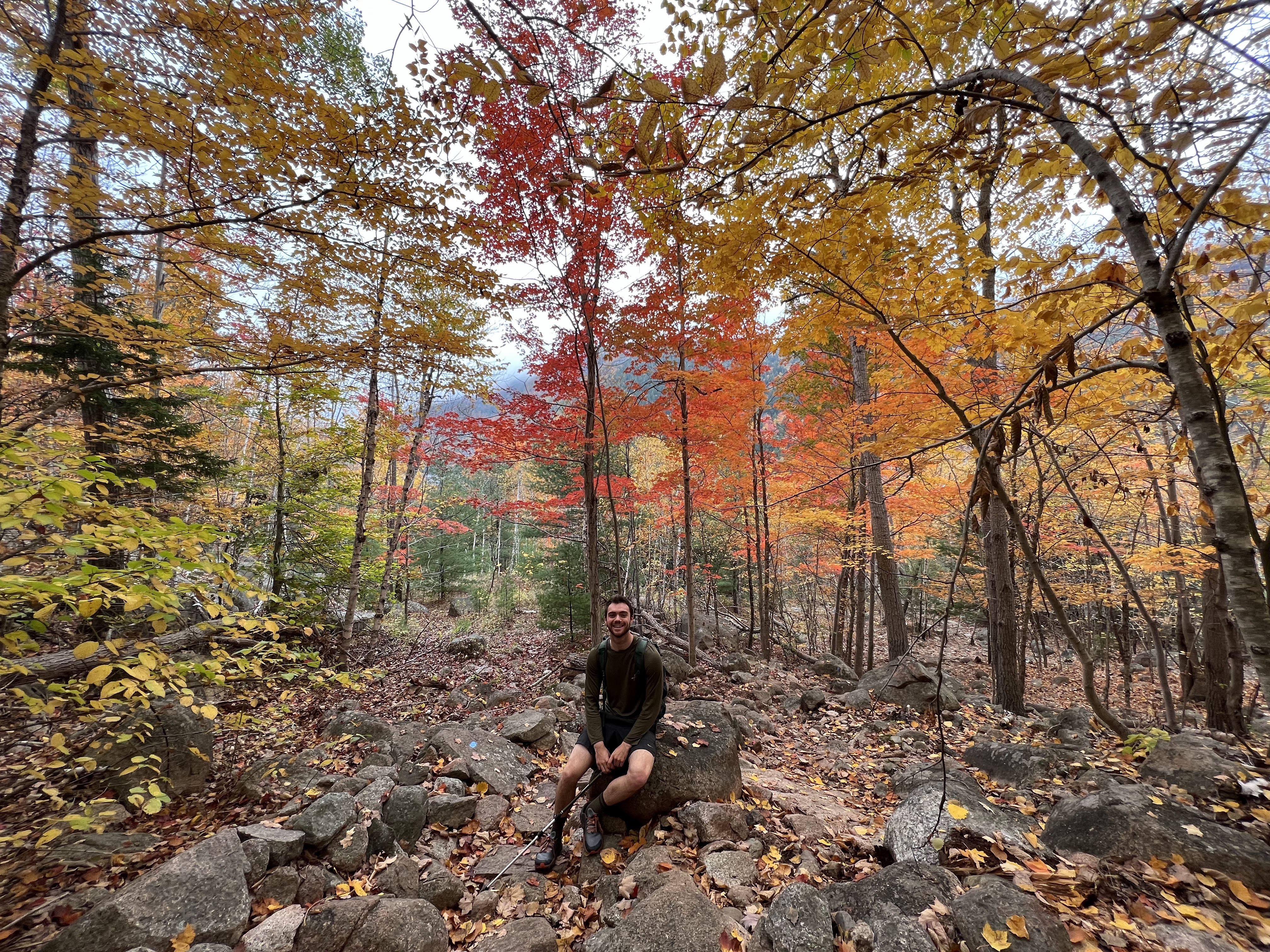
 Snatching the Connecticut state HP "summit".
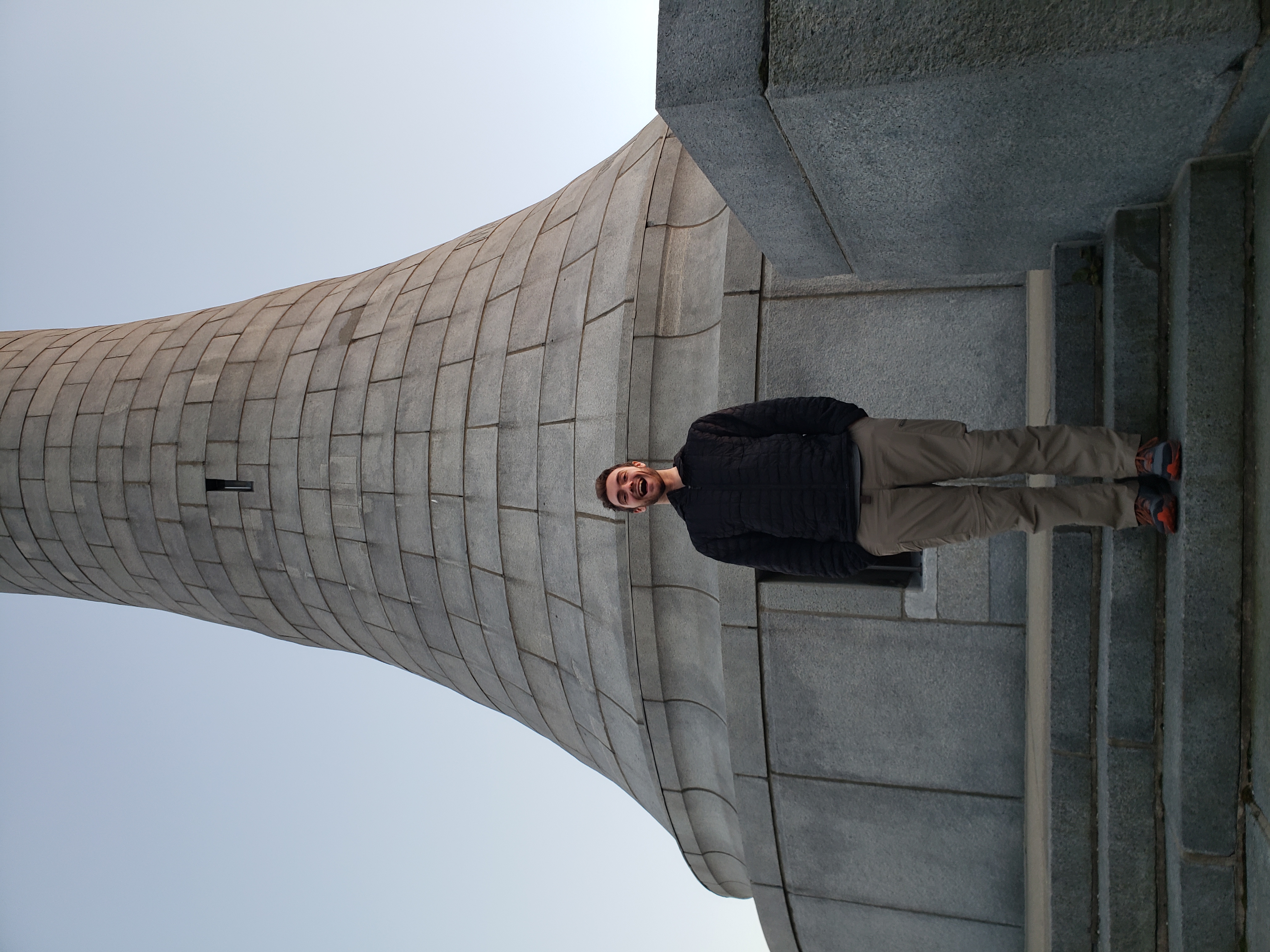 The observation tower atop Mount Greylock the Massachusetts state HP in the fading light. Little did I know I would be spending much more of my twenties in this state.
October 16th - Day 2 - Acadia NP Coast and Evening Hike
With an early rise we were packed up and off well before sunrise, racing across the southern edges of Vermont and New Hampshire toward Maine. With one stop at a rest station for fast food and gas we made it to Acadia National Park before 2pm and started with exploring the coast.
The rocky points reminded me of home in Northern California, but the cobble beaches and plentiful evergreens said otherwise. We visited the Bass Harbor Head Light Station, of similar stature to the Montara Lighthouse near home, and as if on cue a blanket of fog began to form and roll onshore.
Eager to keep exploring and maybe escape the fog we set our sights on getting up high before sunset. We trekked up the Great Notch Trail and made it to an overlook on Knight Bubble shortly before sunset well above the fog. The scramble up was no joke, made worse by the wet conditions and rock faces beginning to ice over. A map of our route up to Knight Bubble can be found here. We retreated in the dark with the forest having a very Blair Witch Project vibe. We were not fans and happy to make it back to our car, and eventually our camp through the thick fog.
Story continues after Day 2 photos.
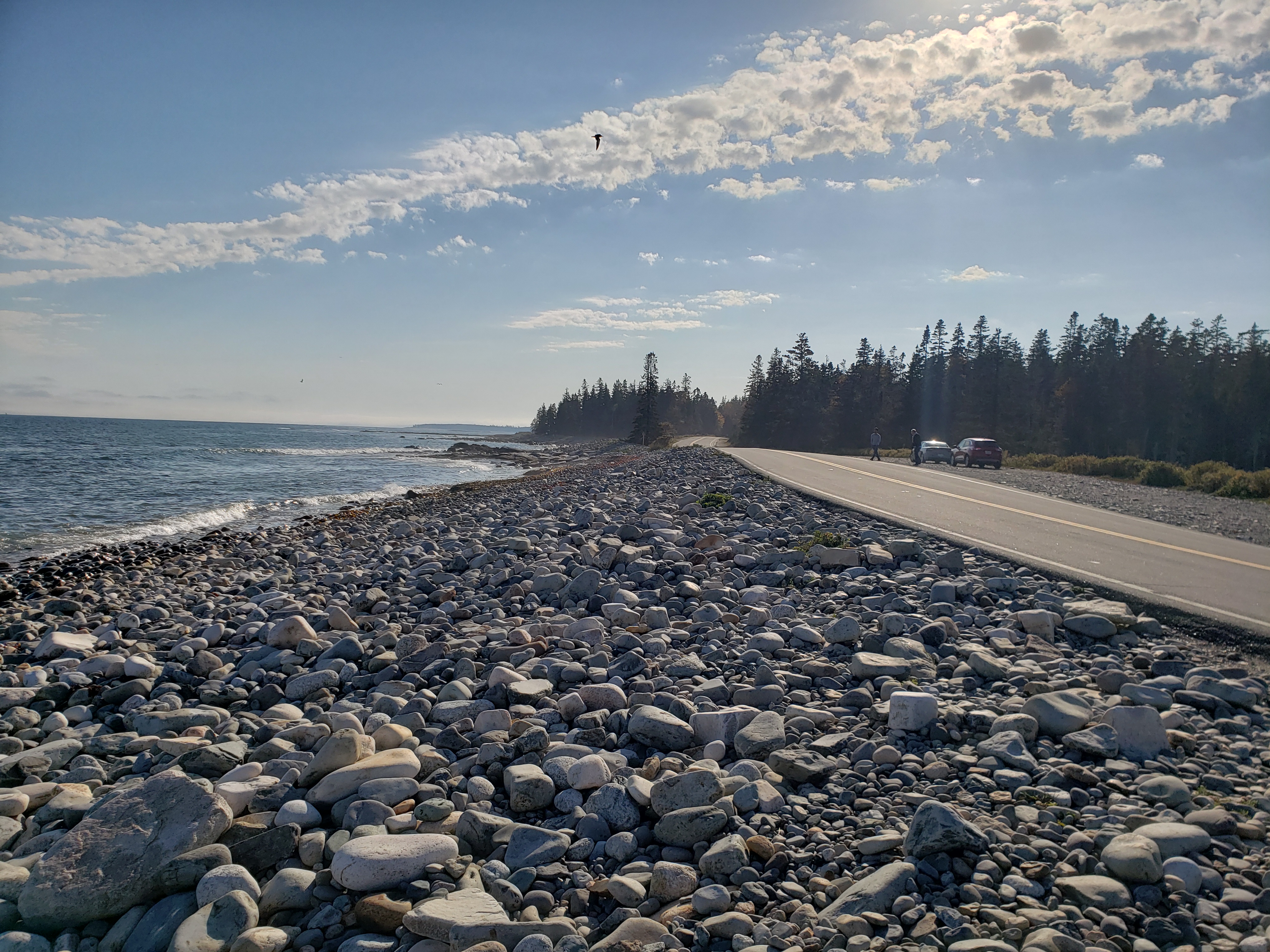 Reaching the coast after a long drive.
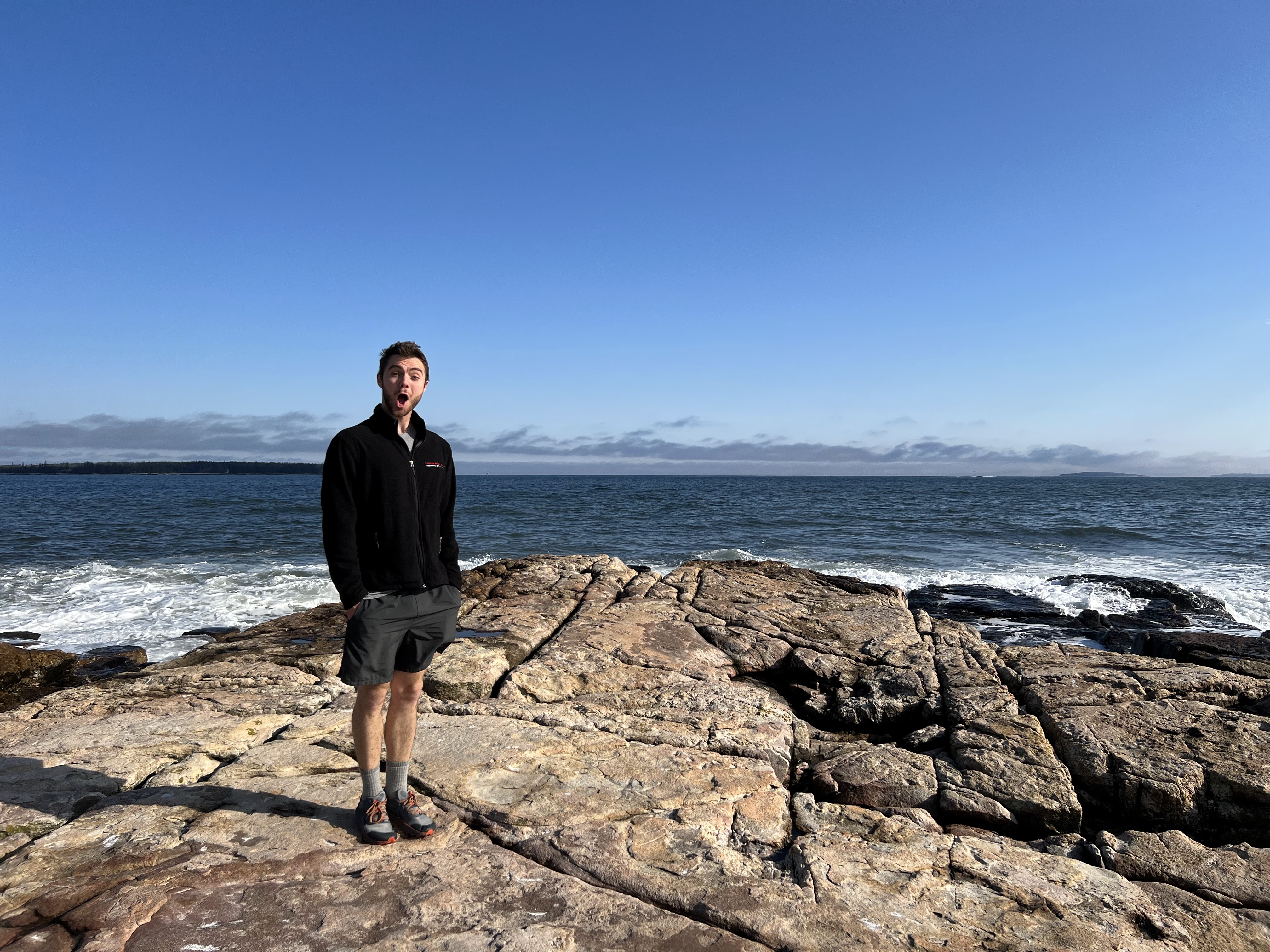 Me, happy to see some waves again!
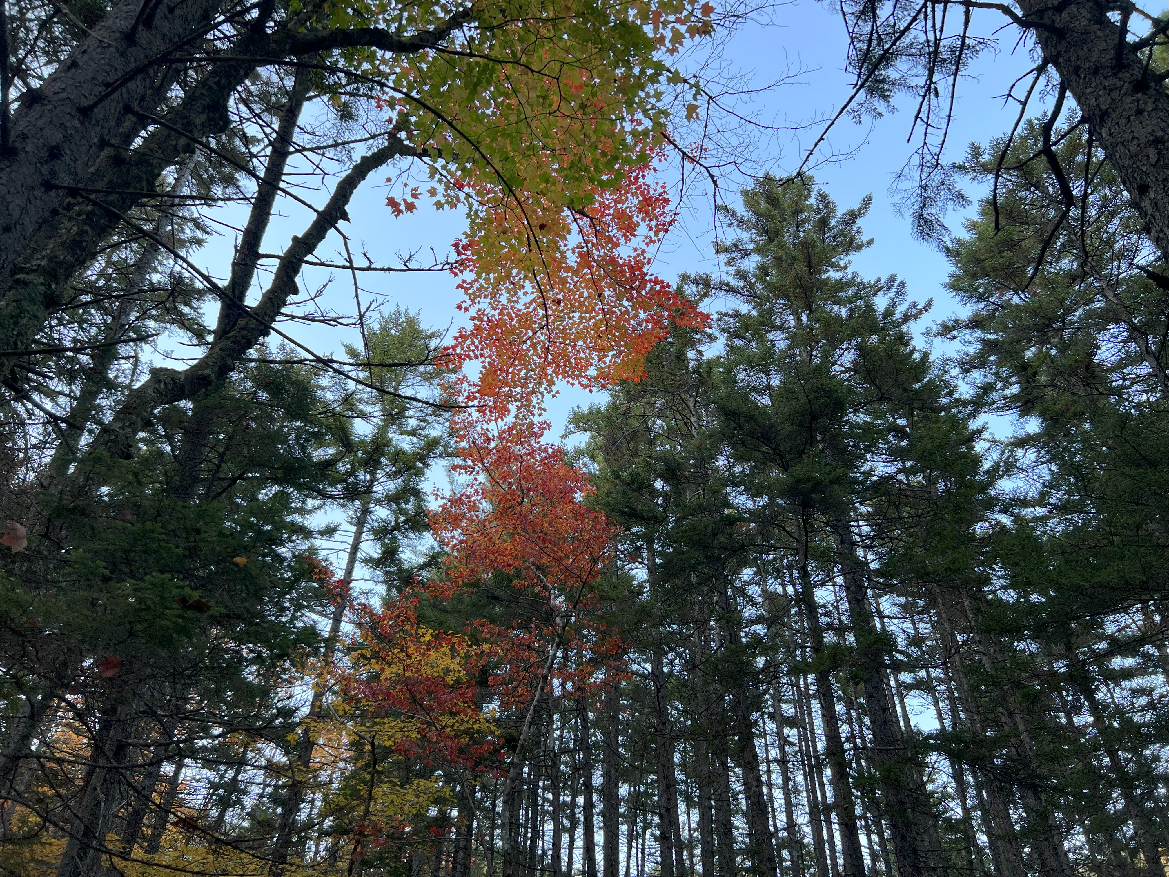
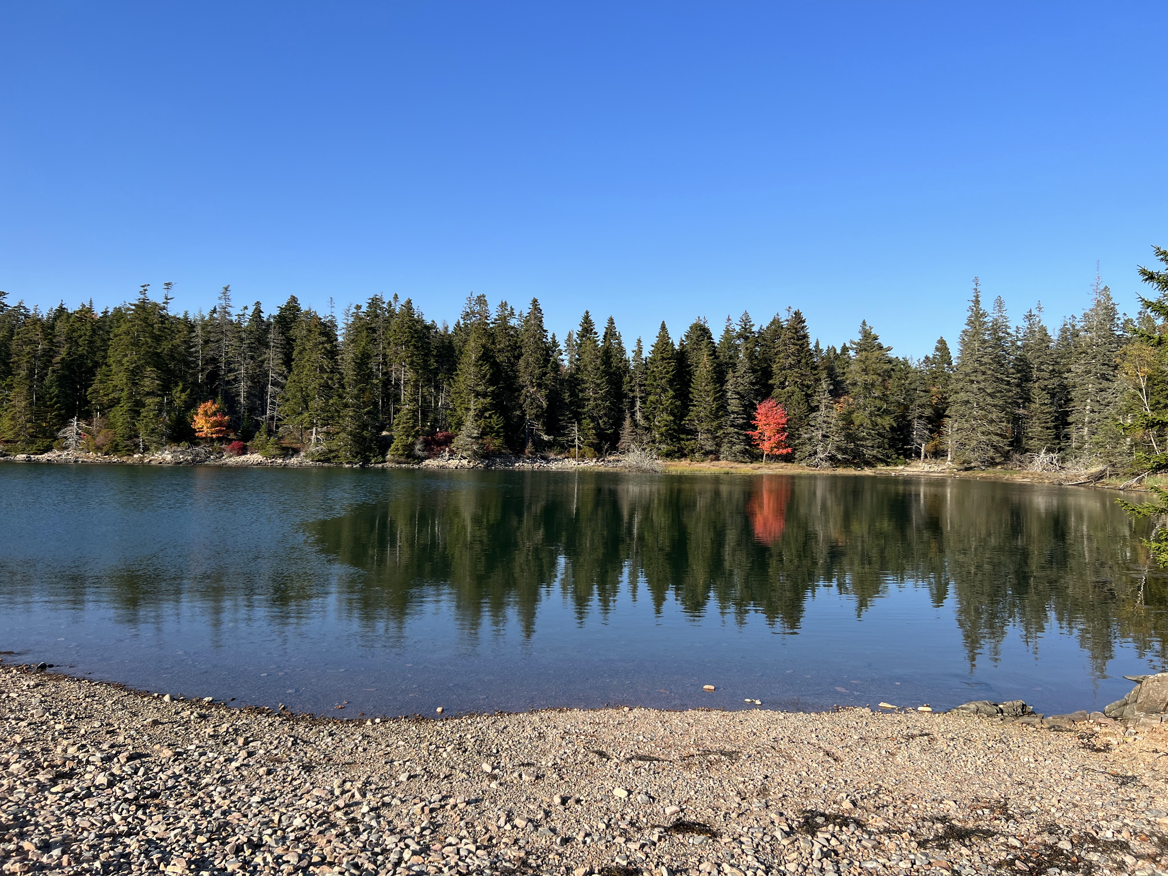 A silly little red tree among a sea of green.
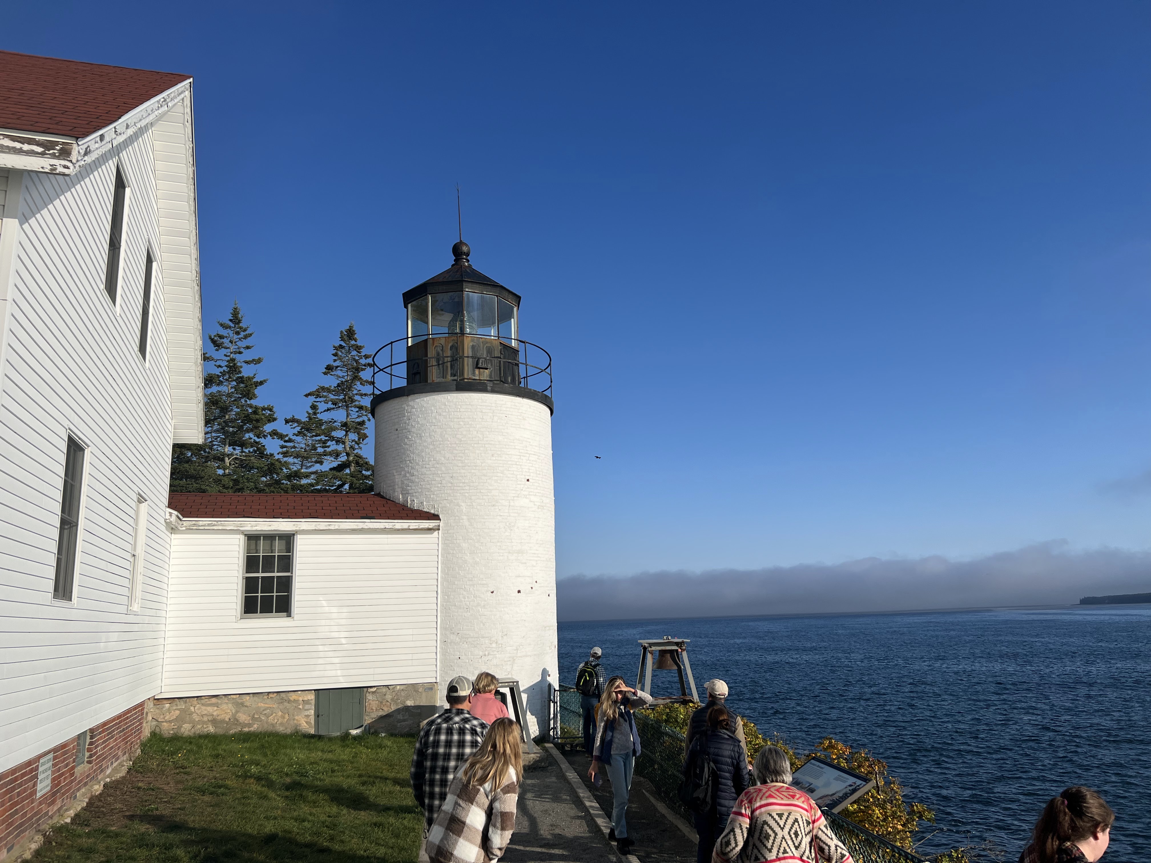 The Bass Harbor Head Light Station, and a fog bank for good measure.
 Some nice color on our way up the Great Notch Trail.
 Lovely moss and lichen cover in the higher reaches of the trail (after we almost died scrambling some slick rock).
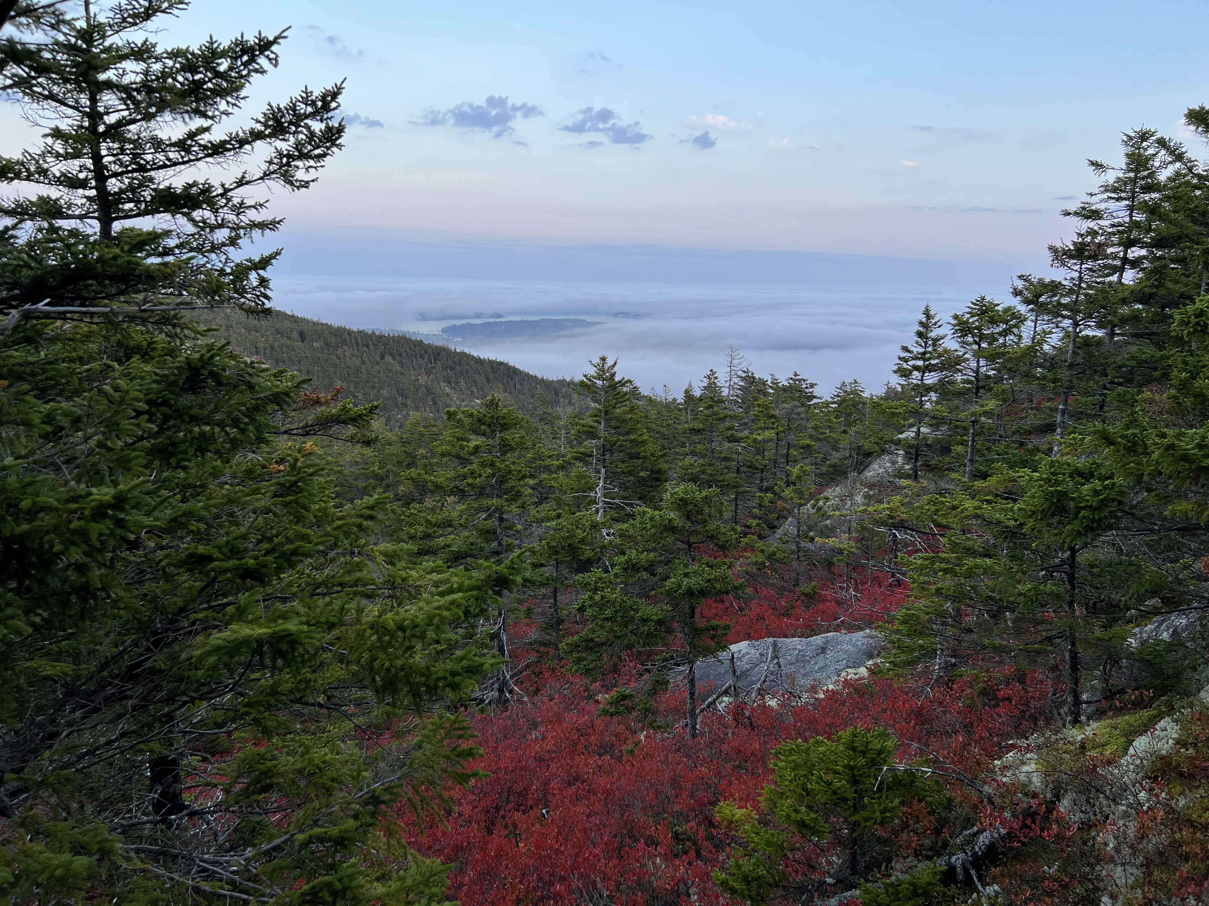 A view from our overlook on the shoulder of Knight Bubble before our Blair Witch Project experience began on the decent.
October 17th - Day 3 - Acadia NP Bubble Rock and Cadillac Mountain
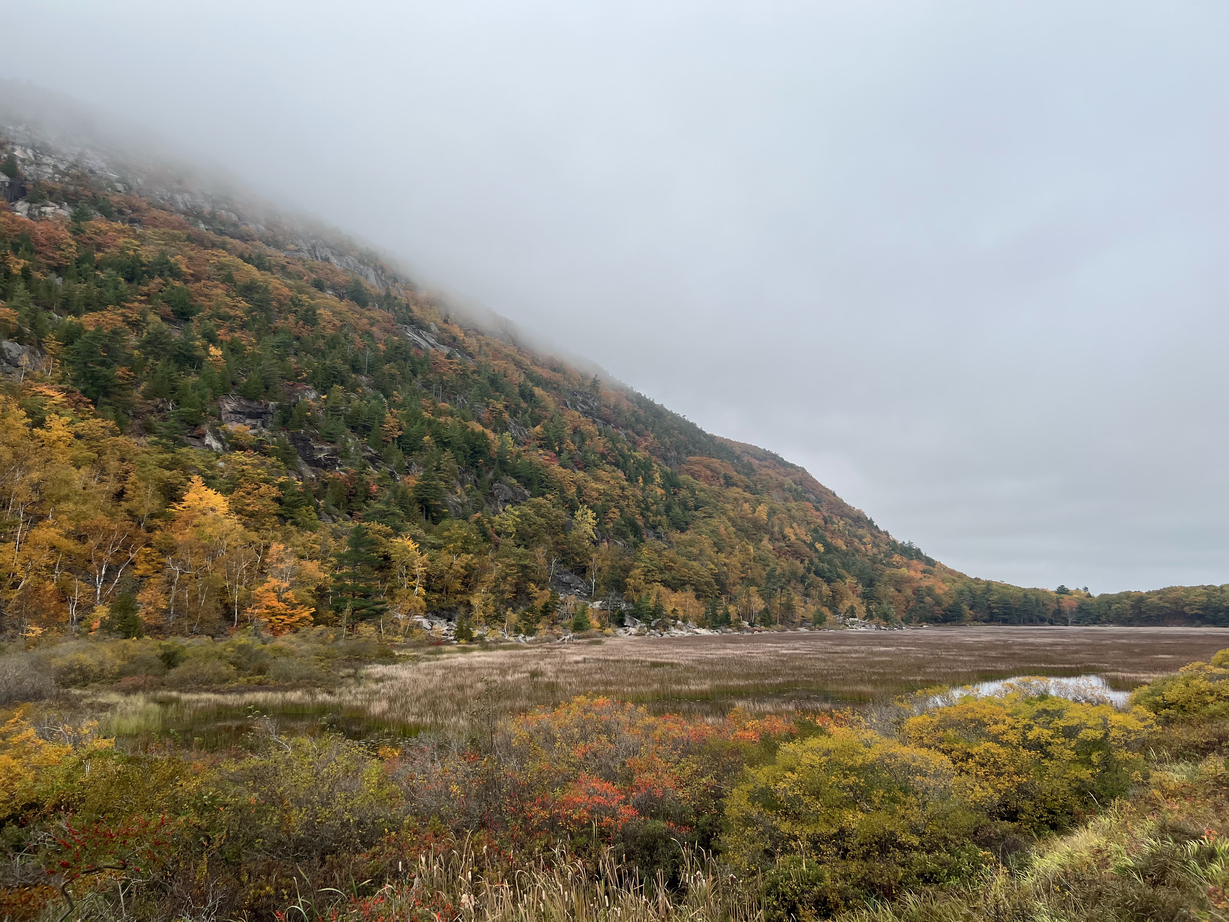
We got up early, again, this time hoping to get on some trails before the crowds arrived, but the fog had other plans. After a short jaunt out to Canada Cliff overlooking Echo Lake, we decided we'd seen enough grey and would seek out a fog free area.
We decided with fog in full force we might as well check out the visitor center to get our pass, re-fill waters, and of course get a selfie with the National Park sign. We headed to the farthest reaches of the park next and after a run in with a porcupine, made it back to the coast with fog slowly lifting.
With the fog mostly lifted we drove back and up Cadillac Mountain, the highest point in Acadia National Park. There was a nice paved walking trail around the packed summit area. The clearing sky presented a nice view of Bar Harbor to the northeast with a cruise ship lurking ominously in the waters just offshore. Just as quickly as they had parted the clouds returned, so after a quick turkey and cheese sandwich lunch we headed down the mountain.
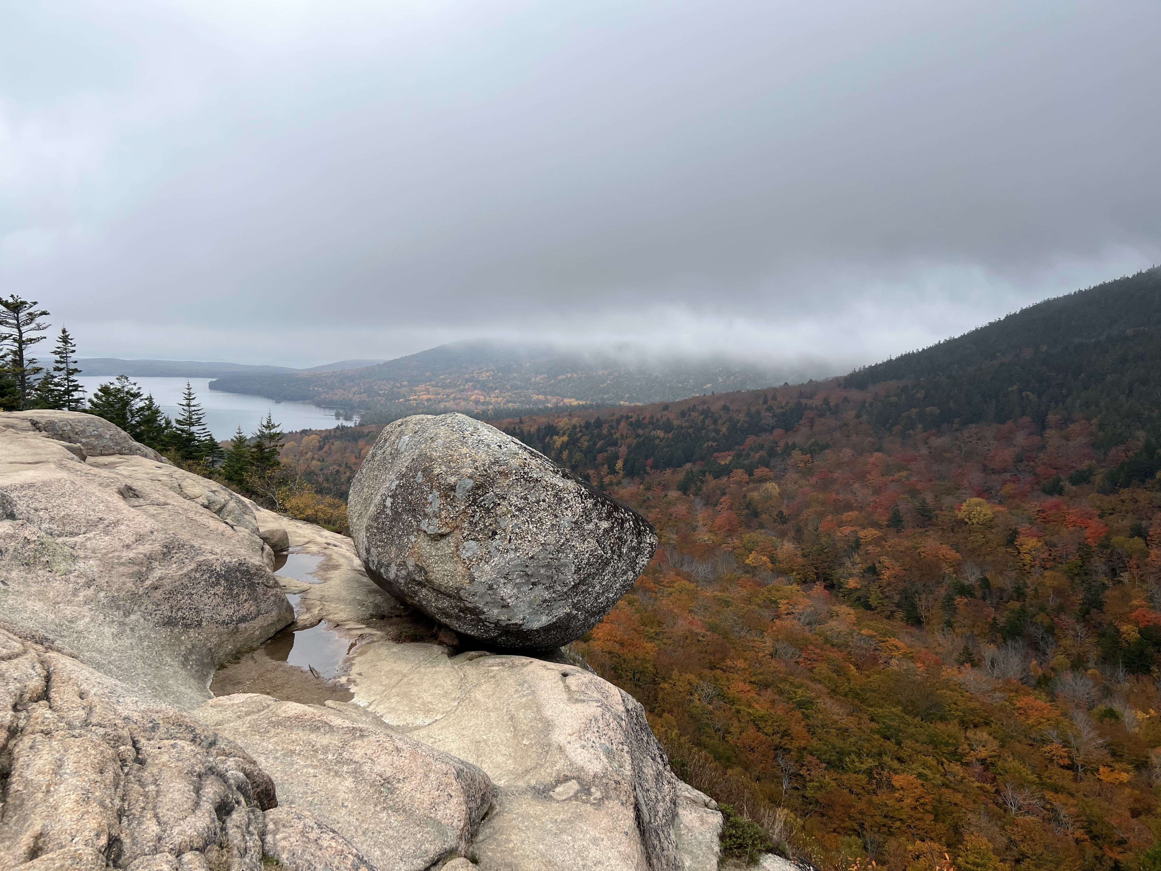
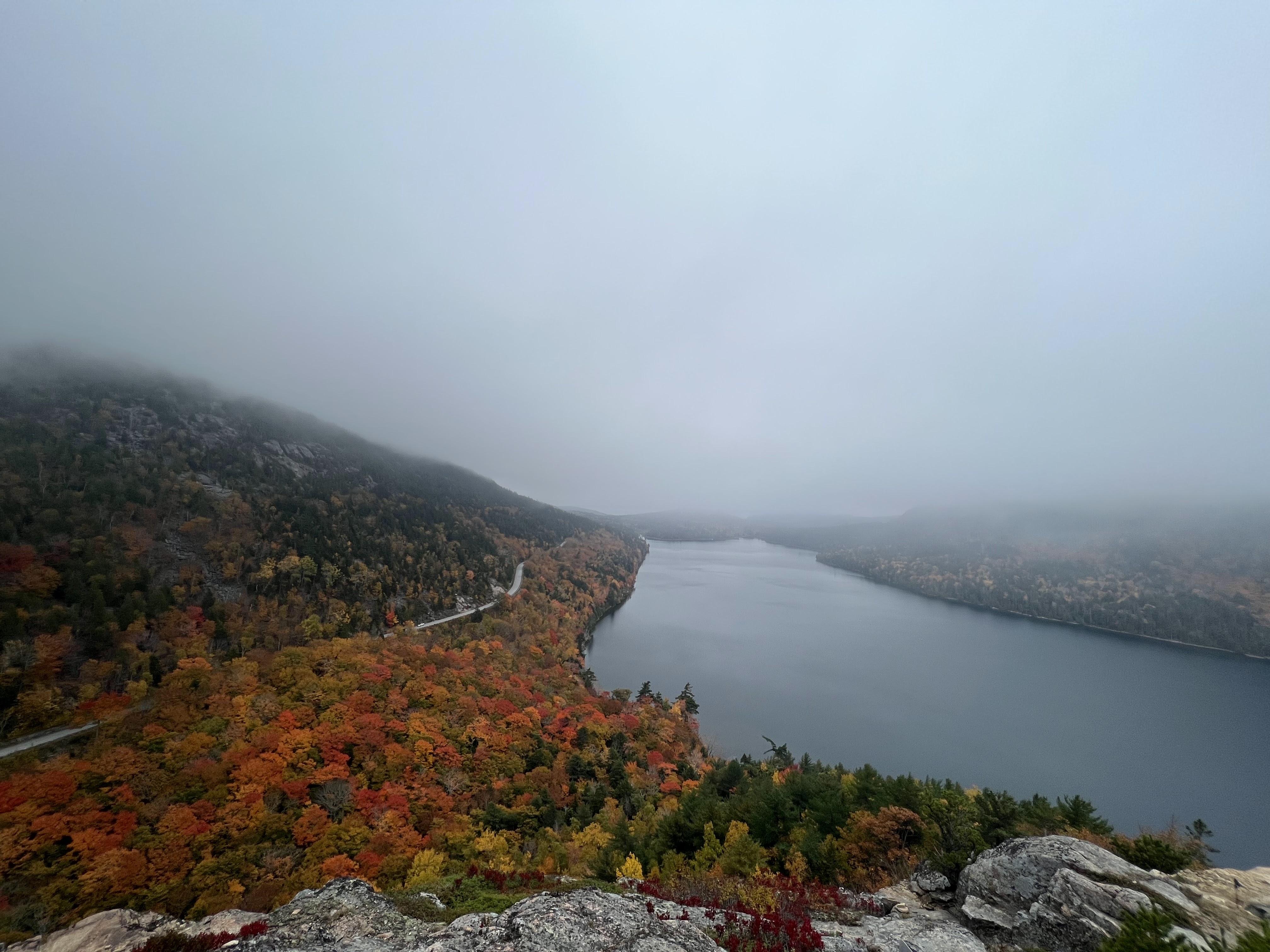
Our chosen longer hike for the day was around Jordan Pond to Bubble Rock, one of the parks most famous features. A map of our route can be found here.here. Starting at the south end of Jordan Pond we made our way around the west side on the raised wooden plank walkway. It was single file with "passing lanes" (extra planks of wood) so we made a game of guessing whether an on coming group was going to yield right of way or not (a very interesting social experiment). Reaching the north end of the pond below North and South Bubble we stumbled across the best show of foliage we had seen so far in a small group of skinny trees. Making our way to the top of the South Bubble we stopped and took our photo op at Bubble Rock, a very large round boulder perched precariously on a cliff. The leaves in the background did not disappoint.
After making our way back around the east side of Jordan Pond and back to camp we decided to breakdown our tent while the weather was still dry and sleep in the car for the night. Not the most glamorous way to spend the end of your birthday :), but it set us up nicely for a very early start the next day.
Story continues after Day 3 photos.
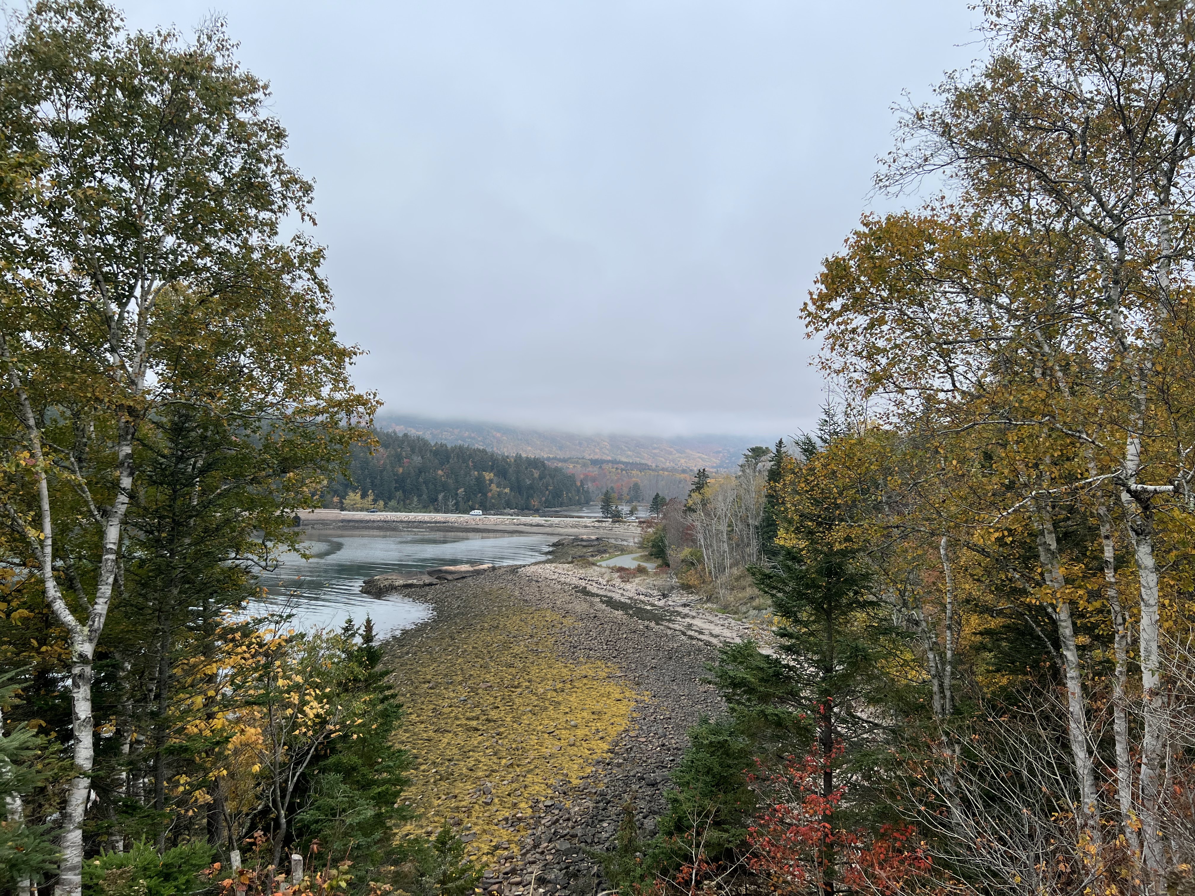
 Fog draped over the mountain foliage on our way to the coast after a foggy morning hike.
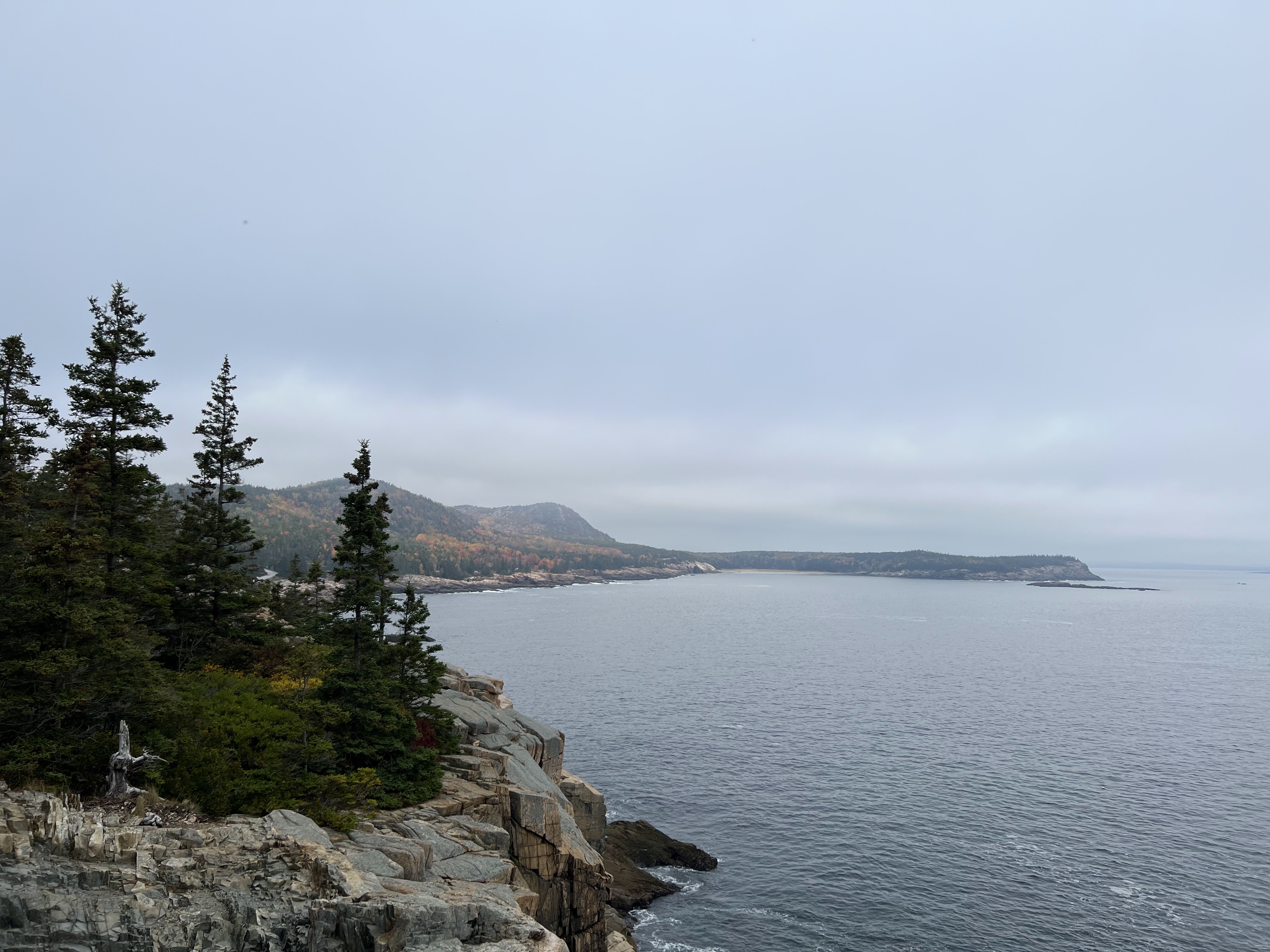 The rocky coast of Mount Desert Island.
 It was low tide as we made our way along the coast, making for some great bird spotting.
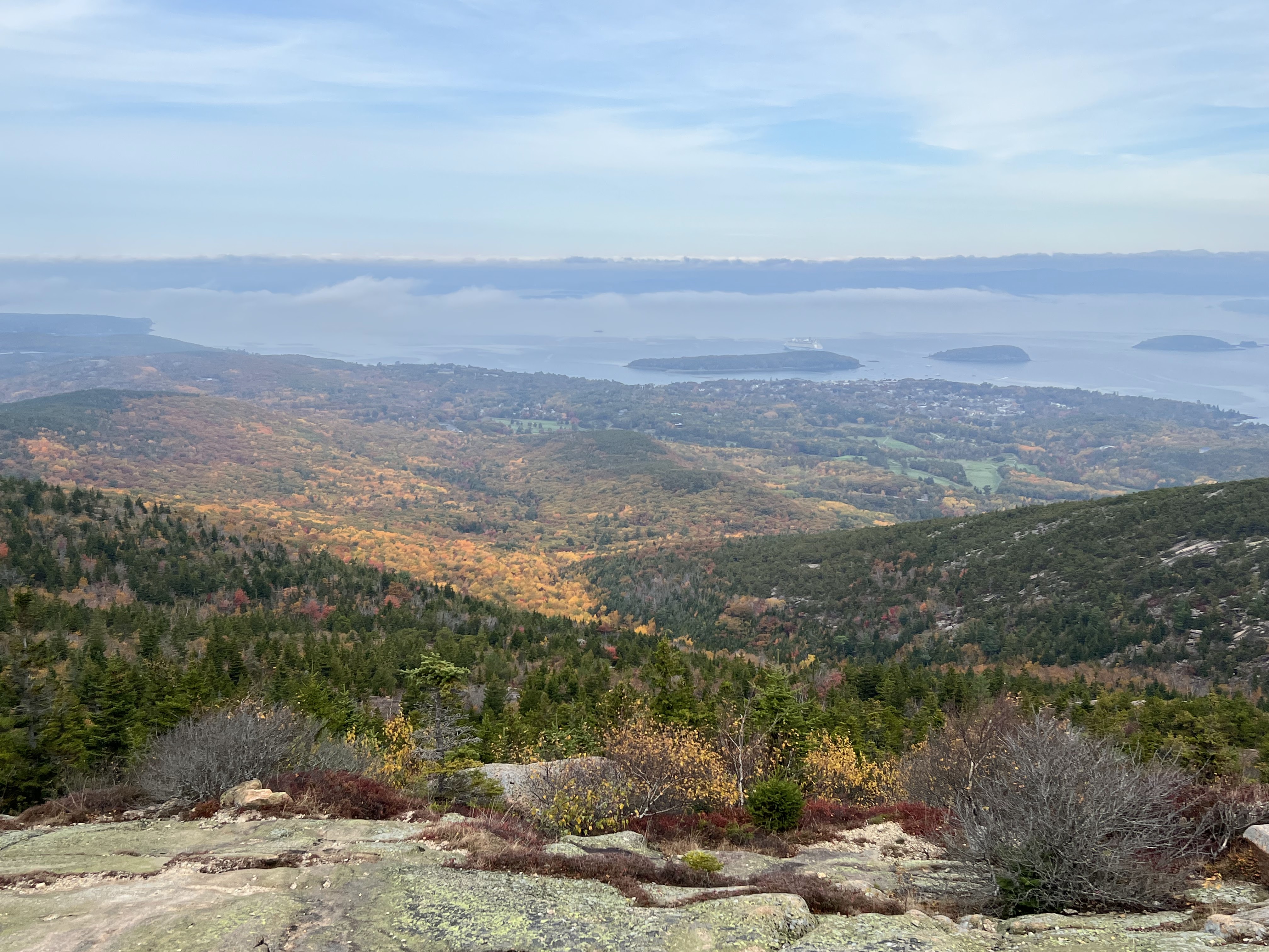 The view from the top of Cadillac Mountain looking to the northeast. Bar Harbor is visible at the edge of the water, as is a cruise ship with greater population than the town itself. A 1,000 person limit on the number of cruise ship passengers allowed per day into the town was passed shortly after our visit.
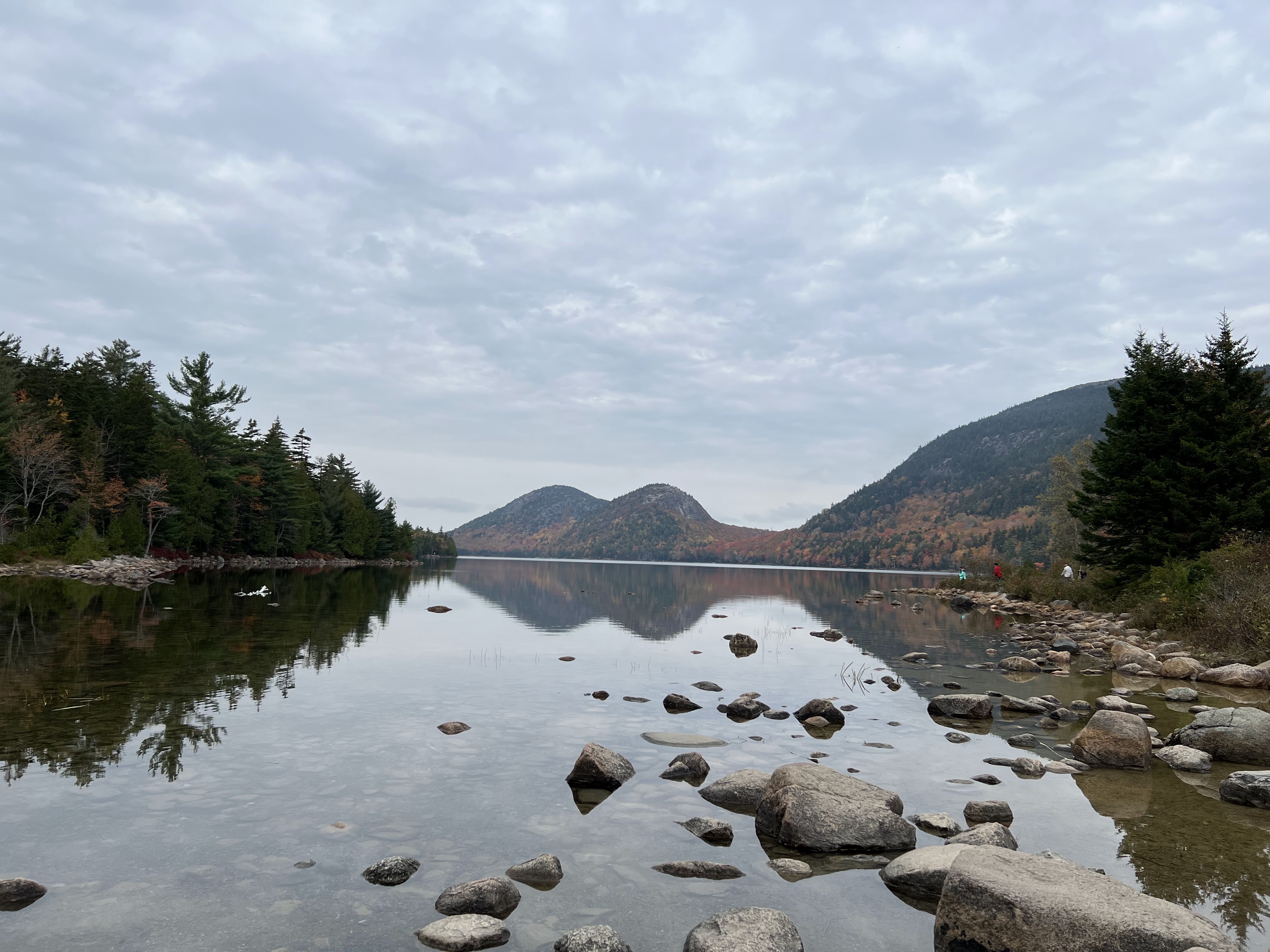 A view north toward North and South Bubble (left and right) from the south end of Jordan Pond.
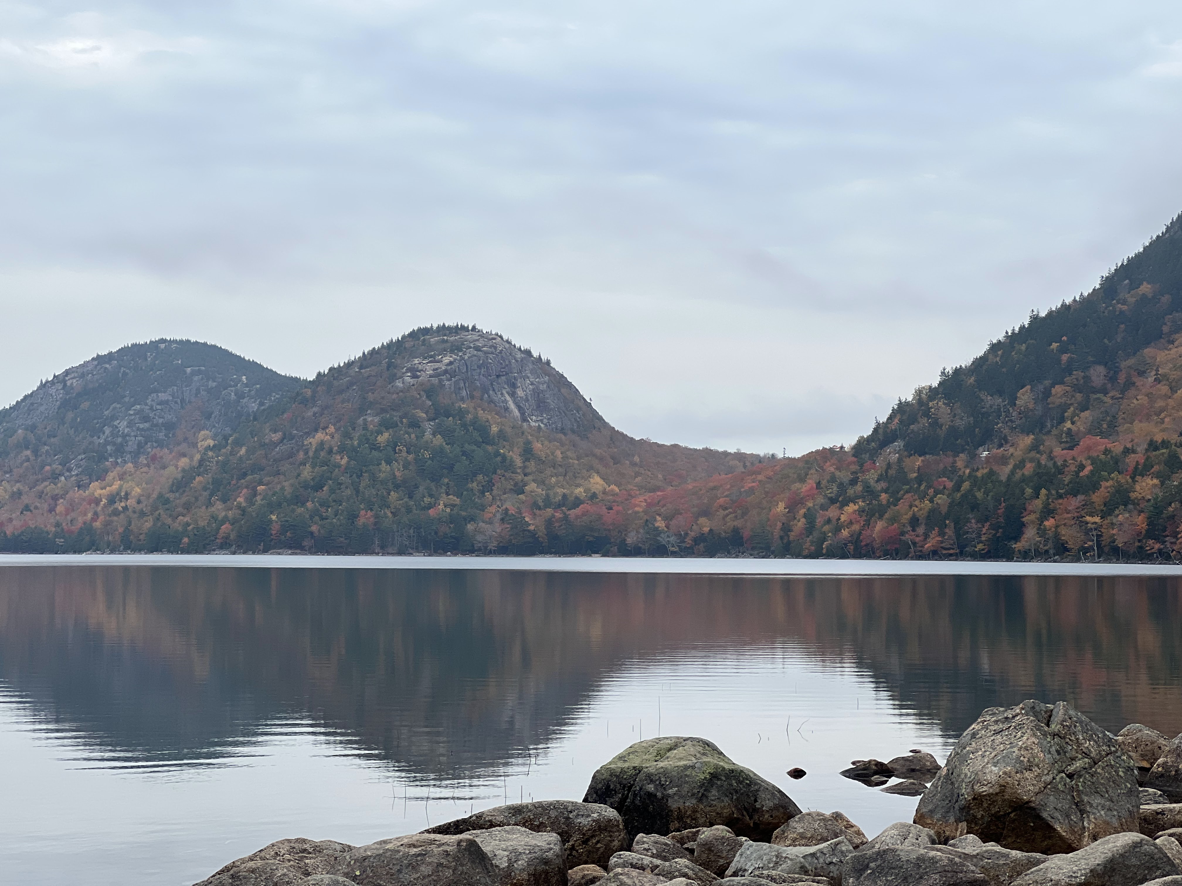 A closer view of the Bubbles, look at that foliage!
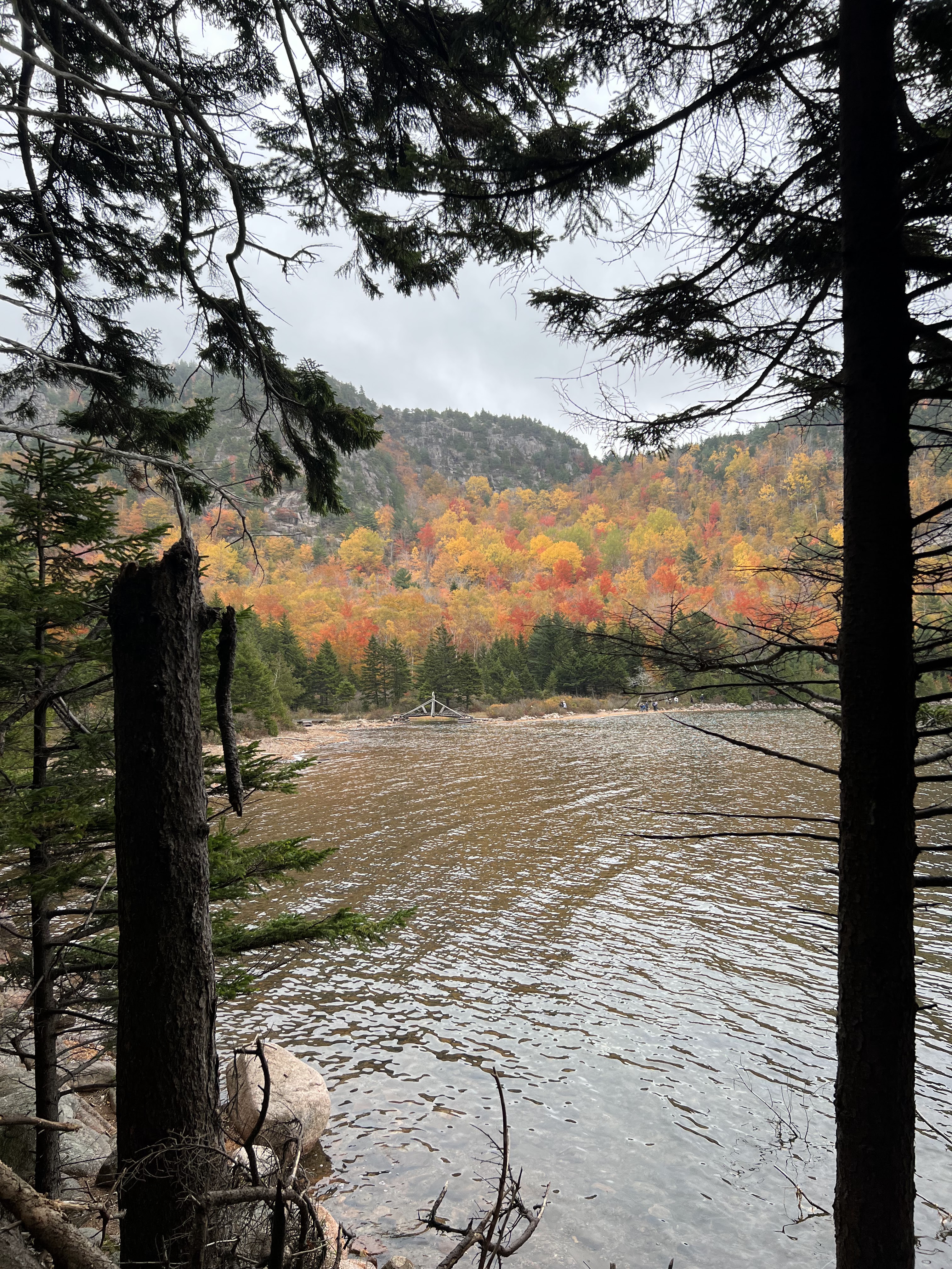 Peaking through the trees on the wooden walk at the north end of Jordan Pond.
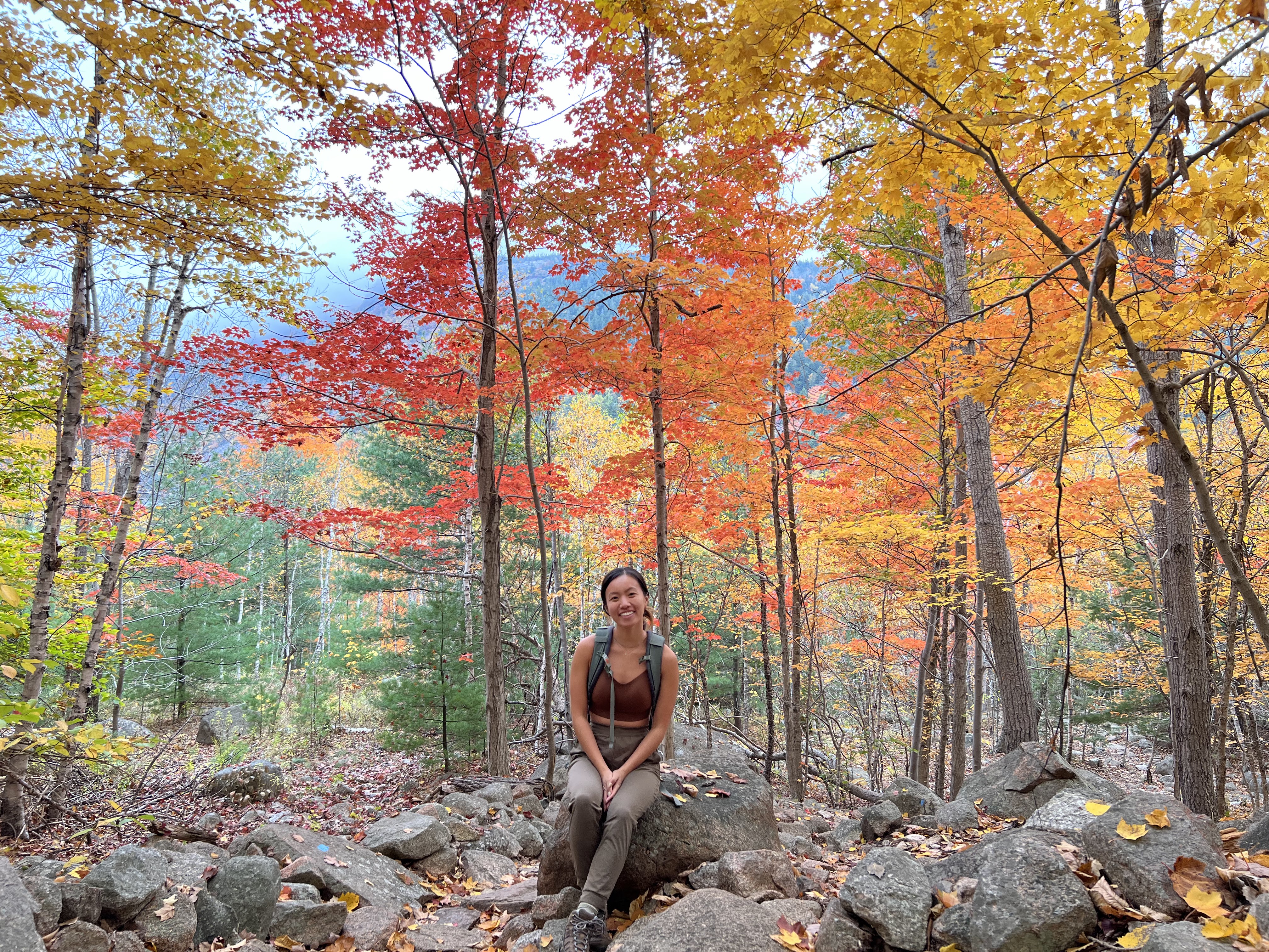 Our favorite grove of fall foliage.
 Bubble Rock, ready to jump. The rock is surprisingly big, easily 10ft tall (and difficult to get atop).
 Looking back south from South Bubble over Jordan Pond.
October 18th - Day 4 - The Eastern Most Point in the Continental U.S.
Our flight out of Portland Maine back to New York scheduled for a 4pm departure gave us a nice hard stop time to try to beat for the days activities. Given the heavy rain beating down on the roof of our Dodge Charger it was clear sticking around in Acadia wasn't going to be all that enjoyable, and we had seen most of the sights we wanted to see anyway. The question became what do we do instead?
10 minutes of Googling later and we had our answer: West Quoddy Head, the easternmost point in the United States mainland. So, not being able to get much sleep in the car anyway, we set off at 5am on our 7 hour drive to the eastern most point and then back to the airport. Much of the interior of Maine has a high tundra feel, with sparse stumpy evergreen trees in the draws and barren short shrubs and grasses on the ridges. Blasting along in the early morning we kept a vigilant eye out for rouge moose but fortunately saw (and hit) none. Turning down some not so well paved roads our phones indicated that we were now in Canada, warning us of international roaming data prices, yet we were still traveling east on American pothole ridden asphalt. Finally, we saw end of the road, a red and white striped lighthouse, and the sea falling away in the distance. The end of the U.S. mainland was about what I expected it to be, cold, windy, and not many people.
On our 5 hour drive back to Portland Maine we capped off our trip in true northeast fashion, visiting the L.L.Bean outlet (and buying nothing) and then proceeding to get some insanely overpriced hotdog buns with a heap of local crustation meat on top (they were ok).
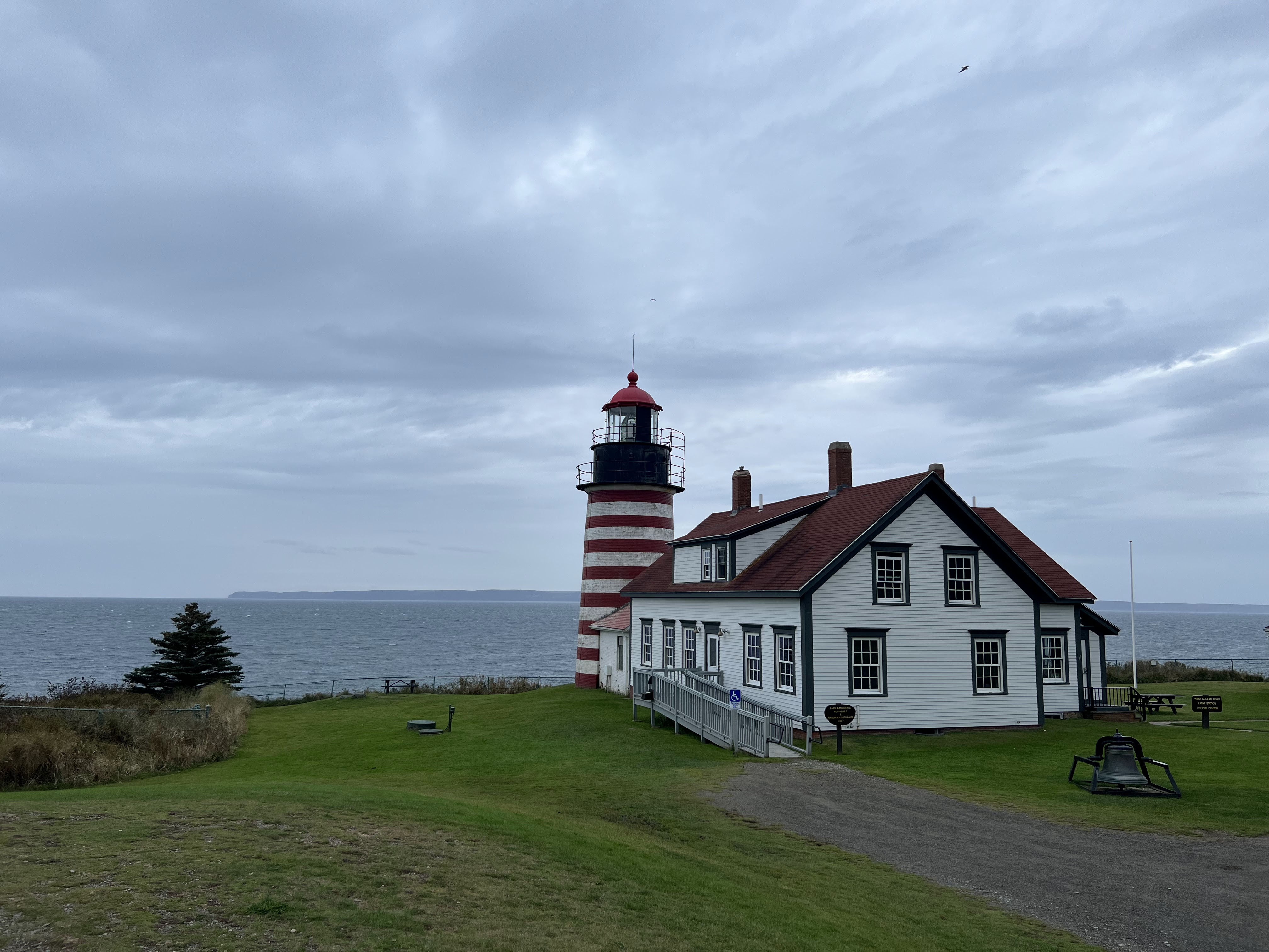 The West Quoddy Head Lighthouse. The shores of New Brunswick, Canada can be seen in the distance.
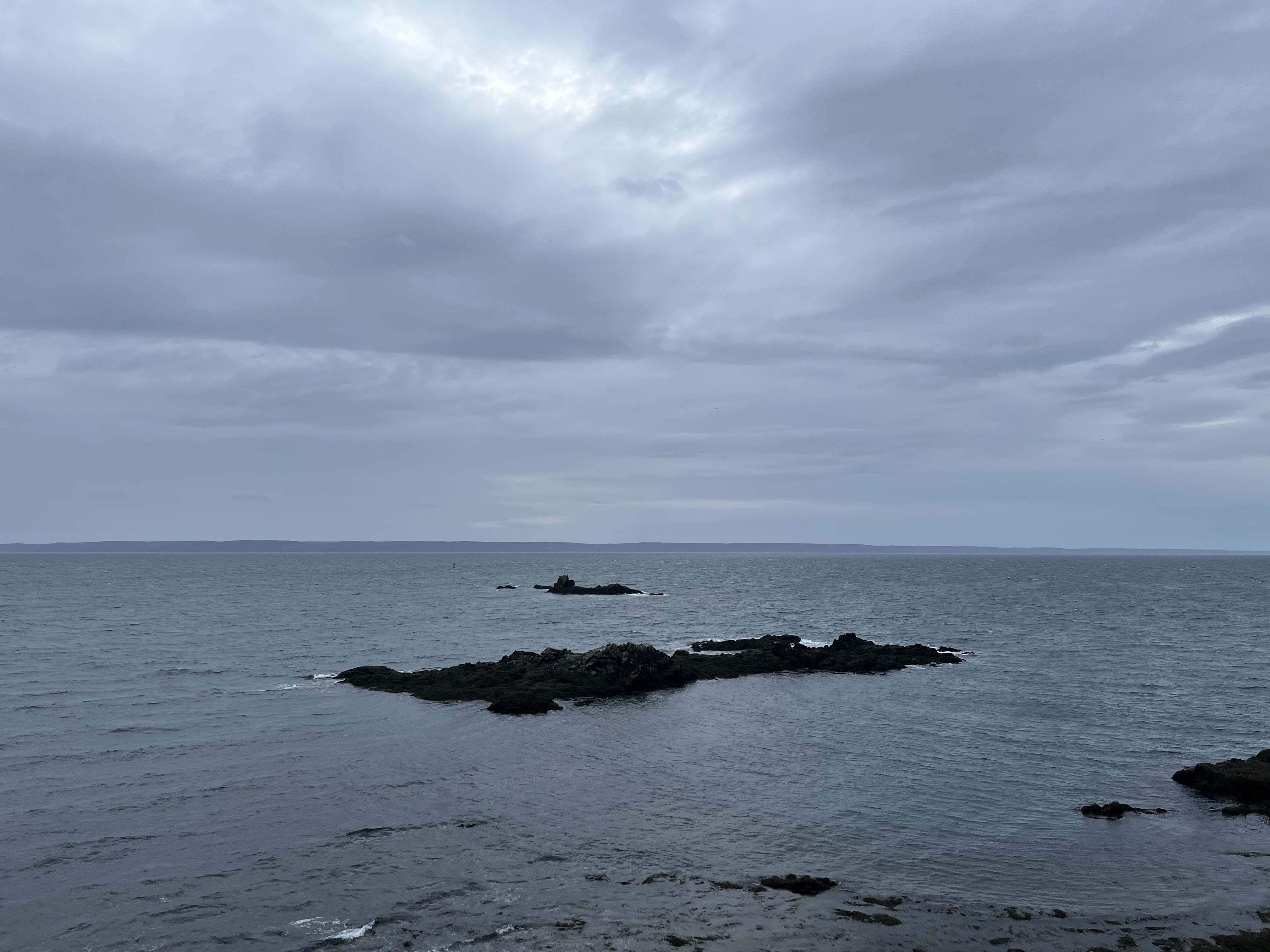 Sail Rock, the true easternmost mainland point (but not really because its not connected above water…).
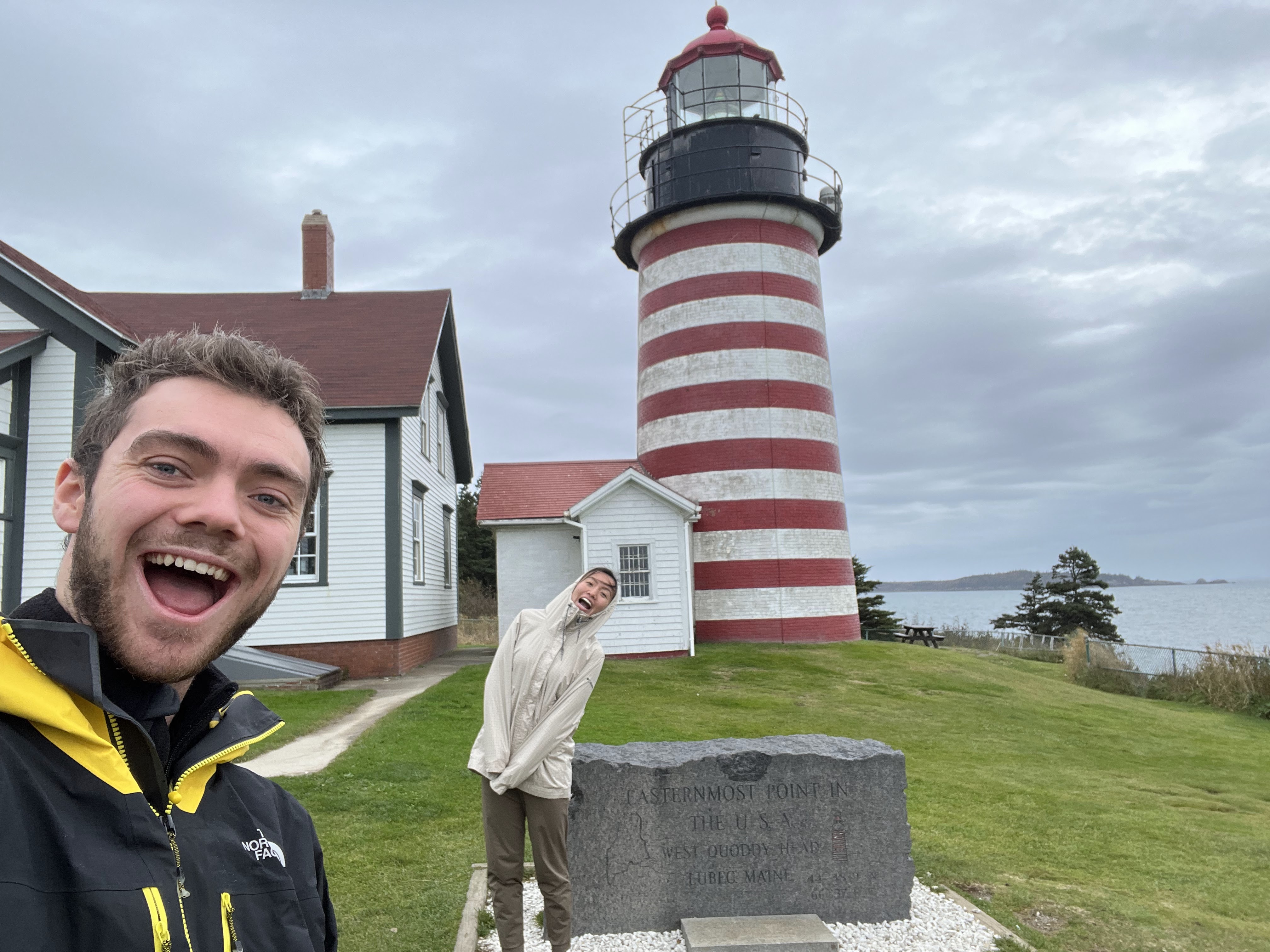 Happy to have found another geographic extremity, and to be out of the car for a bit before our long drive back to Portland, Maine.